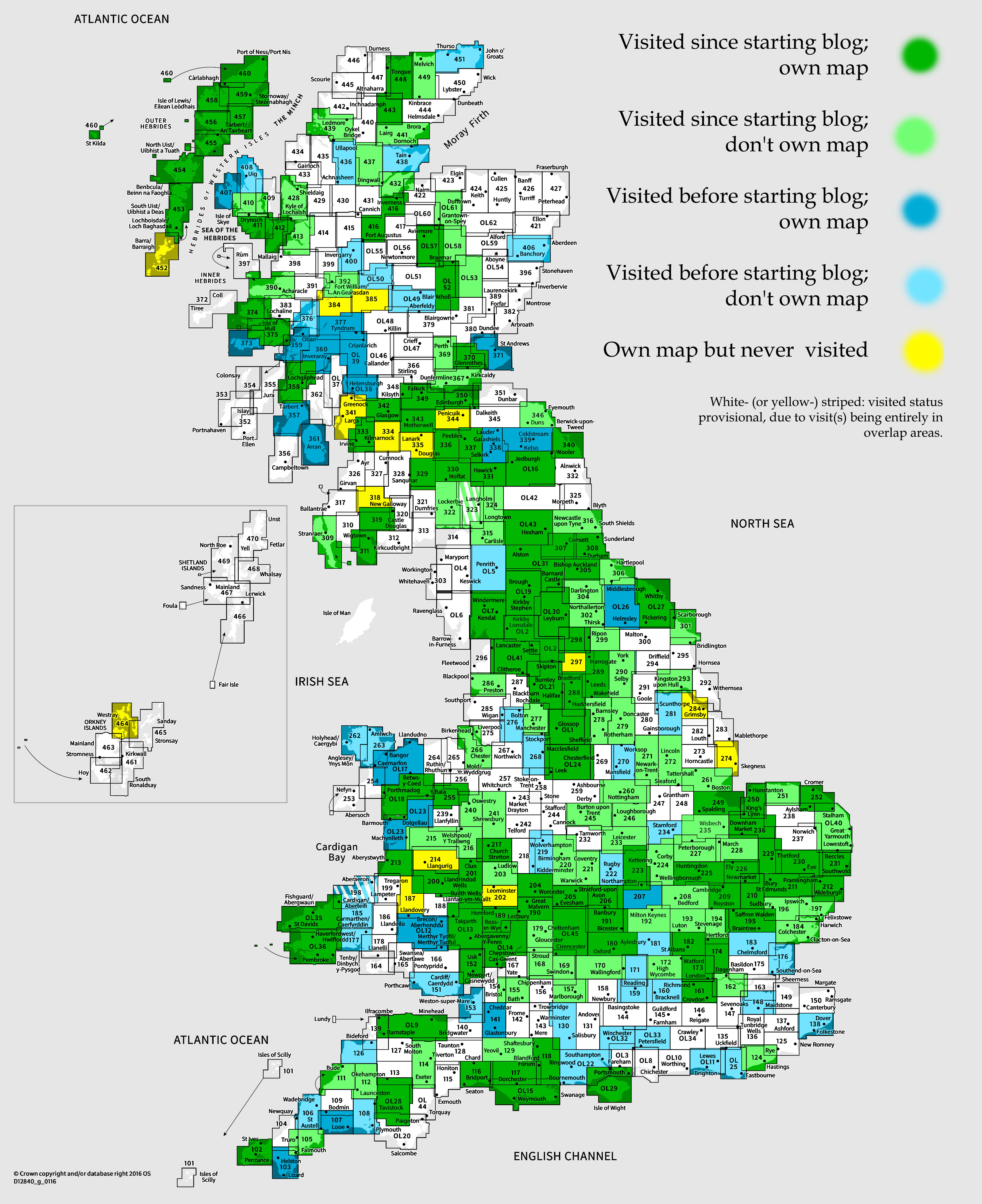
OS Explorer map OL53, Lochnagar, Glen Muick & Glen Clova: Ballater & Balmoral – I do not own this map, and had not visited it before starting this blog. Visited for this post 2nd July 2024.
Map area link. Google Maps location links: Aviemore, Loch Morlich, Fords of Avon, Braemar, Loch Callater, Lochnagar, Gelder Shiel, Crathie, Ballater
Why?
My career break, a practice trip
As referred to in a couple of recent posts, in August 2024, I left my previous job, which I’d been in for four-and-a-half years. That was doing administrative work for a London-based research charity, for which I’d travel into London once a week from my home – first Cambridge, then Moreton-in-Marsh – usually in a pattern of one day / three days in alternating weeks, staying in questionable cheap London hotels for a couple of nights in the three-day weeks, and averaging out to two days a week in the office. At the end of October, I started a new job, doing very similar work but based in Oxford, which is much more convenient travel-wise: it’s only a 35-minute train from Moreton, so I’ve been commuting in three days a week, and enjoying it so far!
I knew for a long time that I wanted a nice long break between jobs, and am very glad I got to do that. I didn’t quite meet my hope of having a new job in the bag before leaving my last one, but it was close: I was near the end of a few hiring rounds when I left, and I accepted my new job offer just a week or so afterwards, having had to do just a few hours of final job application work while on holiday. (That was a separate, later trip up to Scotland with my regular co-travellers Millicent, Erithacus and Vesper, and which I won’t be posting about since it was a trip up to Harris, visiting only map areas I’ve posted about before.) I agreed with my new employers on a start date 8 weeks later, so I’d have a nice long break, as hoped!

Ideas for what I could do in my break had been percolating in my mind ever since I’d decided to eventually leave my previous job back in ~November 2023, and I had several appealing options. A long-distance hike. An Interrail trip around Europe. I could do a residential language course; or since I’ve been learning Norwegian for the last year and a half, spend some time in Norway and try to get some more organic language practice. I could do several longer-than-normal visits to friends – e.g. ask to stay with a friend for a week, do my own thing in the area or the house while they’re at work or busy with life; and have some time with them in the evenings and weekend. And of course, I could spend plenty of time just at home without a lot of obligations, so that I’m not hectically zooming around all the time!
I wanted to at least explore the idea of a long-distance walk. Over the last few years, I’ve done a few long connected walks in a piece-by-piece way, doing a day one Saturday, then coming back to the point where I ended to continue on on some future day when I next felt like doing a long walk – for example my walks from London to Cambridge, Cambridge to Hunstanton and Northampton to Moreton-in-Marsh – all of which are visible as the long lines in my map of past walks. And I’ve done continuous multi-day walks before too – e.g. Kinbrace to the Crask Inn, or the first days of the “Holy Island Trek” in 2016 – but never a longer trip than about four days. I really enjoy the sense of experiencing a whole route on the ground; drawing a long line across the country that I know as a real journey, not just as unconnected islands of place that I’ve been whisked between by train or car. So building up my network of these travelled lines on the map by as much as a whole couple of weeks would allow, was very appealing. If, say, I carried on up the country from Boston (to which I’ve walked from London already), probably veering westwards so I could get into the Pennines, I could get well into the North of England in two weeks.
However, if I’d be travelling for several weeks in total during my break, I’d need to keep things cheap, so I’d need to mostly camp or hostel. Hostelling every night would be really restrictive route-wise, so it’d be much more convenient to be able to camp. I also had half an eye on the idea of doing my hike in Norway, combining two of my options above. Norway has a great network of pretty affordable mountain cabins which allow camping-free multi-day hikes, but at least the easily-findable-as-a-foreigner routes for multi-day cabin-to-cabin hiking are all inland. If I were doing one hiking trip in Norway, I’d really want to be in some of the dramatic rugged coastal scenery, with steep-sided peaks falling straight into the sea, which is just nothing like what you can get in the UK. And while there are coastal cabins, with a moderate amount of looking, I didn’t find any obvious multi-day cabin-to-cabin routes that’d give me that kind of scenery, rather than still-great-but-less-unique inland mountain scenery. So again, being able to camp would really open up the options.
However, I wasn’t sure whether I’d be up to camping. On the one hand, it’d been about five years since I last did a camping-and-hiking trip, carrying all the gear on my back – and eight years since I last actually camped for multiple nights in a row – and I didn’t know whether I was still up to it fitness- and health-wise. [1] On the other, I’ve never enjoyed camping – I’ve just sometimes accepted it as an inconvenience that’s worth it for the good things it let me do, like (especially as a student) making a holiday cheap enough to do, or accessing areas I couldn’t otherwise get to. It’s a lot of effort, and it’s just not very comfortable. So I didn’t want to just head straight off on a lengthy trip and risk discovering that I find it even less tolerable than I used to!
So, obvious solution: a practice trip! I decided that I’d take a week or so to do a reasonably serious hiking-and-camping trip, to see how I find it physically and comfort-wise, before deciding whether to do a long hike on my career break.
Trip prep!
I was initially a bit conflicted about where to go. I came up with the idea in around May, I think, but I wouldn’t be able to take a week off until July: I’d just recruited my successor at work, and June, once he started, was to be our main handover month. July is not a good month for me hiking, since I’m sensitive to heat, so being as far north as possible was appealing. But July is also core midge season in the Highlands, which is not appealing. So I thought it’d probably need to be the Lake District, the North Pennines or maybe the Southern Uplands. However, at friend Geochunderer’s stag party, one of his friends gave me some tips: while the west can be terrible, the Cairngorms shouldn’t be too bad even in July, and if it does get midgey, then in summer you can avoid this by camping at altitude. So he Cairngorms it was! In June, I talked to my successor at work, and very nicely he was happy for me not to book in the exact time in advance, but instead take the week at short notice whenever in July I wanted – which is a great boon to have for hiking trips: I could check the weather and the midge forecast, and just leave whenever both looked good!
June was a bit hectic, as I needed to plan my routes, sort through all my kit, order a fair bit of new stuff, and pack up. I owned some version of nearly everything I’d need already, but a lot of it was very old, and much of it more suited to multi-person trips than lone ones. I also wanted to go light where reasonably possible (definitely not ultralight though), to give the best chance that the trip would go well body-wise, and some of my old stuff was quite cheap and chunky. It also seems like there had been a lot of progress in the last ten years in lightweight kit being less ridiculously expensive. In the end, I bought rather a lot of new stuff, including an inflatable sleeping mat, a water filter – I’d only been familiar with purification tablets or the UV wand things before, but filters seem to be all the rage now, and I can definitely see the appeal: no grit, no weird chemical taste – and a rather expensive new tent. I chose the tent for being a lot more spacious than my current poky little 1-person tent despite being the same weight, which I thought increased the chance I’d find camping an okay experience, since it meant a greater chance of keeping some areas of the tent properly dry when I got in wet from rain; and I could sit up and read inside. I found on eBay that recent second-hand hiking kit still seemed to go for a good chunk of its new price, so I consoled myself that I could at least get a good amount of my money back if I decided hiking-and-camping is not for me and never wanted to use any of the kit again.
The first week in July ended up looking pretty great, so I decided on Thur 27th June that that’s when my trip would be. I packed up on that Thursday evening, and after work on Friday, started travelling north for a week in the Cairngorms!
Having vs. not having a plan
Now, for this trip, I didn’t want to plan out a complete fixed route in advance, because I wanted to be able to be responsive to the weather, to how I was feeling, and to what I’d learnt on the walk so far – e.g. switching to a no-camping route if I found my first camp night terrible, or doing shorter or longer days or more rest days depending on how I found it physically. So instead I scoped out a kind of central route idea, knew some alternatives, and made sure I knew various options for places to stay in various kinds of accommodation. Somewhat similar to the approach I took on my All Line Rover trip a couple of years ago, which I liked to think of as “having a plan to not have to use”.
In terms of navigation and safety, I’d have with me all three of a paper map covering the whole area, the OS Maps app on my phone with the area downloaded, and my walker’s GPS that similarly has OS maps saved on it – so I should be fine for navigation and for being able to decide my route on the fly. And I had my little satellite communicator / GPS tracker, so that regardless of signal I could, at the start of each day, tell Vesper and my parents my route for the day and where I was planning to end, notify them if I decided to change plans during the day, and tell them when I’d reached camp. And they could see my location trace on the tracker, so altogether that felt good enough to not have committed to a fixed route in advance of the walk.
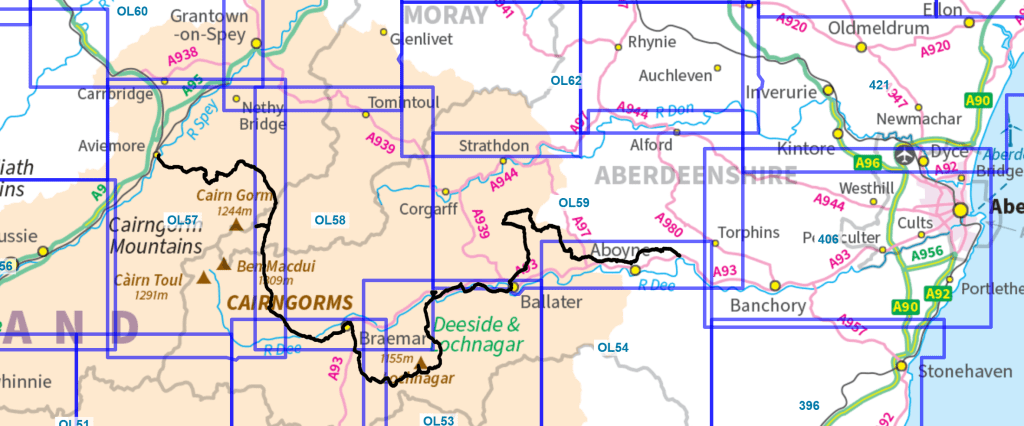
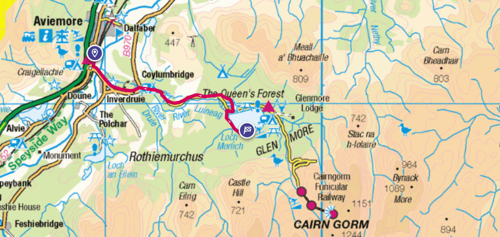
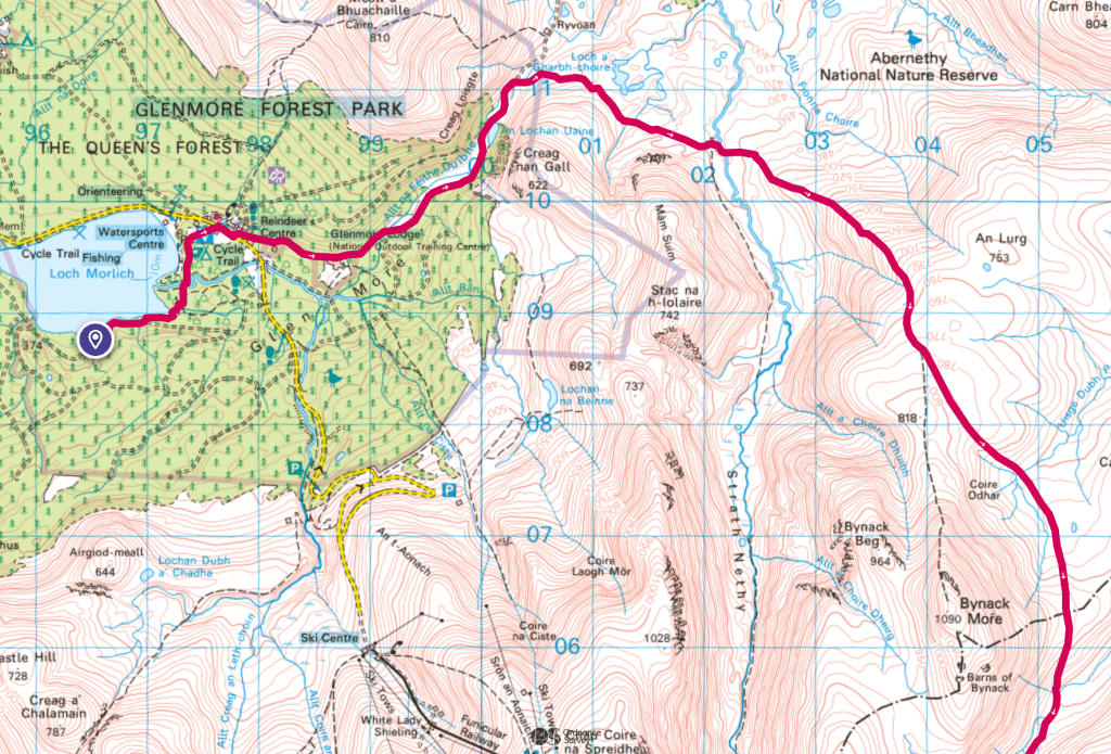
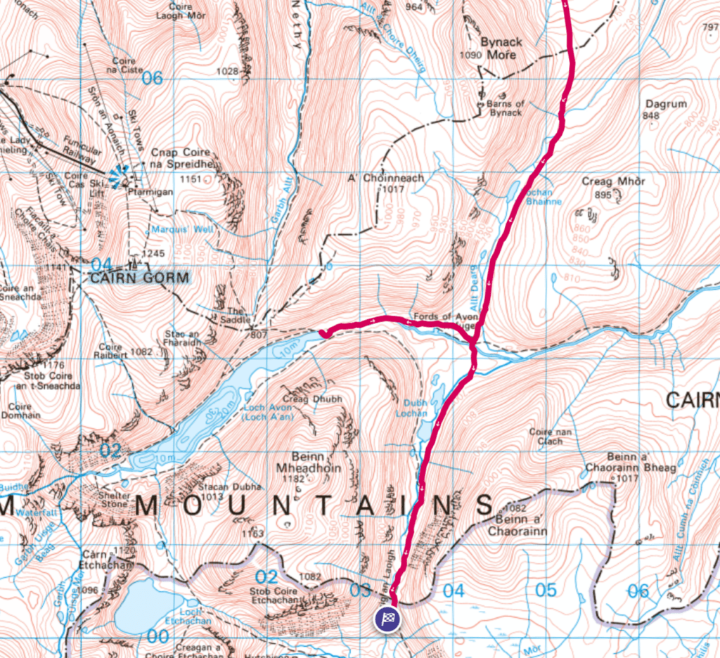
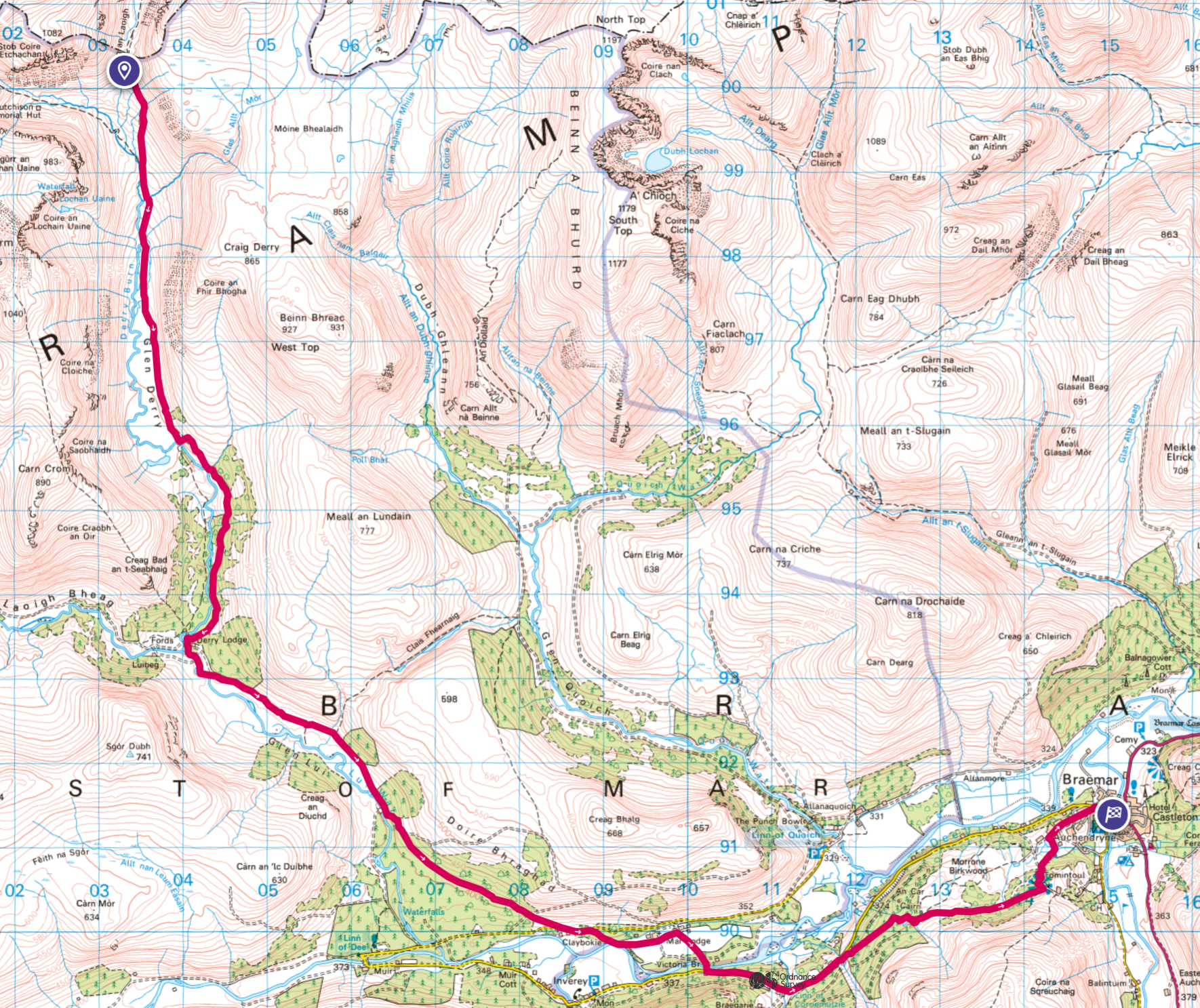
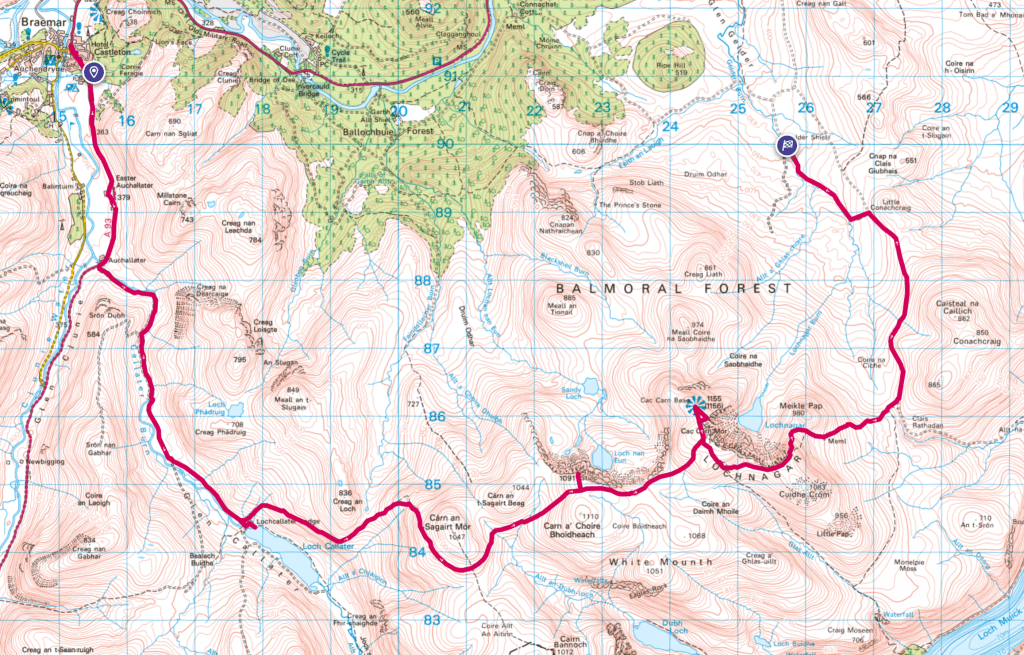
Above, you can see a map of the actual route I ended up doing; over five full days and two half-days of walking plus one rest day, starting from Aviemore. As you can see, it was only a long way into my walk that I entered this map area, OL53; but I’ve posted about OL57 and OL58 before, so I won’t do separate posts for those, and will instead describe the earlier parts of my walk in this post too!
What I ended up doing for the first three days of the walk, from Aviemore to Lochnagar, was pretty much the central route idea I’d sketched out in advance. After that, one option was to carry on west towards Aberdeen: it was a pleasing idea to walk all the way from Aviemore to Aberdeen, but the downside was that it’d involve 2-3 days of pretty flat, not-that-interesting-landscape-wise walking on the Deeside Way after Ballater. As you can see, I indeed headed eastwards towarsd Ballater, but after that ended up doing a more roundabout route via the hill Morven. Other possibilities from Lochnagar would have included turning back into the central Cairngorms and making the walk more of a circuit. So I’m quite happy with how that related to my planning – I did indeed both use and not use my central route idea!
Day 0-1: Travel up
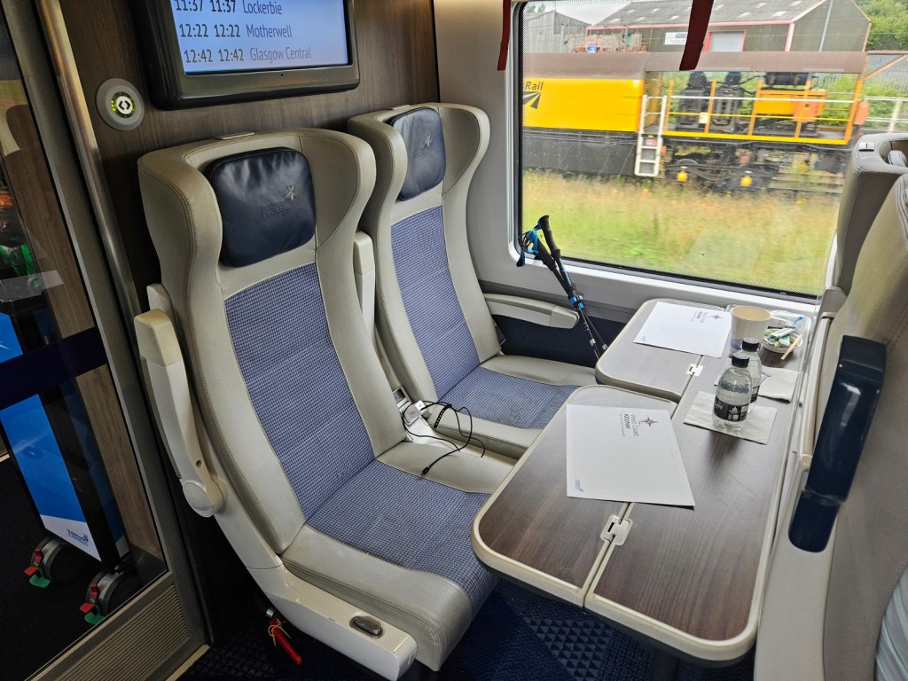
As mentioned above, I made the final call on Thursday 27th June that I’d leave the very next day for up to a week of walking – I say “up to” because I was leaving open the option of coming home pretty quickly if I found it too hard. I finished work on the Friday and, after some final frenzied packing, finally left home at about 8pm. I wouldn’t be travelling far that evening, just a couple of hours on three trains in total to Wolverhampton – Moreton-in-Marsh to Worcestershire Parkway, Parkway to Birmingham New Street, and finally to Wolverhampton. I could have just left early on Saturday morning, but this way I could get to Aviemore a couple of hours earlier – and I somehow doubted that I’d be able to get to sleep early that evening, with thoughts of my trip buzzing around in my head, so better to use a bit more of the evening on travelling!

I had a half-hour-ish change at Worcestershire Parkway, where I took the opportunity to presumably look a bit silly doing my hip physio exercises on the platform. And got to Wolverhampton without hiccups, where I checked into a really great-value Airbnb room: for £47, I got an ensuite bedroom with its own fully-featured kitchen!
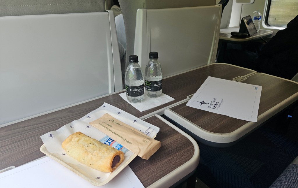
The next day, I continued on the train up towards Aviemore, getting first an Avanti train from Wolverhampton to Preston, then a Transpennine Express train from Preston to Glasgow Central. I treated myself to first class on that second train since there was a good-value Advance ticket available, and was fairly impressed! I like the design of their first-class cabin; it felt very light and airy. I had their vegan sausage roll from the catering, which was rather tasty if unfortunately soggy, having presumably been reheated in a microwave.
I in Glasgow, like the Labour government, had five missions to pursue in my hour between trains. I had to buy some camping gas, a pair of shorts, a map of the Cairngorms, and some lunch; and to get myself from Central to Queen Street station. I got off to a good start, with the camping gas being acquired efficiently in Blacks.
For the map, I was going a bit wild and would be abandoning the Ordnance Survey for this trip, at least for my paper map – I know, me not using the Ordnance Survey! I wanted the 1:40000 “Cairngorms & Lochnagar” Harvey map instead. I’d been curious to try them for a while, since some people (including friend Geochunderer) swear by them. And for this trip in particular, this map just made a lot of sense: it covers the whole of the Cairngorms, including everywhere I planned to be for at least my first four days, giving me lot of options to consider different routes, in just one lightweight, compact, waterproof sheet – rather than the several heavier OS maps I’d need to cover the same area.
The shorts were something I’d realised I wanted just on the way up: in terms of bottoms, I had with me some underpants, my hiking shorts, waterproof overtrousers, and thermal leggings (one good pair for the daytime, one cheap one for sleep). However, I wanted some lightweight shorts for a couple of reasons: one, I didn’t really want to sit about in my thermals for a couple of hours in a hostel while my hiking shorts were in the wash; and two, if it was rainy-but-warm, my favourite is to be in a quick-drying top and shorts I can wear without underwear (like swimming shorts), so I can just get wet but then dry off completely and quickly once it stops raining. For a top, my normal hiking tops are fine for that, but my normal hiking shorts, while quick-drying, aren’t really the kind to wear without underwear; so new shorts it was.
They didn’t have the Harvey map or any suitable shorts in Blacks, nor the map in the Waterstones opposite; but the third shop I tried, a branch of Tiso, had both! The shorts, unfortunately, were really expensive at £49, but I was in a rush and bought them. Maybe not the best decision, but I at least did end up getting a lot of use out of them in the next few months, using them as my main sleepwear when in hostels on both this trip and during my career break in Sep/Oct.
In the end, I got myself a sandwich in Queen Street, and got on my train with time to spare. So that’s all five missions complete and on time, just at a bit higher a price than expected. If Labour manage as much, I’ll be happy!
From Queen Street, I got one train to Perth, then a final one from there to Aviemore, arriving at about 4:45pm. I did a circuit of Aviemore’s big Tesco to pick up some final supplies, and sat by a bin in the car park for a while repackaging things into less bulky ziploc bags – and, alas, discarding a few food items when they came in too-big packets. I then set off for the little bit of walking I’d do that day!
The walk: before this map area
Day 1: Aviemore to Loch Morlich
It being late in the day, I only had a shortish bit of walking to do, about 5 miles to get me from Aviemore to Loch Morlich. This was the reason I’d been keen on starting to travel the evening before: by arriving in Aviemore with some daylight left, I could do this walk on Saturday evening, then start on Sunday and be able to get straight into the mountains, without a long flat section first.
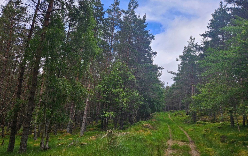
The walking was almost all on the “Old Logging Way”, the old road, now a cycle track paralleling the new road that goes past Loch Morlich up to the Cairn Gorm ski centre and mountain railway.
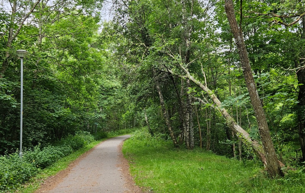
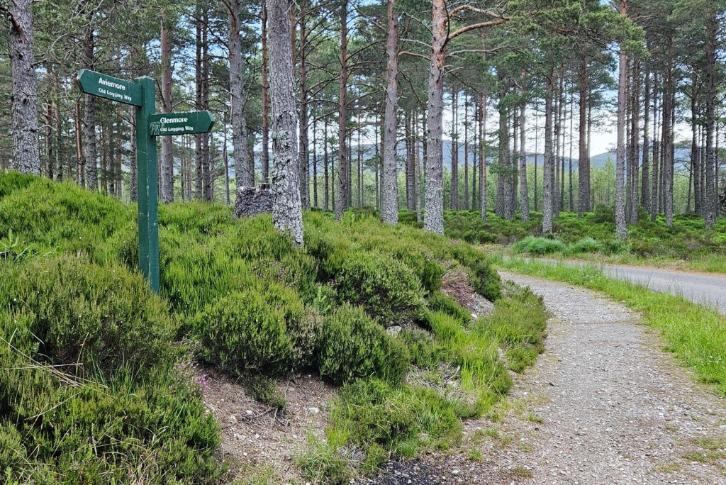
It was pleasant enough, if not especially interesting: flat, easy walking on a wide track through woodland.
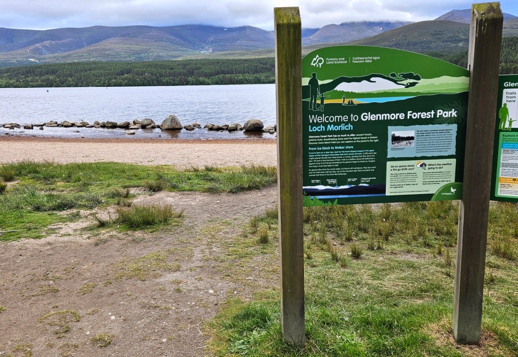
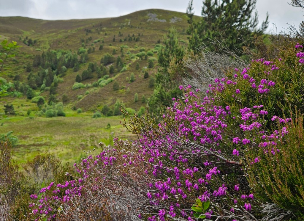
Arriving at Loch Morlich, I could see across to the slopes of some of the Cairngorms, though the highest tops were in the clouds. I didn’t go to the big caravan park, but instead followed the footpath around the loch to the southern side, away from the road, then went off it a few times in search of a wild-camping spot. After a few false starts, mostly too boggy, I stumbled on what was clearly a camp-spot used many a time, with a perfect tent-sized patch of cleared ground, a nice branch for sitting, and, alas, someone’s used fire circle.
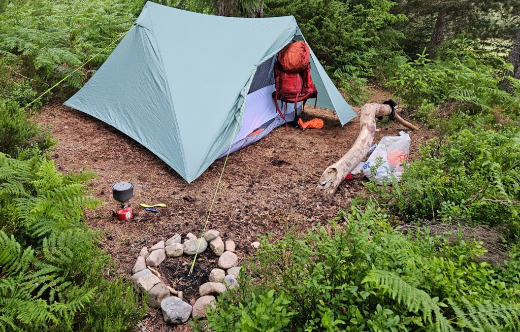
I pitched up, and soon had dinner out. There were a few midges around, which wasn’t promising, but it was nothing too bad, and in the end this was the worst midge night of the trip, so things were actually fine.

Dinner was some of the “chicken” and mushroom pasta flavour of “hot and savoury” Huel, which I really like. Normal Huel – which featured prominently on my last camping-and-hiking walk in 2019, even if I wasn’t the one drinking it – is kind of like a worse, grainier milkshake, and I dislike it; but the hot-and-savoury huel is more like the “just add hot water” instant pasta, noodles or rice-and-curry pots you can get in the supermarket (Pot Noodles and the like), except actually nutritionally balanced and, in my opinion, a lot nicer! I.e. it has real pasta, rice, noodles or similar in it, plus a sauce and little chunks of various proteins or veg; it’s just an instant meal-in-sauce really. And they’re all vegan so lacto-vegetarian me can eat all of them. The “chicken” and mushroom one is my favourite; it’s just an actually very nice savoury flavour, especially if you add a good amount of pepper – which I had done when bagging up my portions at home! I keep a few bags at home and occasionally eat them when I need a speedy breakfast and don’t feel like cereal or toast.
That’s it for that day, really! I soon went to bed.
Day 2: Loch Morlich to Glen Derry
I woke up on day 2 having had an at least acceptable night. As expected, camping isn’t comfortable, but I also did sleep plenty, even if more lightly, waking up more frequently, and less comfortably than usual. It felt pretty moist in my sleeping bag even with the foot end unzipped for ventilation, which I think may be because I haven’t stored my sleeping bag properly for the last several years, so the feathers have probably collapsed.

Anyway, I got up and had breakfast, which was some cheesy porridge. Savoury porridge isn’t really a thing in Britain and sounds very odd to people, but I really like it. At home, I’ll often make some porridge with some cheese, spinach and pepper, maybe a fried egg on top egg if I have any eggs I can eat at the time. [2] There are a few recipes on the internet, e.g. this one, so clearly I’m not completely alone in this, but I’d like to spread it! For the first days of this trip, I’d made up a couple of zip-lock bags with oats, milk powder, powdered cheese sauce, pepper and some dried dill; which I could just add water to and bubble for a while. It was a lot less nice than my usual with fresh cheese and milk (I tend to use a mix of milk and water), but still okay.
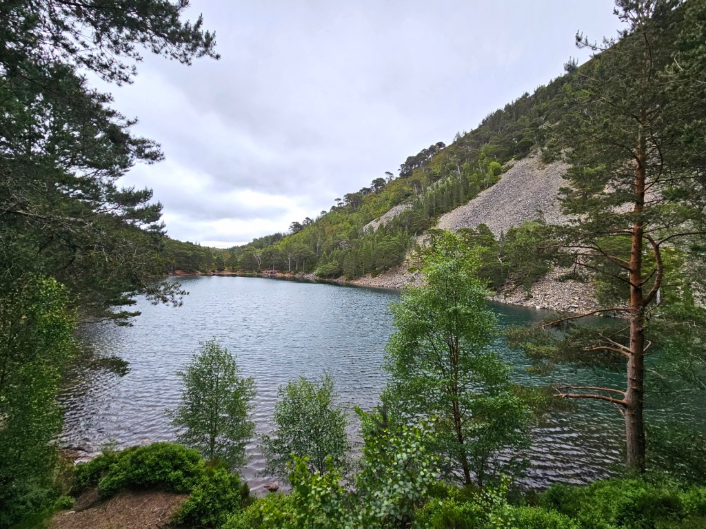
Once I was packed up, I walked around the other side of the loch, past the caravan park and Glenmore Lodge, in the direction of An Lochan Uaine and Ryvoan bothy. Despite it being a grey day, An Lochan Uaine was really beautiful, though I don’t think the photos do it justice.
I turned right a little before Ryvoan, crossing the River Nethy and then taking the path that heads up the mountain Bynack More, though I wouldn’t go to the 1060m top, instead ascending only to about 800m before curving around to the east on a path through Coire Odhar to get down into the giant Glen Avon – I did want to try going to a mountaintop, to see if I could do that comfortably with a pack on, but I thought perhaps not on the first day. There’s a lower-level path through Strath Nethy that I’d considered, but having read it could be really boggy I’d decided to avoid.
I had my classic long-distance hiking lunch of smoked tinned oysters and squeezy cheese, this time in wraps rather than my typical pitta bread looking down over Coire Odhar, then stopped to fill up on water in the Coire Odhar stream, while a D of E group lying collapsed nearby with their bags had an argument over who was carrying what – though fortunately they’d calmed down by the time I walked on.
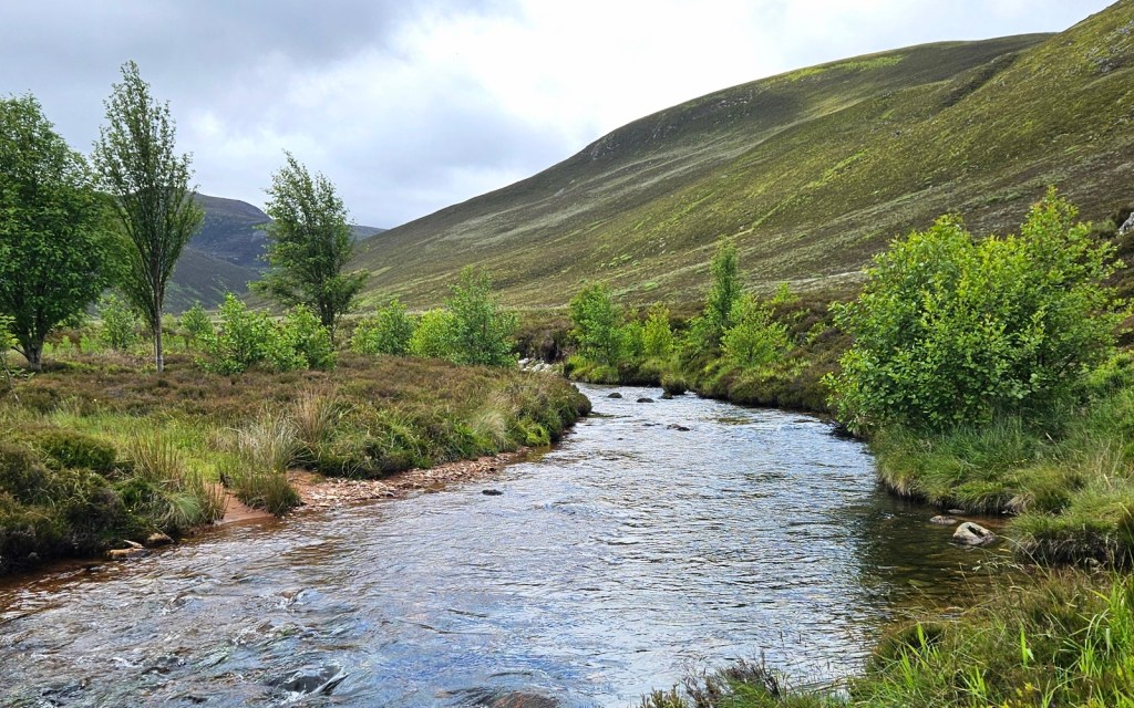
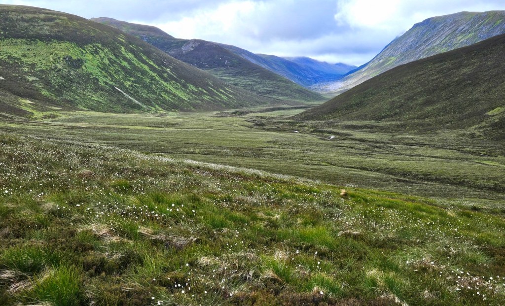
From there, my next couple of miles took me down a valley which I don’t see named on the map, to descend into Glen Avon, meeting it at the Fords of Avon, at a kind of crossroads of three/four glens, since another valley and stream flows in to Glen Avon from the south at the same point.
The Fords of Avon Refuge – an emergency-shelter-only bothy – sits here, and as I arrived there were a couple of German hikers with truly giant backpacks, sitting having a snack outside on rather chunky folding stools they’d brought with them – while I’m not sure I’d want to have to carry them, I was a little jealous of them having something nice to sit on in their campsites!
In terms of continuing my route from that point, I’d considered heading up to Loch Avon and then over the higher pass to Loch Etchachan, and past the Hutchison Memorial Hut to camp near the top of Glen Derry. I was tempted, but the weather looked like it might turn in the evening, and I thought I’d rather take things a little easier on my first day – plenty of time to try a steeper ascent later in the week – so instead from the Fords, I’d be taking the path southwards through the Lairig an Laoigh. However, I still wanted to see Loch Avon, which is meant to be really pretty, so I dropped my bag near the refuge, to pop quickly and unencumberd up the mile or so to the loch and back.
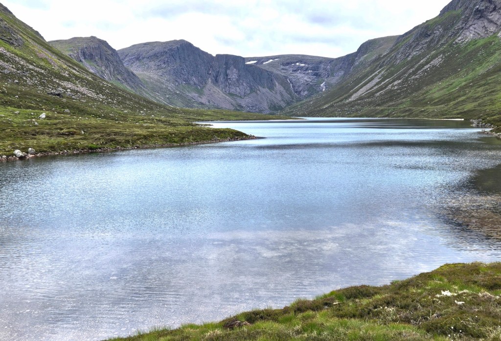
Loch Avon, at the head of the glen and river of the same name, is surrounded on three sides by steep slopes leading up to some of the highest of the Cairngorms. It was indeed a spectacular spot, and well worth the little side trip! I’d love to come back on a sunny day and see it then, and get up into the high hills around it.
After sitting up there for ten minutes or so, I headed back, collected my bag, and crossed the river at the Fords to proceed southwards as planned. Just over the ford, I found that the D of E group I’d passed earlier had clearly joined up with several other groups, as I walked right through the middle of their little tent city pitched on either side of the path – they were all sitting inside their tents at the time, and loudly joshing around, presumably unaware I was passing about five yards away and could hear everything they were saying…

A little later, I was overtaken on the path by their two teachers who’d come to check in on the groups. Despite it being about 5:30pm at this point and us being far from the nearest road, the teachers weren’t camping out or bothying, but going back to their beds that evening – they were going to walk the six or so miles to Derry Lodge , where they’d left their bicycles, to then cycle on to where they were staying.

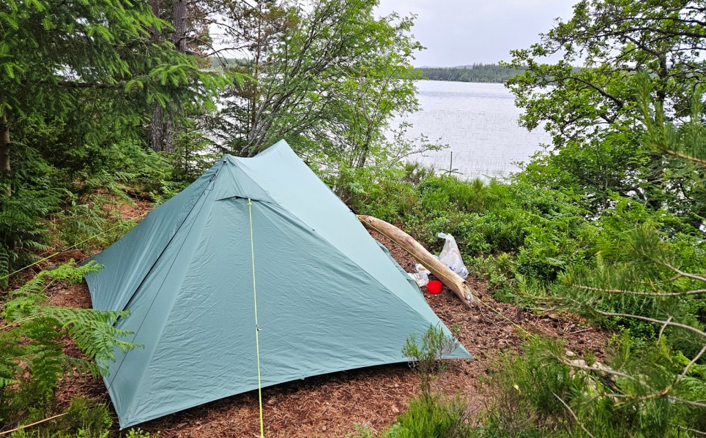
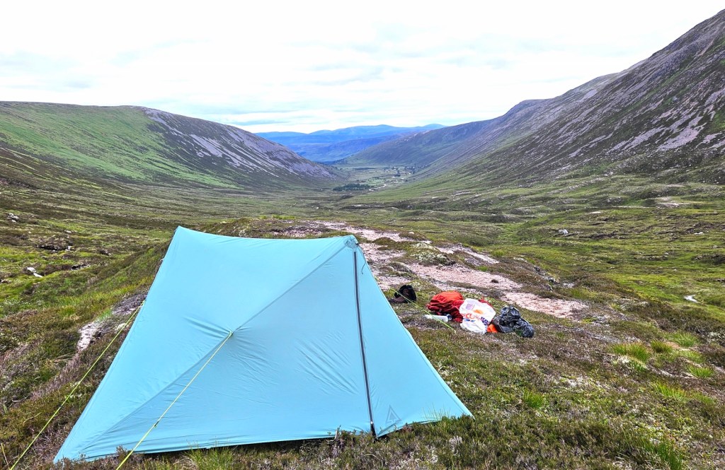
I stopped for the night just over the pass into Glen Derry, which was a really pretty spot, letting me look from my tent down across the whole wide valley.
I was pretty pleased with how the first day had gone – I’d done a shade under fifteen miles with about 750m of ascent, and felt fine physically having done so with my heavy-ish pack. It was also enjoyable, I’d seen some great scenery, and the weather had stayed dry and clear enough to see the mountaintops, even if it was a grey day. A good start to my trip!
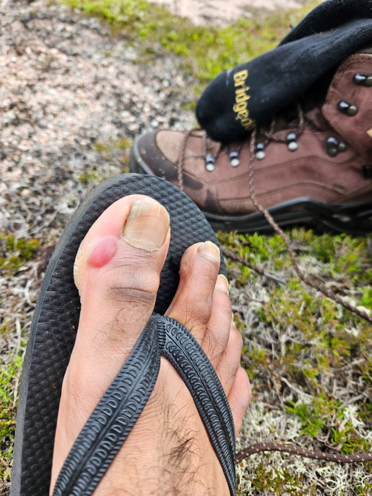
I had, unfortunately, developed a rather angry-looking blister on my right big toe. I was doing something rather foolish-sounding in doing a week’s hike in a completely new pair of walking boots, but these are actually my third pair of exactly the same boots which I really like – each of the previous times, they’ve somehow been entirely fine instantly, without needing breaking in. They haven’t lasted me that long – I think I’d done about 900mi in the previous pair, and they hadn’t been waterproof for the last third or so of that – but I do like that I just know they fit well and are comfortable, so I’d gone ahead and bought another pair. Alas, it seems I was a bit too hubristic in going for such a serious walk immediately. My blister was also in the exact spot where my last two pairs had eventually split an outer seam, suggesting that I am pressing against the boot there much more than normal. Oh well, I put on blister plasters for the rest of the trip, and it didn’t burst or cause me any notable discomfort. And just one blister for a new pair of boots on a serious week-long hike is still pretty good going, I think!
That day I’d also also enjoyed how by the afternoon, I was in an area where, it being late in the day and several hours’ walk to the nearest road or settlement, everyone who was there would be overnighting in the mountains. It wasn’t busy, by any means, but all of the five or so times I met people, it wasn’t just a hello in passing, but they’d ask where I was staying that night and so on, and we’d have a couple of minutes’ chat; there was just some nice sense of camaraderie. I feel like most of the time when I’m on walks, it’s either been in areas that are perfectly easy to access on a day hike, or in areas so remote that I don’t meet anyone at all. The Cairngorms, being a popular outdoorsy region, but big enough that a lot of it is accessed primarily on multi-day trips, is a category I haven’t done much of before.
Thoughts on camping
I’d now done two consecutive nights’ camping, and actually ended up doing no more camping nights for the rest of this trip: I did two in hostels, one in a bothy, and two in an Airbnb room, so I’ll write here about how I found camping.
Overall, not much of an update on what I’d thought before, I think. It was okay; I can still do it. I slept adequately if not excellently both nights, and I had no major problems. That said, it is, as expected, pretty inconvenient. Setting up camp, cooking, washing up, digging toilet holes, and everything else that needs doing just takes up so much of my day. I was probably spending two hours in the evening and two in the morning just on necessary tasks – many of which I’d need to do anywhere of course, like having breakfast and dinner, brushing my teeth and so on; but many more I had to do because of camping. If I’m out walking from, say, 8am-6pm, and want to be sleeping from about 10pm-6am, then that means I have barely any time to just be relaxed. And while it’s adequate comfort-wise, it is obviously a whole lot less comfortable than being actually indoors. So I think overall: I’m still willing to do it where there’s a big enough upside; e.g. when it allows access to wild places I couldn’t get to otherwise, and I expect I will continue to camp from time to time. But I expect those times will be pretty rare.
Day 3: Glen Derry to Braemar
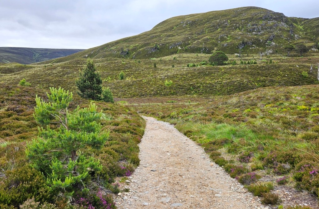
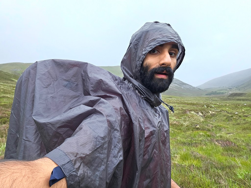
Day 3 would be an easier one, and without any major sights to see; slightly shorter at about 14 miles, but more importantly, pretty much all flat or downhill, coming out of the central Cairngorms to the village of Braemar. The weather was a bit worse with some on-and-off light rain, so here are some attractive photos of my in my poncho looking like I’m wearing a bin bag! I was glad it was a more straightforward day as I was feeling more tired and less motivated than the day before, though nothing too bad.

TStarting off down Glen Derry, I entering some woods shortly before passing Derry Lodge. After that point, the footpath became a vehicle track and, eventually, meeting the road between Braemar and Linn of Dee. One of yesterday’s D of E groups passed me just after I set out, and the other just before Derry Lodge; and I met their teachers twice that day; once heading towards me in the morning to find the further-behind group, and again passing me on their bicycles after they’d all met up again near the Lodge.
I had lunch on a stony beach by the River Dee soon after meeting the road and passing through the grounds of Mar Lodge. For my final approach to Braemar, I ascended the hillside a little way again, heading through some forest and moorland, for a view down over the town and the flat valley of the River Dee.
I got to Braemar itself at about 4pm, bought dinner for that day in the shop, and waited around a little for its 5pm opening time before heading to the hostel where I’d be staying the night.
The Braemar hostel was nice! I’d found out when booking it a couple of days earlier that I’d be staying the very first night it was open again after a year or so of being closed for refurbishment. This was actually also, somehow, my first time ever staying in a shared hostel room with people I didn’t already know – that is, I’ve stayed in hostels before, including sometimes in large shared dorm rooms, but always on larger or smaller group trips where we had the whole room to ourselves. All fine, of course! And I ended up doing it many more times during my career break later in the year.
I did a bit of laundry, had my dinner – a macaroni cheese microwave meal with extra grated cheese on top, and a packaged chickpea salad pot – talked to people a bit, and spent a while lying on my bed making my plans for the next few days. This was the point where I’d need to decide between two major possibilities, namely turning back westwards to do more walking in the Cairngorms, or continuing east, likely through the Lochnagar area, to then afterwards turn either northeast towards Ballater, or southeast into emptier country before eventually descending into flatter Angus farmland. I decided, as you can tell from the title of this post, to have a challenging day 4 heading over Lochnagar, to follow it with an easy day 5 to Ballater, and a rest day there on day 6.
The walk: this map area
Day 4: Braemar to Gelder Shiel via Lochnagar
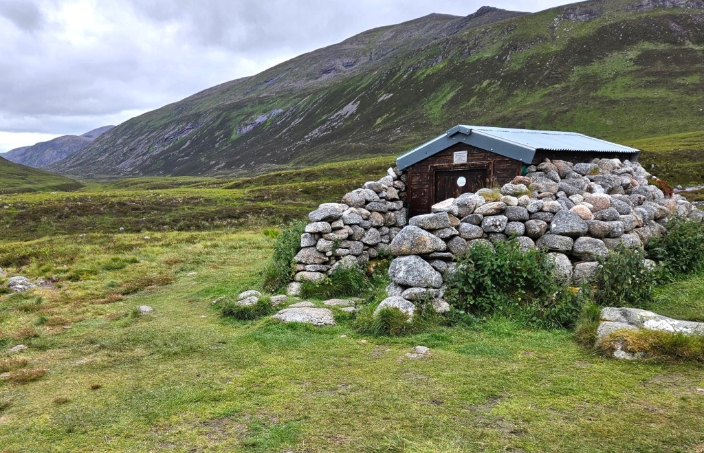
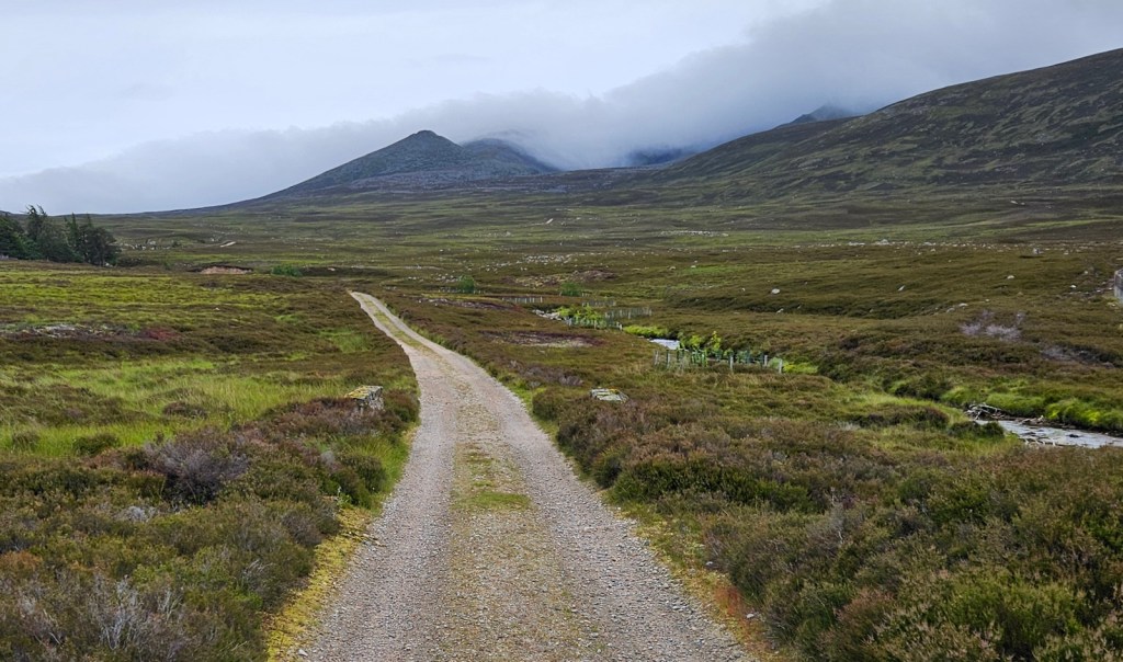
I slept well and, after my slightly tired and less-motivated Monday, felt nicely fresh on Tuesday, for what would be more challenging day. I wanted to try a proper hill climb at some point in my walk, again to see if I could still do that comfortably with a full camping pack, so I’d decided to go up Lochnagar, a well-known mountain. I’d wild-camp if necessary to make my day shorter, but ideally I wanted to stay in the Gelder Shiel Stable bothy, which’d make this day a long one too, at about 18 miles.
I picked up some more groceries in Braemar, but was able to have less food with me than I had for my last few days, since I needed only one day worth of food (plus the emergency food I always carried) to cover me up to the next day’s breakfast; instead of two and a half days as I’d set off from Aviemore with – by the next day’s lunch I expected to be able to get some food in a café around Balmoral. I had so far also had a little gubbins of poles and fabric with me that allowed me to set up my sleeping mat as a kind of chair at camp, but I’d found it to be more faff than it was worth, so I stashed it in a bush in Braemar to come back for from Ballater on my rest day, and thereby save a bit more weight. These together probably took about a kilo off my pack, taking me down from about 13.5 to 12.5kg with water and food; which I think I could really feel – the day before, I’d been feeling the pack as a bit of a drag and feeling a little sore under the straps on the chest and hips; but despite heading up a mountain and back, I felt pretty light on my feet on day 4.
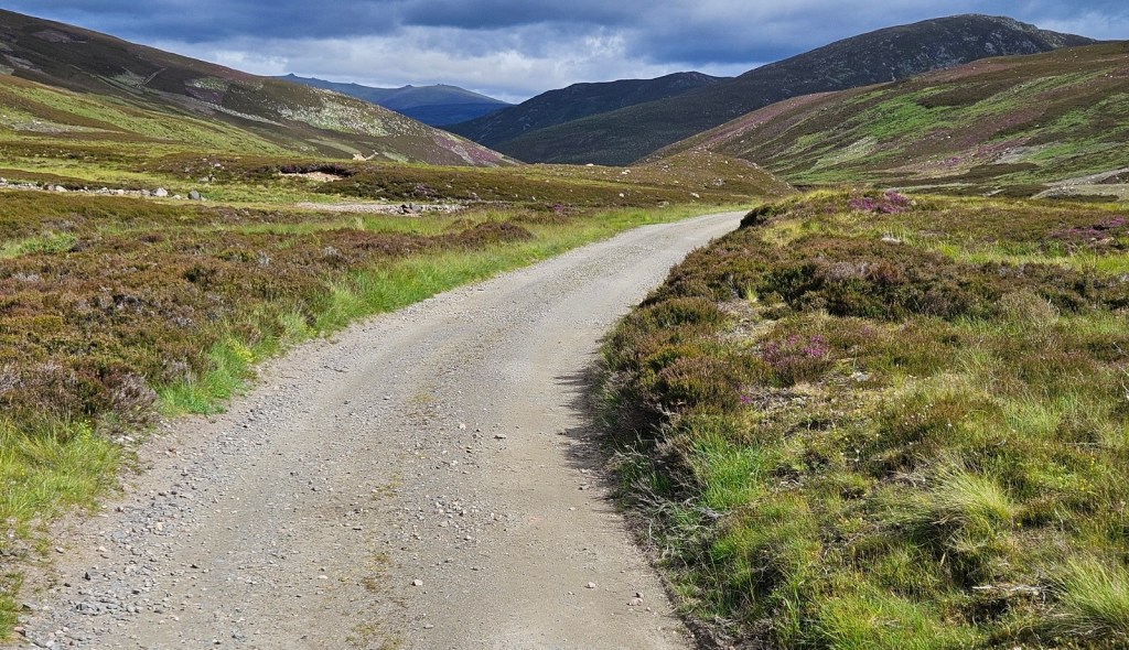
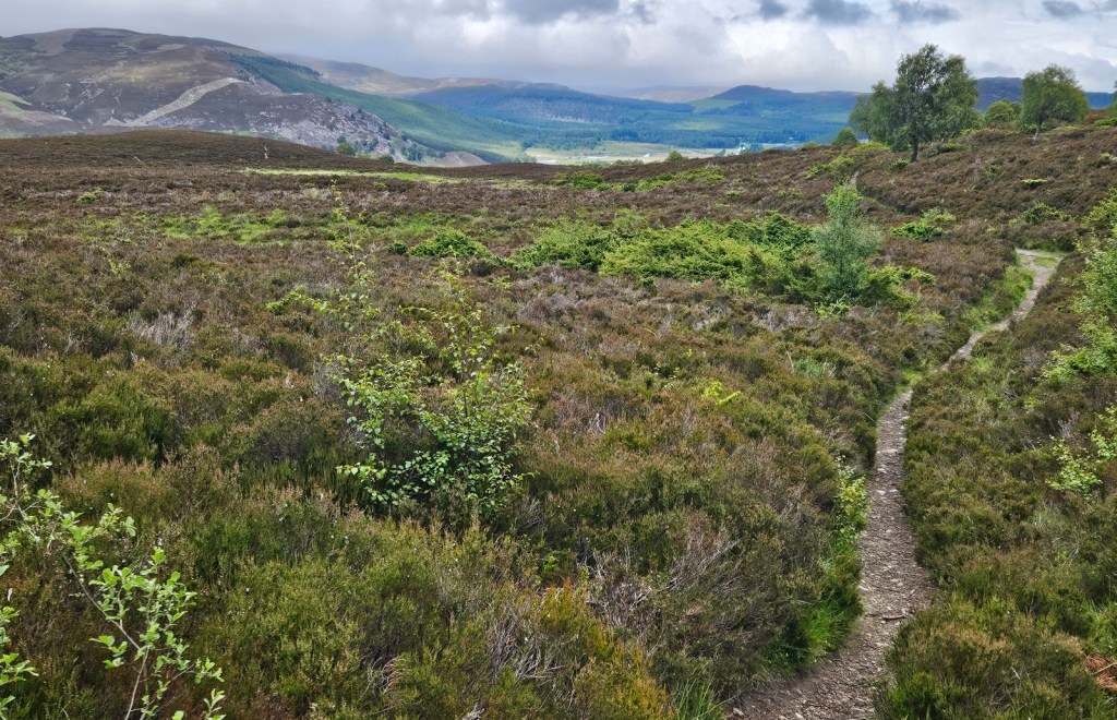
My route took me first just south along the A93 main road for a couple of miles down Glen Clunie to Auchallater, before I turned southeast on a track leading up Glen Callater. It was a little way in to Glen Callater that I finally entered this map area, OL53! I’d spent the previous three days walking through maps OL57 and OL58, and then for just about two miles this morning was in non-overlapped parts of OL52; all of which are map areas I’ve posted about before, which is why I narrated the arlier trip at the start of this post. On the Glen Callater track, a man on a quad bike passed me at least four times, making trips back and forth with various items in his little cargo rack, including at one point a very large number of bottles of milk.


I arrived at the loch and had a quick poke in the Callater Stable bothy, which looked very nice. Interestingly the bothy has a toilet available in a nearby building, consisting, if I remember correctly, of some proper toilet seats set in a bench built over a long drop into a toilet pit.

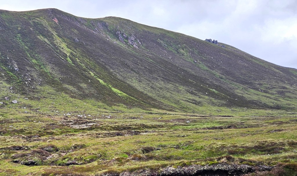
From there, the proper climbing started, up the northwest side of the glen. I stopped for lunch at about 1pm after skirting around the mountain Càrn an t-Sagairt Mòr, with the biggest part of the day’s climbing now behind me. There were no sandwiches I could eat in the Braemar shop that morning, so lunch was a wrap with squeezy cheese again, but livened up with some mangetout and Space Raiders!


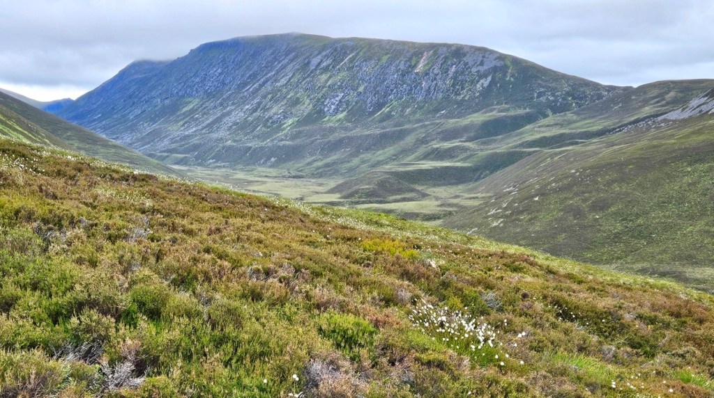
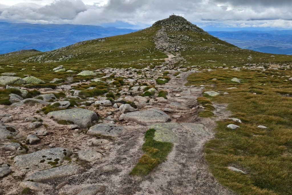
The summit of Lochnagar is a kind of point extending northwards between two steep-sided north-facing corries. I approached from the west, seeing the gentler of the two corries first, then ascended the peak itself, before walking around the Corrie of Lochnagar to eventually descend.
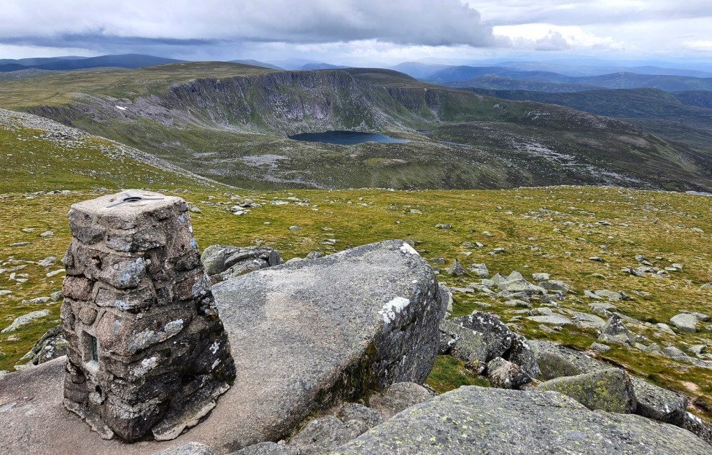
I was lucky with the weather, in that while it was pretty cold and windy, it was clear, and the views were quite as great as expected! I wasn’t seeing as far as the summit marker claims are visible on the clearest days – no Ben Nevis or the Cheviot, but I could clearly see across to plenty of the Cairngorms, and I think I could see the sea off to the southeast, which would be about thirty-five miles away, though I’m not sure. It was a great view!
The views were always so wide that they’re quite hard to do justice to in this column-shaped text area; I always wanted to be taking panoramas, as any little normal-photo-shaped slice always looked a bit underwhelming, oh well. You’ll just have to make do with these wide photos shown quite small to fit in the column.

Since leaving the road, things had been very quiet, and I met barely anyone between Loch Callater and the summit – it’s much more common to approach from the east, and indeed there were more people around on my way down in that direction. But while approaching the summit I thought I could hear distant singing, which was interesting. When I got to the top a little before 4pm, there was a man standing there who asked me if I wanted to hear a song, and I saying okay, launched into a very impressive rendition of “Dark Lochnagar“, which was very atmospheric up there! I afterwards found a sheltered place to sit just below the top, and stayed there a good while.
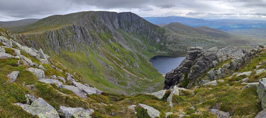
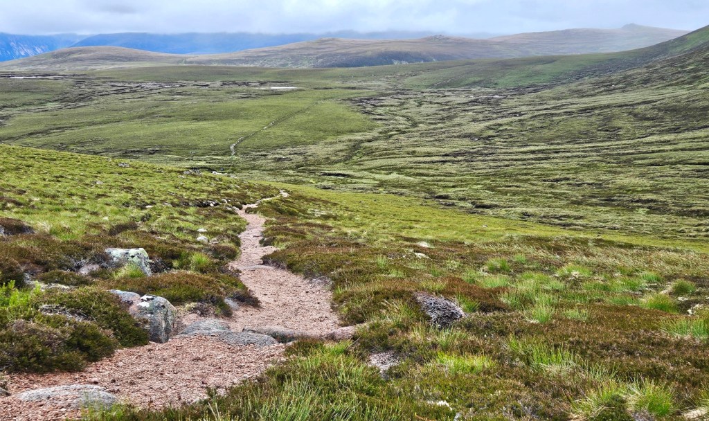
I had about another six miles to do after the summit, taking me first around the Corrie of Lochnagar, then descending first steeply and then more gradually eventually down to a vehicle track, where one can turn right to head to the Spittal of Glenmuick car park from which people usually climb Lochnagar.

I instead turned left, for some final gradual descent to my destination for the evening, Gelder Shiel Stable bothy. I arrived at about 7:30pm after a very long day (for me at least) – some 18 miles, including a Munro! I was tired, but was still feeling okay physically, so that was good.
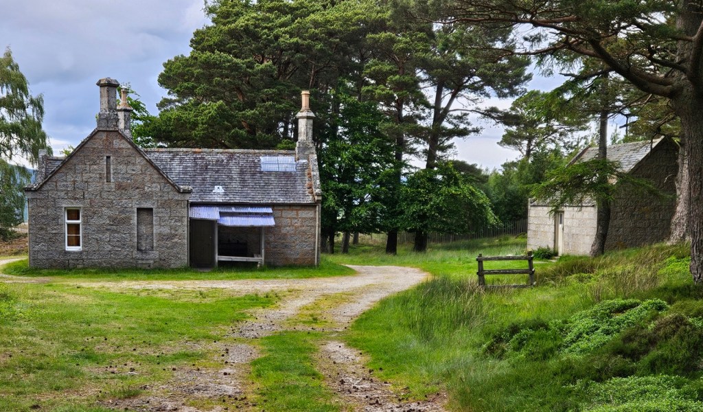
I’ve stayed in bothies two times previously, both on the same trip, but one of those was unmaintained, and the other was one maintained by the estate. So this was my first time in a Mountain Bothies Association bothy. It was very nice!
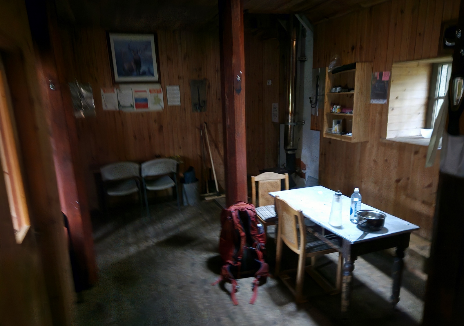

I had the bothy for myself, but it looked pretty well-used from the logbook, with several entries per week. I hope I’m not too sacreligious a bothy-user for not being particularly into fires – I just don’t really find them worth the effort, so I didn’t set the stove going.
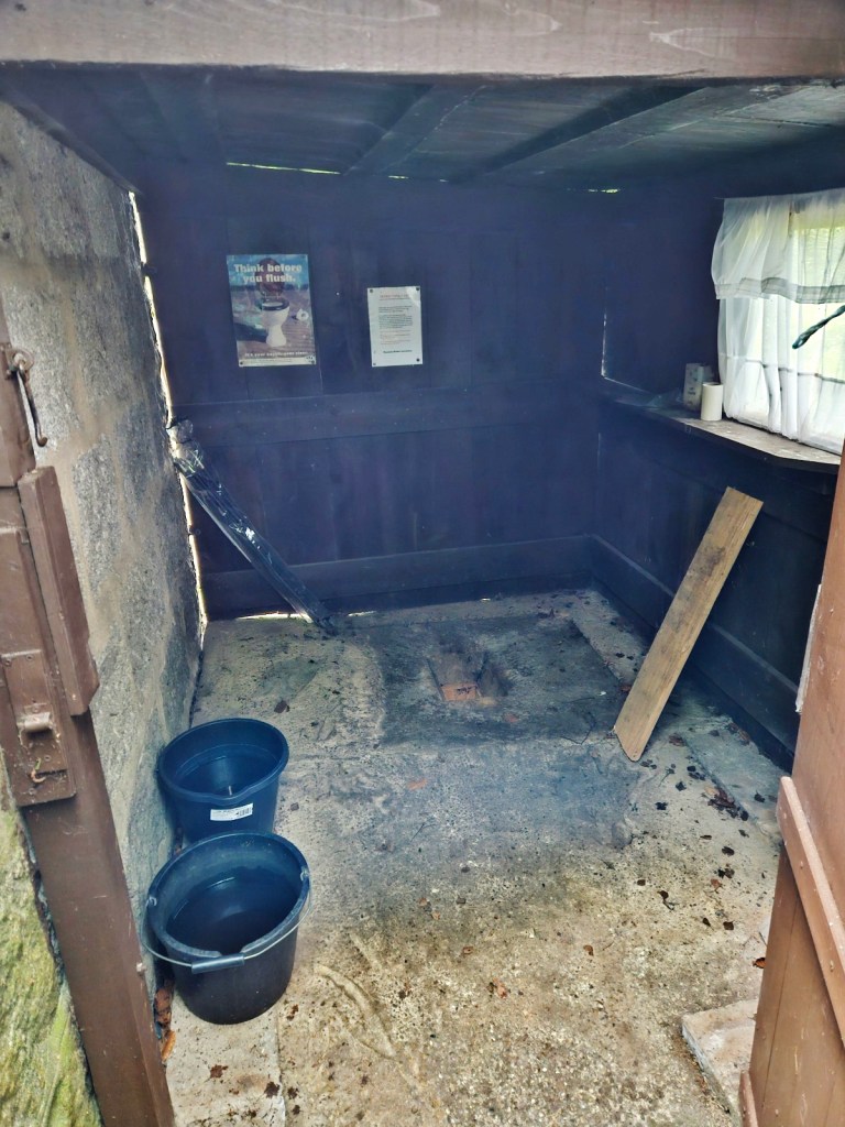
This bothy, luxuriously, has a tap and a toilet – the latter being a room with a toilet depression in the floor with a sewer pipe leading out to a septic tank, to be flushed with a bucket you can fill at the tap. Very convenient!
I had the last of my “chicken”-and-mushroom flavour huel pasta for dinner, and settled in early to sleep.
Day 5: Gelder Shiel to Ballater
Following my long, hard Day 4, Day 5 would be easier, at about 13 gently downhill or near-flat miles to get me to Ballater, where I’d then have a rest day on Day 6. Breakfast was a little odd, being some instant vegetable couscous, with the remaining squeezy cheese added along with a sachet of mustard a kind soul had left in the bothy. Out of curiosity I tested the carbon monoxide alarm in the bothy and it showed low battery, so I noted that down to report to the Association once I had internet.

Given the easy day, I had a leisurely morning, leaving at about 9:30am – late enough that, when I turned on my satellite communicator to say I was starting my walk for the day, there was a message from my mum waiting, checking that all was well since it was much later than I’d left previously!
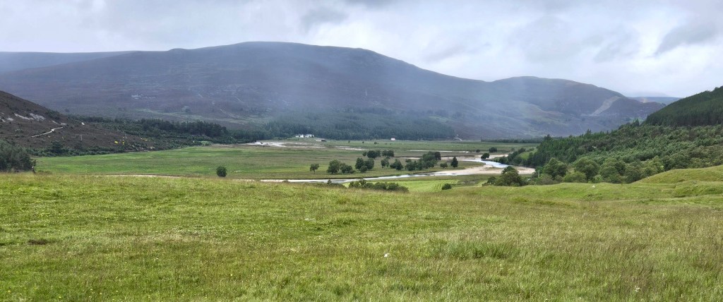
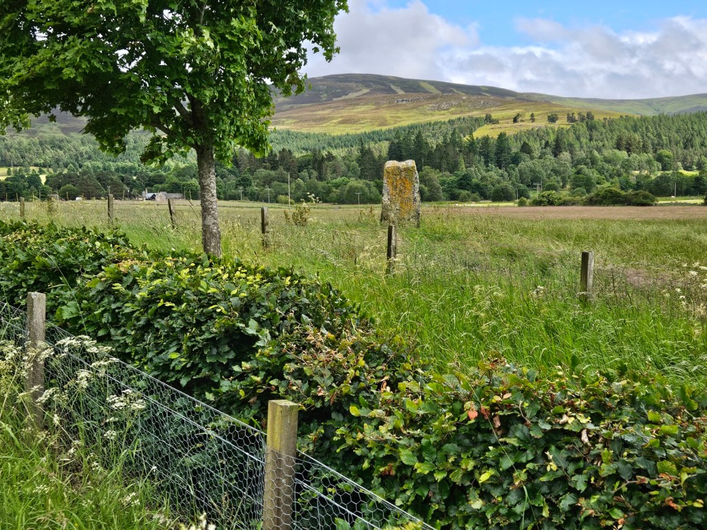
The day’s walk started with two-and-a-bit of miles of gentle descent on a track through sloping moorland, then another mile or so through the woods surrounding Balmoral Castle.

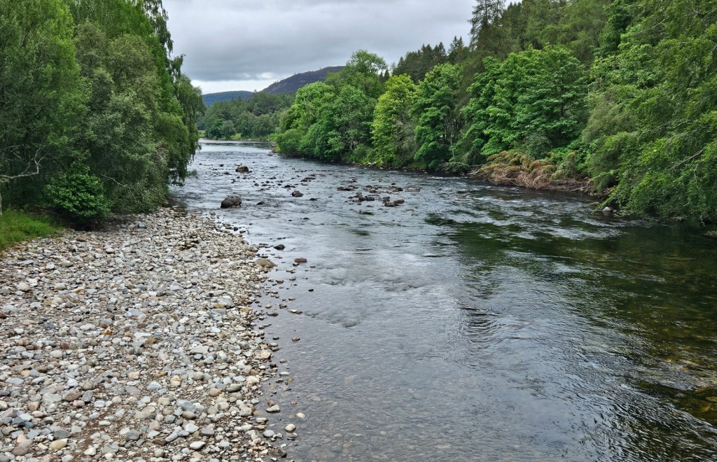
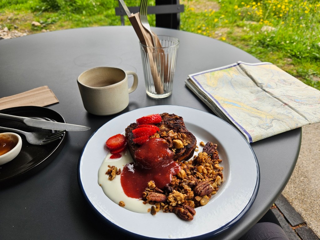
Crossing the River Dee on a footbridge, I came into the villlage of Crathie, where I treated myself to brunch in a café! The main option I could have was a nutty vegan French toast with yoghurt and berries – very much not the sort of thing I’d normally pick, but it was quite nice, and I also had a chai and a little mini snack pie with peas in.
Having my big backpack with me and being an obvious long-distance hiker does rather get conversations going and various café patrons chatted to me – one group had been up Lochnagar the day before some three hours before me, but it had been too cloudy at the summit to see anything. A couple of older local chaps from Ballater were alarmed to hear that I was planning to walk into Ballater, but were mollified when I said I’d take the south side of the river rather than walking along the A93, which they were concerned would be unsafe.
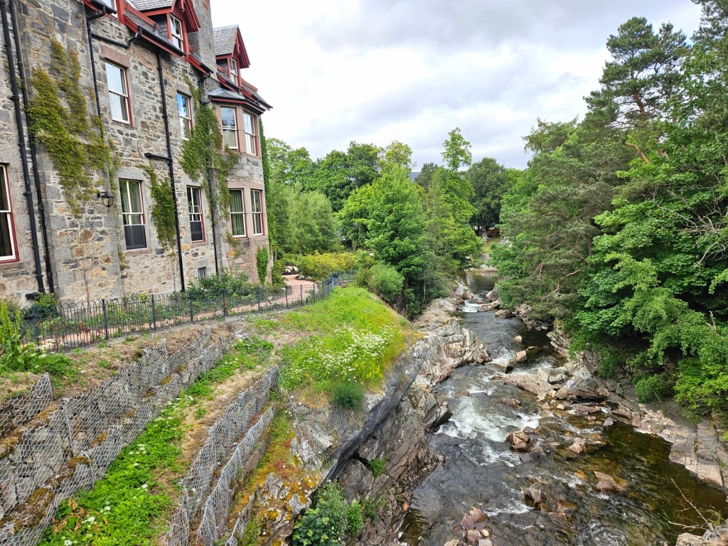
From there, I went on another eight or so miles to Ballater. Mainly I was following a quiet road, the B976, with some diversions off it when there was a suitable route on smaller tracks and paths. It was uneventful, and I got in to Ballater at about 4pm, and checked into my accommodation for the next two nights –since I’d be taking a rest day – a nice little room above an Italian restaurant, which felt very luxurious after my camping, hostel and bothy nights! I had some chip shop chips, cheese and curry sauce and a Co-op samosa for dinner, and was well satisfied.
As I entered Ballater, I also entered map area OL59. While Ballater is in an overlap between OL59 and this map (OL53), I’ll let you know what I did there in my next post, about OL59, since this one is already extremely long. See you then!
[1] Last time I did a camping-and-hiking trip, namely the walk the walk from Kinbrace, I was fine physically during the trip, but I got back with some seriously achey hips. This got milder quickly, but never really went away; instead coming and going over the following several years. Of course, I did nothing about until, finally, this year I went to a physio and found it was a textbook case of trochanteric bursitis, and can just be fully cured with a few months of exercises…
[2] I am lacto-vegetarian, i.e. no eggs in general, but I make an exception for “eggs from chickens I know personally”, as I jokingly tend to call them – i.e. eggs from chickens in people’s back gardens and so on, when I’ve seen the chickens myself or know and trust the person.

What an adventure!!
LikeLiked by 1 person
The camping looks so nice omg
LikeLiked by 1 person
WOW YOU did a real Lord of the Rings walk O_O I’m the opposite with camping/hiking, I hate walking but I love camping. I also took Norwegian in school (at the same time as Old Norse) but I’ve forgotten most of it LOL.
LikeLike
Interesting! Hehe yeah I’ve definitely forgotten a lot/most of my school languages too.
LikeLike