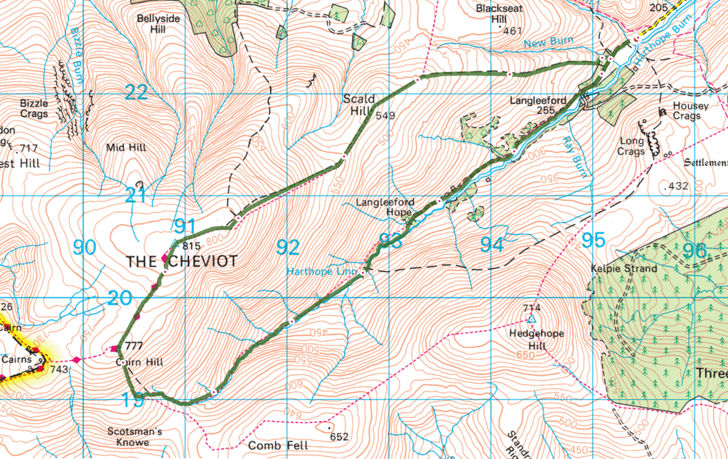
OS Explorer map OL16, The Cheviot Hills: Jedburgh & Wooler – I own this map, and had visited it before starting this blog. Visited again for this post 9th July 2021. This is the second of six posts about my trip to Wanlockhead in Dumfries and Galloway with my school friends Cabbage, Joystick and Climbing Programmer, including time I spent in Northumberland and the Scottish Borders alone on the way there.
Google Maps location links: Ancroft, Langleeford, Wooler, Town Yetholm, Jedburgh
From Berwick-upon-Tweed’s branch of Go Outdoors, where (as related in my previous post) I’d stopped to remedy my lack of a few bits of necessary hillwalking kit, there was about a 45-minute drive southwest to Langleeford in the Cheviot Hills (and in this map area), where I planned to start my walk.
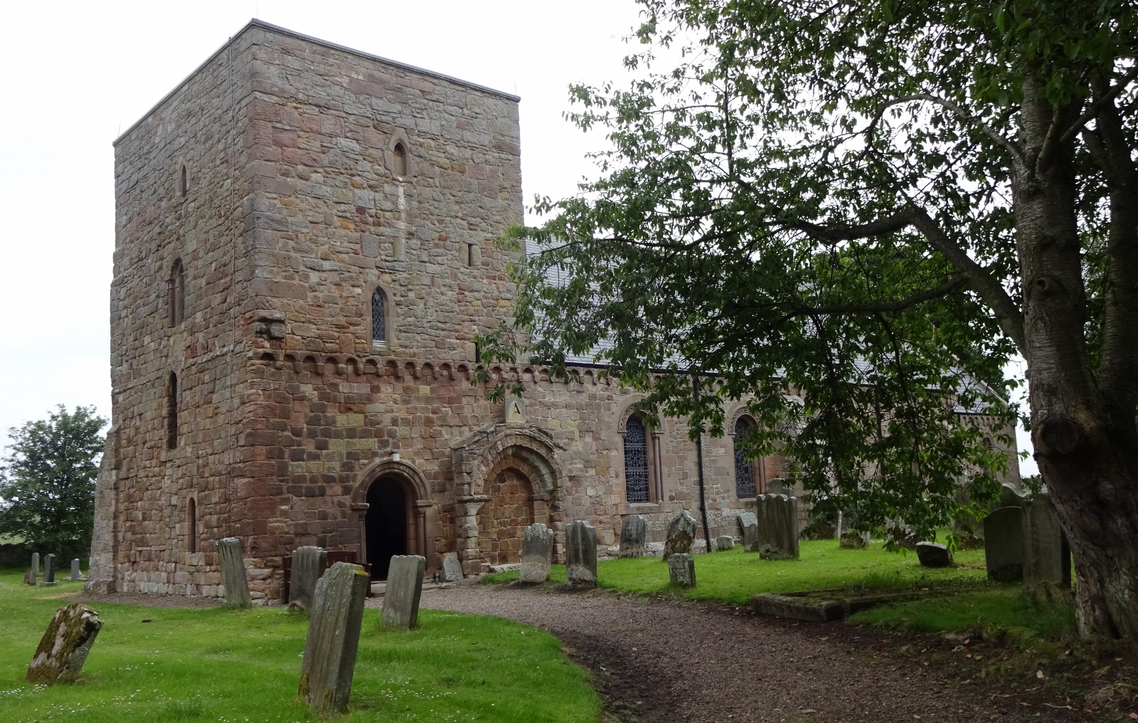
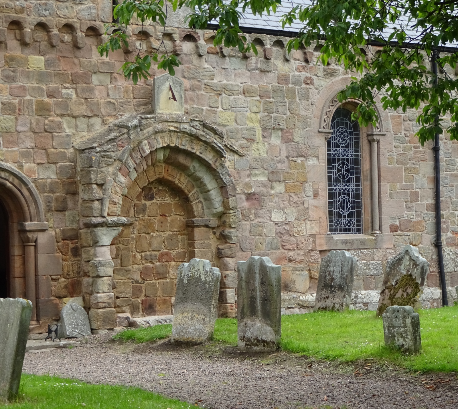
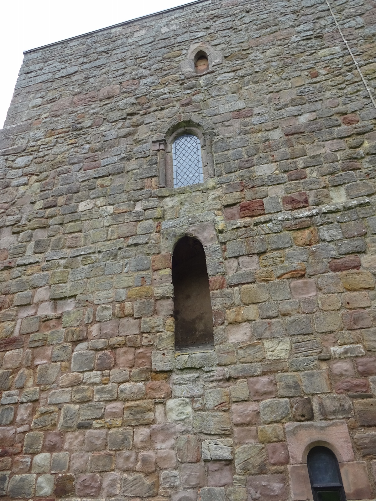
I stopped briefly a couple of times on this drive, the first time being when my attention was grabbed by the always-alluring sight of a brown sign saying “Anglo-Saxon Church”. This took me to the church of St Anne’s, Ancroft, and I duly had a quick wander around the outside. It did indeed look good and old, with a fun haphazard array of weirdly aligned windows of seemingly wildly varying age. I think the “Anglo-Saxon” might have been a bit hopeful on the part of the tourist authority, given that the Historic England listing doesn’t claim any of the church to be older than 12th-century, but still, it was very pretty! I didn’t go inside, not knowing whether that would be welcome in those days of theoretically waning pandemic; but it was a nice stop nonetheless.
I also stopped, just south of Wooler, to buy some snacks at the interesting institution of a 2-in-1 petrol station and antique shop – I feel like you know you’re in a vaguely isolated bit of the British countryside when you encounter dusty antique shops by the side of minor roads, set up in old farm buildings or the like! In the petrol-station half of this establishment, I bought myself a flapjack, and was also pleasantly surprised to encounter that they stocked the questionable foodstuff that is Smith’s Scampi Fries. Now, as you’ll read about when I write about Wanlockhead in a few posts’ time, on this trip to Scotland with my school friends, we’d be playing a few games of Games Workshop’s Middle-earth Strategy Battle Game – it was our primary collective hobby throughout our schooldays, and we’ve kept playing every now and a gain as a thing we do whenever we meet up for a longish while.
Scampi Fries, as you may have guessed, are fish-flavoured (though actually vegetarian) crisps, commonly sold as bar snacks in slightly grim pubs. My parents, courtesy of their business, had memberships at a Booker cash-and-carry, and during my schooldays, I’d occasionally accompany them there to get snacks for entertaining my friends when they came over. Presumably because it also sold to slightly grim pubs, Booker stocked Scampi Fries (and their thematically similar cousin, Bacon Fries), and so they were for many years a staple snack during the wargaming sessions that my friends and I would have in my parents’ cellar, where I had a gaming table set up. I was therefore happy to find some to take to my friends on our Scotland trip, for old times’ sake!

Langleedford is a collection of farm buildings, sitting alone in the fairly deep Harthope Valley save for a single other farmstead, Langleeford Hope, a mile and a half further on. The tiny, bumpy single-track road that took me there – and had me drive through a flowing ford, which I’ve only done a couple of times before – led me to half-expect that the place would be empty, but there were a good six or so other vehicles present at the very pretty little riverside grassy area that seemed to serve as the valley’s walkers’ car park: I think Langleeford gets some amount of traffic for being a solid place for walkers to access the Cheviot (which is the highest point in Northumberland) and the wider area of fells and moors around it.
My planned route was quite simple, just ascending up and along one side of the valley, before turning around at the head, and coming back along the valley bottom. Now I don’t normally go for a “climb the highest hill there is” approach to walking. I do love a good peak or ridge; the feeling of being able to see for miles in every direction is just great, but smaller-but-carefully-chosen hills are often better for this than the biggest ones around, and the Cheviot is a good example of this: despite its height, it’s ery flat-topped, most of your field of view from the summit itself will be taken up by the ground you’re standing on even on the clearest of days. And there are plenty of great walks that don’t require height at all, of course: woods and rivers, low-lying heaths, or some good lumpy, sheepy farmland.

Nevertheless, I did pick the Cheviot this time. After my long absence from most any kind of altitude, I was craving hills, so I didn’t want to go to any of the flatter bits of Northumberland or the Tweed Valley; and I also felt like some nice, empty moorland or similar. I planned this walk fairly hastily the evening before, and the Cheviot just looked like a good option fairly quickly: there was a nice, logical circular walk of around the right length, I’d get to go up high into a moor-y area; and when looking at my maps I was tired and wanted to go to bed, so just decided to go with that!
Having packed up and just about to leave the car behind, I realised that I’d forgotten to reactivate the subscription on my satellite beacon/communicator thing, whose SOS facility I usually rely on as my safety net when walking alone in remote areas – that being more convenient than digging around for the right local authority with whom to lodge my intended route beforehand, and then having to worry about forgetting to tell them when I returned and thus inadvertently causing search parties to be sent out after me and the like. I didn’t have phone signal either, so couldn’t text my plans to a friend; so instead I trusted to the others who’d left their cars parked near mine, and left a note in the windscreen telling of my route and when I planned to be back. Hopefully someone would think to look at it eventually! (I did also send a text to Vesper, which found its way out to her at some point during my walk.)
I soon set off, initially along the road for just a little way, before taking a track to carry me up the hillside. Just before I left the road, I met an older, presumably local couple, who were just out for a ramble up the road and back: we had a short conversation – they were very interested in my having just been on Lindisfarne, whom I was meeting and why. It was nothing special, and I’m introverted at the best of times, definitely not usually one to strike up conversation with a stranger – however, in the pandemic days of mid-2021 it had been such a long time since I talked to anyone other than my usual ten or so people, that I found it rather refreshing and pleasant!
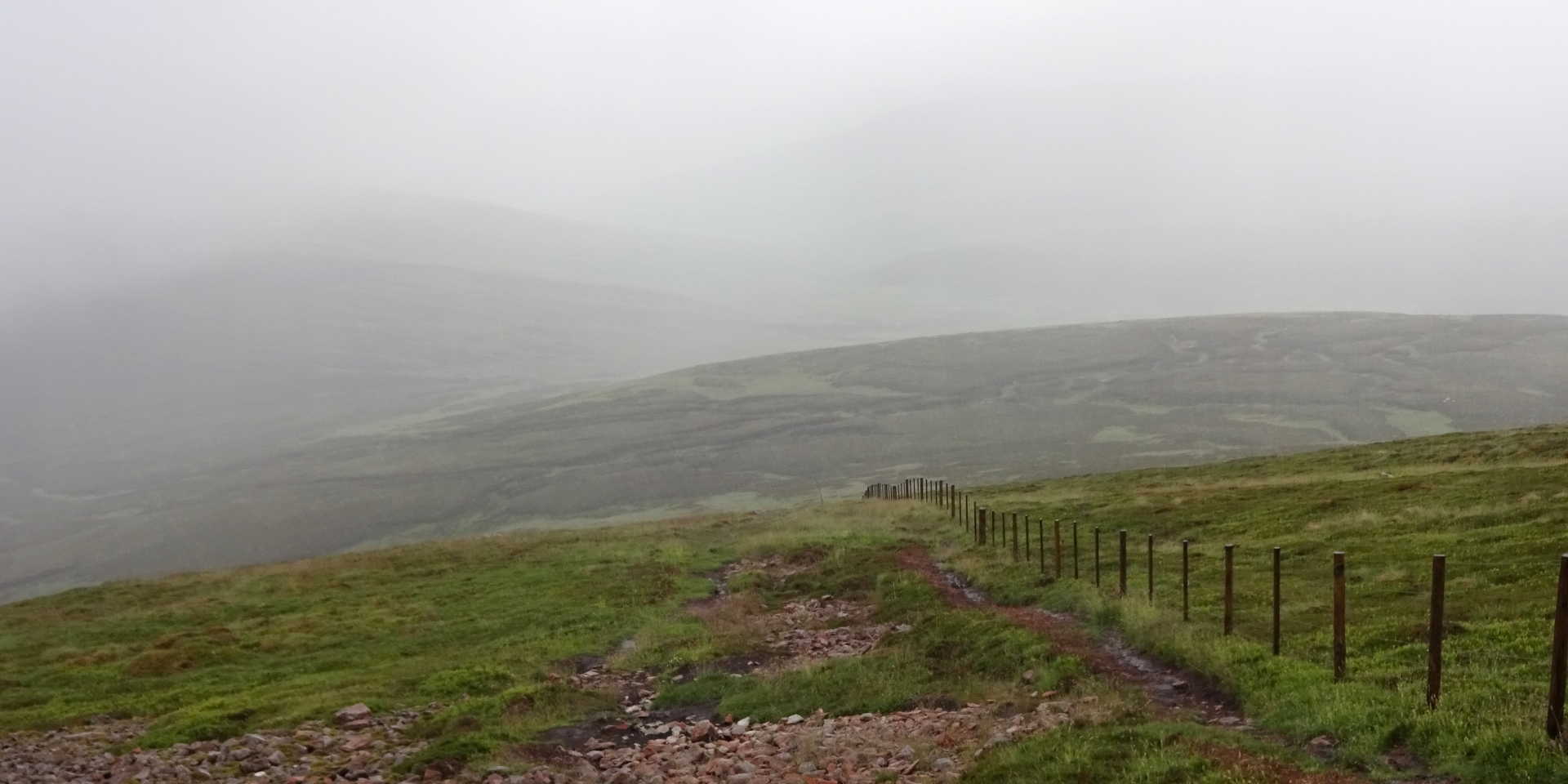
There was unfortunately a lot of low-lying cloud around as I set off, so it seemed likely there wouldn’t be much of a view once I got up high. I started out in my raincoat (rain being a distinct possibility, and it seemed fairly chilly when I started), but I quickly removed this: it was really very humid, not all that cold, and I get warm very easily once I start doing anything faintly physical. Unfortunately, it did indeed get very foggy quickly after I started my ascent, with visibility probably at about 25m, and it also started raining. But, oh well, I knew the risk from the weather forecast, and I was still enoying myself being out on the moors!

Due to the rain, I ended up sporting a distinctive look of having raincoat hood over my head, but the back just hanging over my rucksack, so that I could keep my hair reasonably dry, but my torso and arms were out! I wished I’d brought my hood-that’s-not-attached-to-a-coat (see my Durham post).
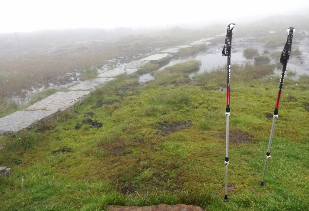
As I was approaching the summit, the dirt path beneath my feet gave way to sturdy stone slabs. This is because the the northernmost (and so, for most people, final) section of the Pennine Way runs close by the head of the Harthope Valley, and there’s a mile-long spur of the Way that leads to the Cheviot’s summit and back: the Way, being rather popular, gets heavily eroded in places, so several sections of it are paved in this way. I’m unsure whether most Pennine Way walkers include the section to the Cheviot or skip it: I can’t imagine I’d be feeling particularly enthusiastic about it in their situation, given that, as I understand it, the already 27-mile-long final section from Byrness to Kirk Yetholm is usually tackled in one extremely long day!
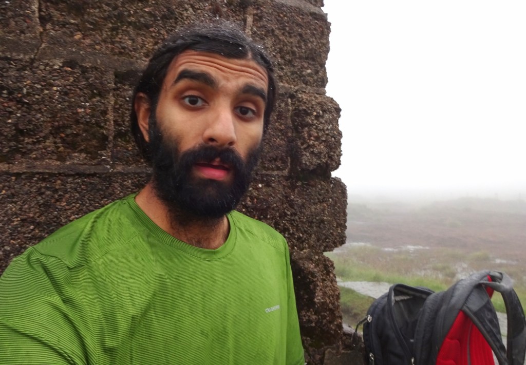
I reached the summit of the Cheviot an hour and a bit after I set off: it was still foggy and rainy, so there wasn’t much to see, but still, I was enjoying the sense of openness and slight desolation. There’s a big trig pillar on the summit, raised on a high platform so that it can be seen on the hill’s round top, which provided a convenient ledge where I sat down, in the lee of the main pillar so out of the rain, to eat my lunch: an unfortunately now slightly damp sandwich made with some Quorn non-chicken slices, cheese, leaves, cucumber and garlic mayonnaise, plus some cherry tomatoes and a packet of crisps. [1]
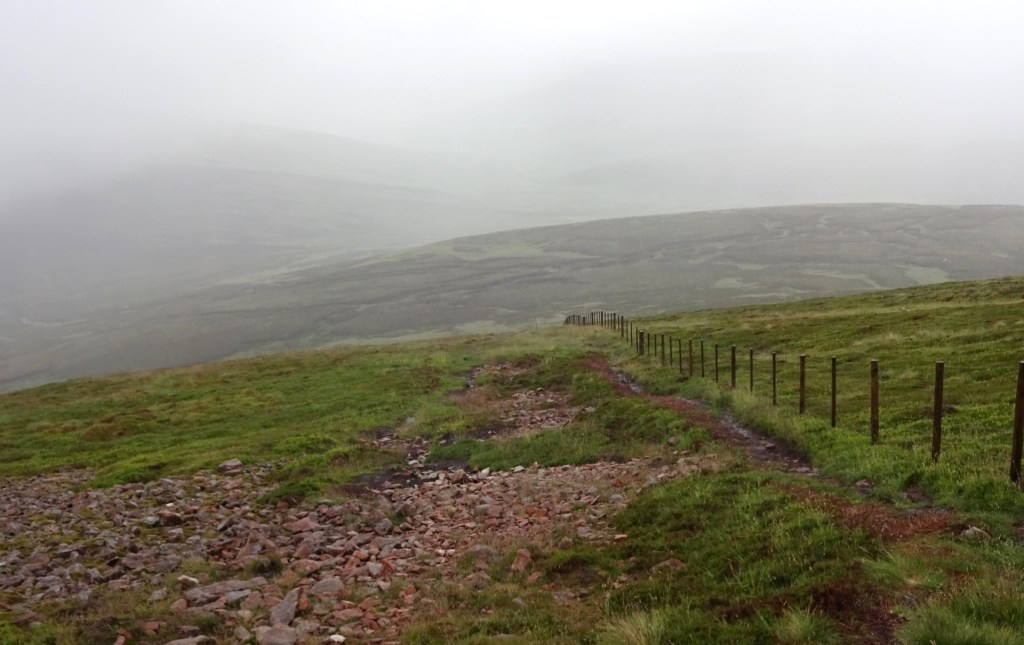
After my lunch, I started my descent, which would be much more gradual than the initial climb. After a flattish hilltop section along the Pennine Way, I turned off the Way to descend a reasonably steep slope down to near the col at the head of the Harthope Valley. Continuing straight on from that point would take me up the other side of the valley, where if I wanted a longer route, I could continue over the summits of Combe Fell and Hedgehope Hill before descending from there to where I’d left the car. I considered it, but it still being wet and misty, I decided to stick to my original plan and turn left again, onto a path that would follow the Harthope Burn along the valley floor until I returend to my starting point.
I enjoyed the walk along the burn path: even within the larger valley, the upper bit of the burn runs within its own little sub-valley, giving the walk a very sheltered feel. The path crossed the burn again and again, seeking flattish ground, and my boots – which have a hole in, and were already thoroughly moist on the inside, especially since I’d foregone my gaiters due to feeling warm – were soon waterlogged enough that I stopped stepping from rock to rock and instead just planted my feet freely in the running water, whether it topped my boot or no. Wet boots, while very unpleasant when you have to put them back on again, are strangely freeing in this way!
A way down this path, I caught up to a party of seven youths out on a walk, who very enthusiastically stood aside to let me pass (while telling me how much less experienced they felt than they imagined me to be), inducing me to speed up a little so as to not inconvenience them for too long. Due to this, I managed to slip, falling on to one knee and my hands as I stepped to the side of the path to pass the final one of them, who was walking a fair way ahead of the rest of her group – she was very nice about it, checking I was okay and all, but some sense of rushed embarassment (plausibly induced or strengthened by their protestations of inexperience relative to mine) made me get up quickly, disdaining her proffered hand and professing my entirely-okayness, and rush off before actually considering whether I was injured! (I was fine, fortunately!)

Soon, the path turned into a vehicle track as it passed through Langleeford Hope, the second of the two farmsteads in the valley, and I passed another five of the youths, this time fortunately without incident – I guessed they were part of the same bigger group, since they were all girls and looked of similar ages: late teens, maybe a few in their early twenties. I was a bit puzzled as to how they knew each other: they seemed too old to be a school group; but twelve seems rather big for a group of university friends, and if it was some kind of society or interest group, it seems unlikely they’d all be the same gender. I suppose they probably were a group of school leavers, some of whom happened to look old for their age – but I didn’t ask, so it will remain a mystery!
Langleeford Hope sat in a really pretty little wood, which I’d have sat down in and taken some photographs of if I didn’t feel odd about letting the party I’d just passed pass me again so quickly, and then presumably having to pass them back just a little later. I soon enough got back to the car and generally sorted myself out, changing out of my wet clothes, then sat reading for a bit while I waited for my feet to dry enough to make putting my dry socks and shoes on a pleasant experience. The girl groups both arrived, and sorted themselves out next to their three or four cars, and had settled into a circle of camp chairs and were watching something apparently very amusing on a phone as I drove off.
From there, I drove off to Hawick, where I’d be staying the night. For details about that, see my next post!
Previous visits
I’ve visited this map area previously as part of the Holy Island Trek, the attempt that I made in May 2016 with my friends Millicent, Queenie, Vesper and Erithacus to walk across Scotland from Lindisfarne to Iona. Now, we ended up leaving and re-entering this map area several times over a few days, for which reason I’m going to separate out my narration into a few sections!
Holy Island Trek day 3: Wooler to Town Yetholm
In my Lindisfarne post, you can read about our first full day’s walking of the trip, which took us from Beal, the village just over on the mainland from the Holy Island, to a campsite in the town of Wooler. The next day of walking took us from Wooler to the village of Town Yetholm, just over the border from Northumberland into Scotland, and was entirely in this map area.

As with the previous day, out walk for the day was entirely following St Cuthbert’s Way, a long-distance walking route from Lindisfarne to Melrose, which we intended to walk the whole of as the first section of our planned coast-to-coast route. This day’s route was only ten or so miles, but compared to the previous day was much hillier, ascending from valley bottoms up to high moors twice. Somewhat unideally for such activities, it was a very hot and sunny day; however that did mean we got some great views over the Northumbrian countryside.
The most notable waypoint on the first half of the route was Yeavering Bell, a hill with a classic Iron Age hillfort on top, but which, most interestingly for us, looks down on the important Anglo-Saxon site of Yeavering, where the very clear remains of a Saxon hall were uncovered a few decades ago – looking down from the hill, we thought we could make out the hall complex site itself, showing up as different textures of ground in a field.

I’ll leave narrating most of the rest of this day to the Annal, the collaborative journal that we kept on this trip:
The descent from the Bell passed in a positively Amazonian fern-tangle and insect-swarm. Pausing for a moment after a brief cut through a cow-field, we were met by a pleasant and chatty lady who warned us both of the unforgiving shadeless hills ahead of us, and of a Danish priest and his flock whom we would apparently soon encounter collapsed in a heap – she assured us that they were in fact, not dead but merely resting. We somewhat underwhelmingly encountered them soon afterwards fully capable of and actively exercising their ability of locomotion.
Our slow wearying day thus far had been encouraged by the prospect of lunch at Hethpool, over halfway along the route; however our perseverance finally gave out a third of a mile early at a shady spot under a tree, it having become quarter past two by this point.
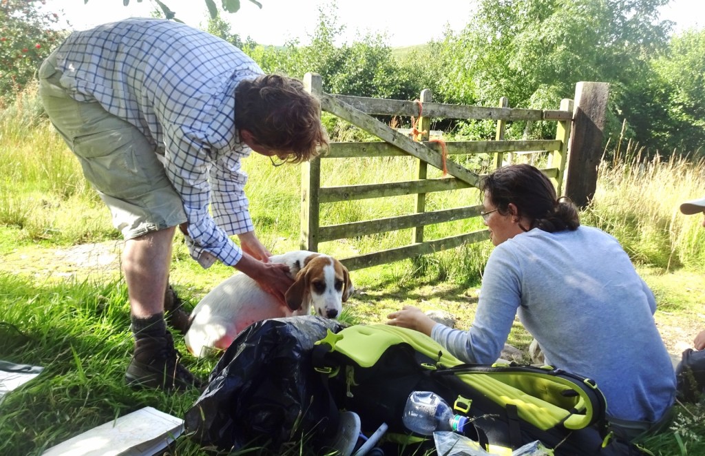
However, this stopping point was a good idea, because our lunch was soon delightfully interrupted by a sudden puppy tidal wave! A lady arrived, preceded by her dozen-or-so furry companions, who proceeded to nuzzle us lovingly, giving much-needed emotional reinforcement. Truly, St Cuthbert smiled on us this day.One puppy clearly took to [Millicent], settling down fo a rest by his feed despite the protestations of its owner. Eventually, [Millicent] was obliged to pick up the reluctant puppy and place him on the other side of the gate: a maneuver that succeeded on the third try.
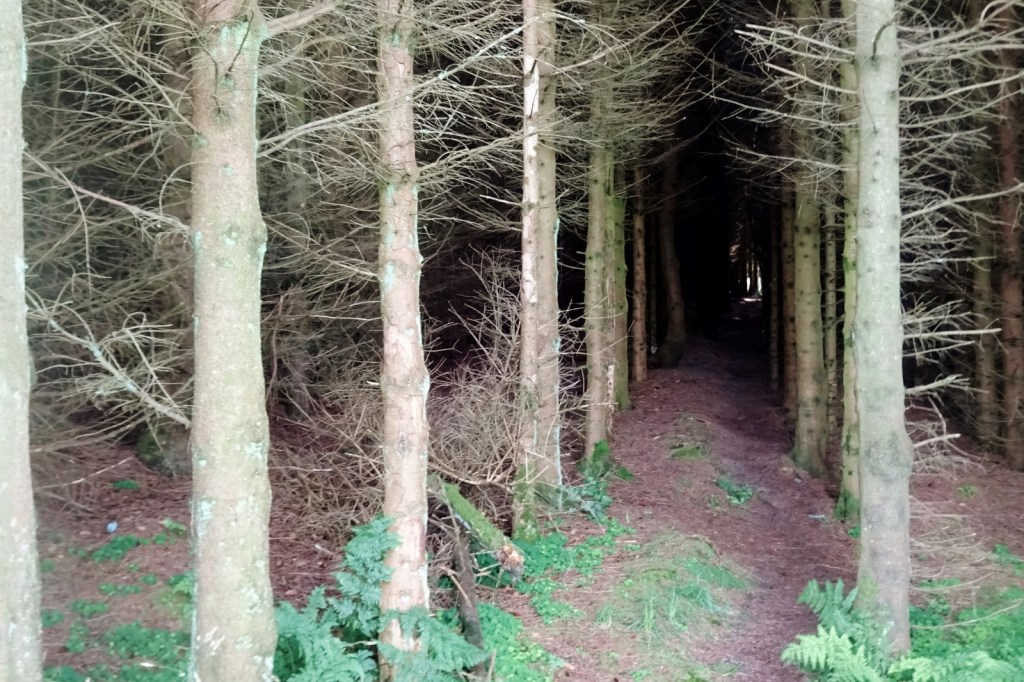
Our route continued, consisting after Hethpool of a few miles of straight, flat, mercilessly shadeless tarmac road. Blessed, blessed shade was finally reached before we began our ascent to teh aptly-named Border Ridge. Midway up this imposing climb, we entered the equally imposing Enchanted Forest [or at least so we called it]. Light gave way to dark, grass to bare earth, merciless sun to deathly still coolness. Despite what all the fairy tales had told us, we strayed from the path, immediately becoming ensnared in impenetrable tangle. It was only the benevolant magic of GPS / on-looking gaze of St Cuthbert that allowed us to emerge with only a few scratches.
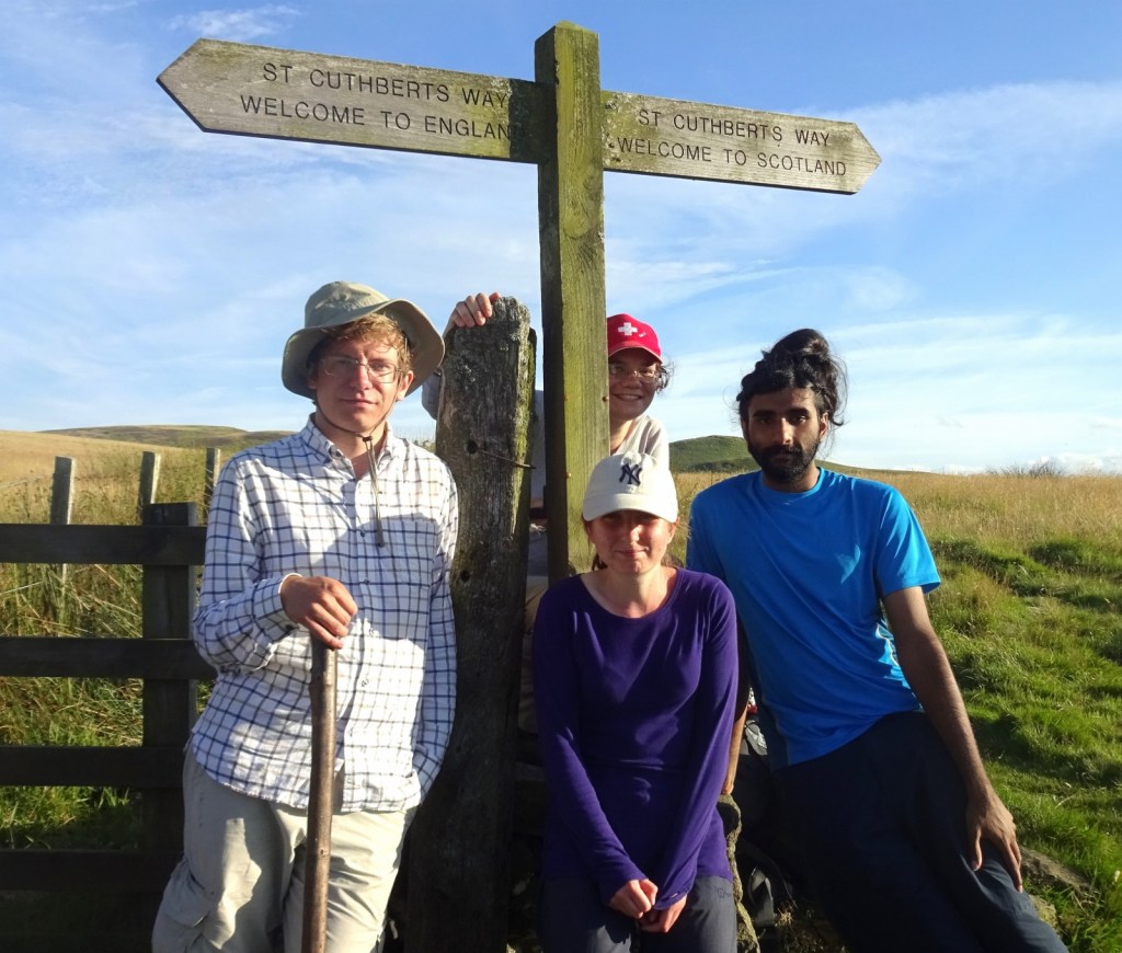
Not long later, we crested the Border Ridge, to see Scotland spread itself out below our gaze, including the impressive Green Humbleton hillfort. We were amused by the short, stony border wall , accompanied by the sign “please close the gate SECURELY” – one must keep the Scots out, you know!
From the border ridge, it was just a couple more miles to Town Yetholm and our campsite for the night. As well as being on St Cuthbert’s Way, the Yetholms – Town Yetholm and Kirk Yetholm – are well known to walkers as the northern endpoint of the Pennine Way. When we arrived, cooked up and ate a prodigious amount of pasta – satisfying our bellies even though I managed to clumsily tip Erithacus’s first portion all over her boots.
Holy Island Trek days 4-5: Jedburgh
After Town Yetholm, the remaining two days of walking on St Cuthbert’s Way would take us first from the Yetholms to Jedburgh, then from Jedburgh to Melrose. After our tiring day’s walking, we decided to take the next day as a rest day, and came up with the cunning plan that we’d travel to Jedburgh, set up at a campsite there, and could thereby stay there for three nights rather than one, letting us take the Yetholm-Jedburgh and Jedburgh-Melrose days of walking without bags, by making use of buses at the start or end of the walks.

Our route to Jedburgh was that we got the bus first to Kelso – outside this map area, so I won’t narrate what we did there here – for some lunch and exploring there, and then, as it was raining and we didn’t feel like waiting for the next bus, travelled on to Jedburgh (and back into this map area) by taxi. Arriving in Jedburgh in the rain, we were rather disappointed to discover that we’d only be able to stay at the campsite for one night, since, it being a bank holiday weekend, the following two nights (a Friday and Saturday) were fully booked. Some telephoning around revealed this to unfortunately be the case at all the other sites in the vicinity too.
After getting ourselves some dinner at a local fish and chip shop, we settled into a pub for the evening – as was our usual habit, there not being particularly much to do at a campsite after dinner, especially a rainy one – and hashed out the a plan for our next few days.

The plan went thus: in the morning, Erithacus and Queenie would get the bus back to Berwick-upon-Tweed. There those two, who needed to return home, would get on the train, and I’d collect my car from where we’d left it behind, before driving back to collect Vesper and Millicent in Jedburgh. We three would then drive up to Edinburgh, where Millicent had secured us somewhere to sleep, namely his grandmother’s vacant flat. We could spend a couple of nights there, before returning southwards to continue our walk, which could now take the form of car- and bus-enabled day walks with much lighter packs – having experienced two long, hot days of walking with heavy packs, this rather appealed to us.

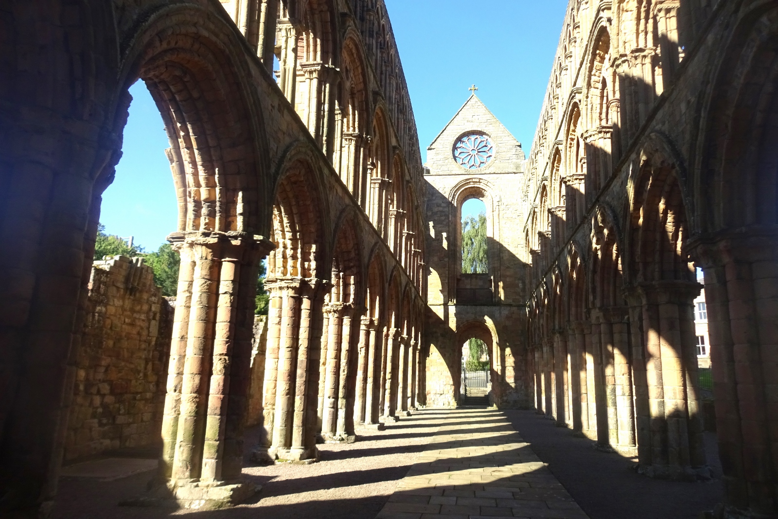
The next morning, the full group of five had one last hurrah on this holiday before splitting up, as we visited the very impressive ruins of Jedburgh Abbey. Along with Melrose, Kelso and Dryburgh (which we didn’t visit), it’s one of several big ruined abbeys in the region, and we enjoyed having a long poke around.
Following that, we executed our plan and went our separate ways. Vesper, Millicent and I duly travelled up to Edinburgh that evening, and you can read about our adventures there in my Edinburgh post.
Holy Island Trek day 7: Bonjedward towards Melrose
In the end we spent two nights in Edinburgh, taking the day in between as a rest day and to do some exploring in the city, before returning to the Borders to continue our walk. Since we now had a car – which, if left behind at the start of a linear walk, naturally won’t be present when you end your walk several miles away – each day of walking would now need to be enabled by some use of buses. Due to the way that Sunday bus timetables worked, we ended up deciding to do the two remaining days of St Cuthbert’s Way in reverse order: we’d walk first from the village of Bonjedward (near Jedburgh) to the end of the Way at Melrose, and the next day do the missing section, from the Yetholms to Crailing (also near Jedburgh and Bonjedward).

We drove down from Edinburgh on the Sunday morning and parked up in Bonjedward – the plan for this day being that I’d use the bus to pick up the car from here at the end of the walk, rather than the other way around as we sometimes did.

The Annal again:
Bonjedward was a little off the Way, and rather than walking along the road a little to join the Way, we decided to follow a path that would theoretically lead us there a little sooner. However, it seemed the path in question had not been used since not long after St Cuthbert’s day: having to climb over a mouldy gate at the start foreshadowed a mile of beating our way through densely overgrown field verge and flooded potato field.

Fortunately, our path bringing us to the Way was heralded by a sign from St Cuthbert as a deer ran across our path: beore long, we crossed Jed Water on a spectacular (though rather wobbly) footbridge, and joined the Way as it followed [the Roman road] Dere Street, for a few miles of dead-straight walking. We passed the site of the Battle of Ancrum Moor and a stone commemorating the Lady Lilliard, legendary participant in said battle.

After a short while on Dere Street, we walked out of this map area, so I’ll leave telling you of our remaining adventures on the way to and in Melrose for another time. However, after reaching Melrose, and following a bit of bus travel, we reunited with our car and made our way to our campsite for the next two nights, at Lilliardsedge, near the aforementioned Lilliard’s Stone. Here we had a somewhat notable check-in experience:
When we finally arrived at Lilliardsedge, the lady behind the bar was not able to book us in, since she was just temporarily looking after the bar so didn’t know how to do it, and tragically, none of Scott, Dale, Sarah nor Graham were picking up the phone. Finally, we were escorted to the pitch by a fellow camper.
We pitched up, ate, made use of a tumble dryer, and then we went to the campsite bar, which is sort of a pub.
Holy Island Trek day 8: Town Yetholm to Crailing
Our final day of walking along St Cuthbert’s Way started with us driving over to Town Yetholm, where we’d last been four days previously.

The day was another hot one, and while we didn’t appreciate the sun on our way up to the ridge of the excellently-named Wideopen Hill and Grubbit Law, it did give us some great views over the Borders countryside. After a few miles, we descended from the hills into the village of Morebattle, where Millicent purchased a Selkirk Bannock while Vesper and I undertook the interesting exercise of using a public toilet in the dark since the lights weren’t working.

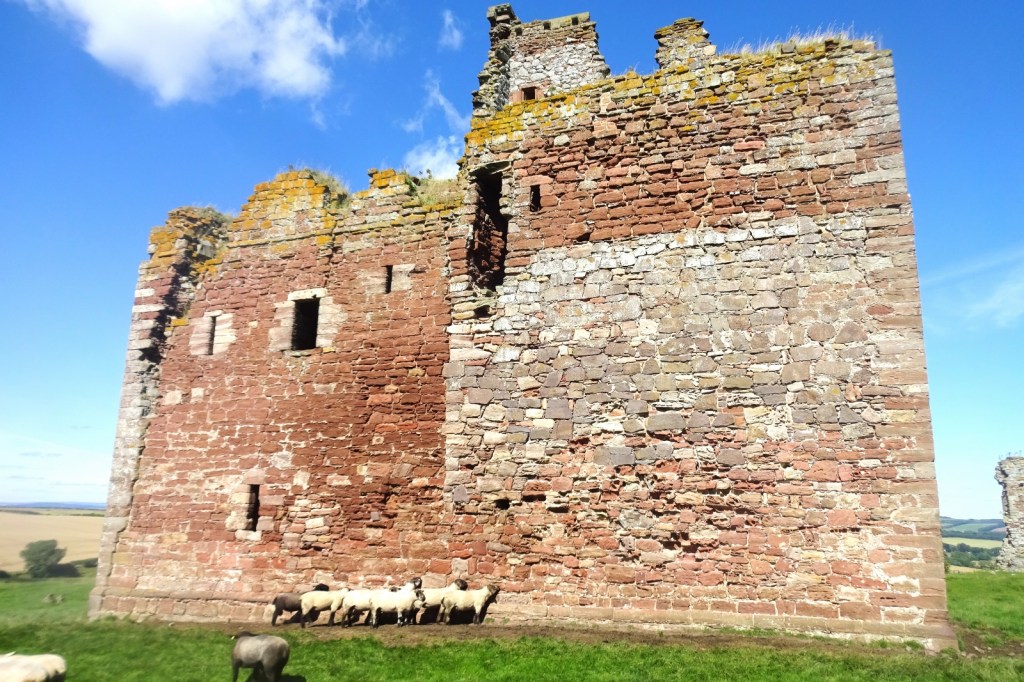
Following that, we continued onwards to eat our lunch in the shadow of the ruined Cessford Castle, which was unfortunately in too precarious a state for people to be allowed to enter, but did seem to be appreciated as a scratching post by the local sheep.
The remainder of our walk to Crailing was through comparatively flat farmland, and we ended up arriving well before our bus:
Since we were an hour and a half early, we read the pamphlets in the phone box, particularly enjoying learning about Ian of Kelso’s pottery and the marvellous design features of the C220 caravan toilet.
When the bus did arrive, it took us to Kelso, where Vesper and Millicent did some shopping while I took another bus to rescue our car from Town Yetholm, before collecting the others and heading back to Lilliardsedge.
Now, while the initial plan for the holiday had been to walk all the way through from Lindisfarne to Iona, we realised a long while before the trip started that, with the amount of time we had available, this wouldn’t be possible. At the start of the trip, we’d therefore already decided that, after St Cuthbert’s Way, we’d skip across to the Isle of Arran before starting to walk again. Though we now had a car, this was still our plan, so the next day was one of travelling: we packed up our stuff in the morning, and skipped a hundred miles of walking by driving over to Ardrossan, to the southwest of Glasgow, where we got the ferry over to Arran. So that was it for this map area!
[1] I find it a little alien when people eat sandwiches with just one plain filling: fairly often I see people with a sandwich that they’ve brought in to work, or with them on a day out, that’s just bread, spread, and cheese or ham. It’s fair enough, of course, that they find it good enough, or not worth the effort to be more creative; but I just find eating such a sandwich quite a grim experience and would never go for it myself. A good sandwich, in my opinion, needs a few things: bread, spread, one other spready thing such as chutney, mayonnaise or pickle; some leaves, and probably two “proper” fillings: for example cheese, a sliced meat or meat substitute, avocado, cucumber or tomato. Personally, I find it well worth the effort!

6 thoughts on “OL16: Cheviot Hills”