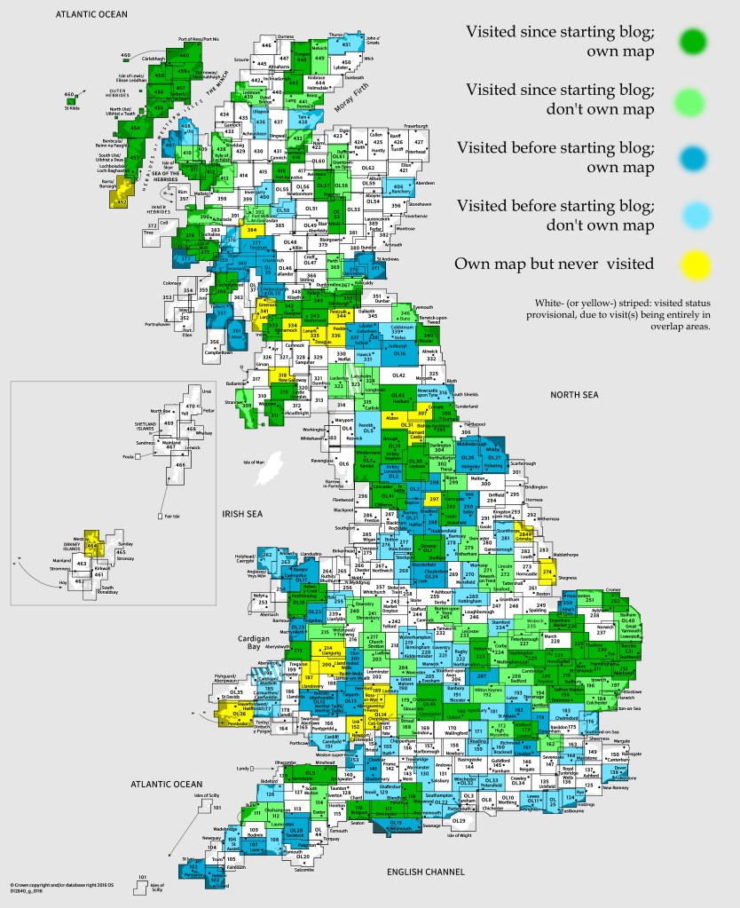
OS Explorer map 346, Berwick-upon-Tweed: Eyemouth, Duns, St Abb’s Head & Cockburnspath – I do not own this map, but had visited it before starting this blog. Visited again for this post 9th July 2021. This is the first of six posts about my trip to Wanlockhead in Dumfries and Galloway with my school friends Cabbage, Joystick and Climbing Programmer, including time I spent in Northumberland and the Scottish Borders alone on the way there.
The next few posts are going to be about a trip I went on in July 2021 that was actually two or three trips in one. Vesper and her parents had planned to go on a holiday together to Lindisfarne in summer 2020, but what with there being a pandemic at the time, that was postponed for a year. This time around, it worked out – the government having loosened restrictions to allow people from different households to meet indoors just a few weeks before – and Vesper spent a week there with her parents, in a holiday cottage.
I joined Vesper and her parents there for the last two nights of their trip, travelling up to Lindisfarne on the Wednesday, and staying until they departed on the Friday. However, the day after that, I had another holiday starting: I’d be joining my school friends Cabbage, Climbing Programmer and Joystick for several days staying in a cottage in Wanlockhead, in Dumfries and Galloway in southern Scotland. The possible third trip there is the time between these two more major stints: I had most of the Friday and much of the Saturday alone, which I spent going on a couple of walks, and staying the night alone in the town of Hawick.
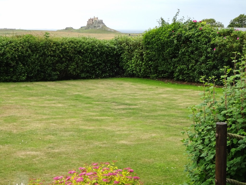
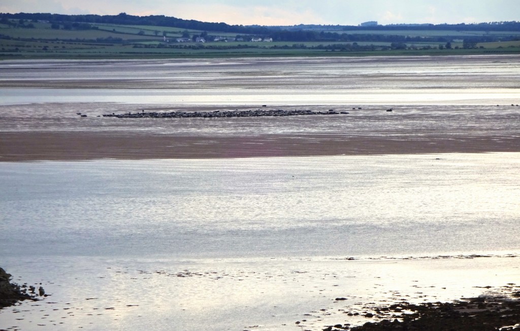
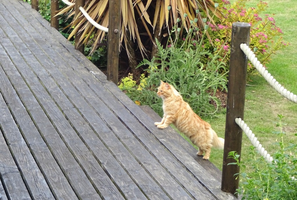
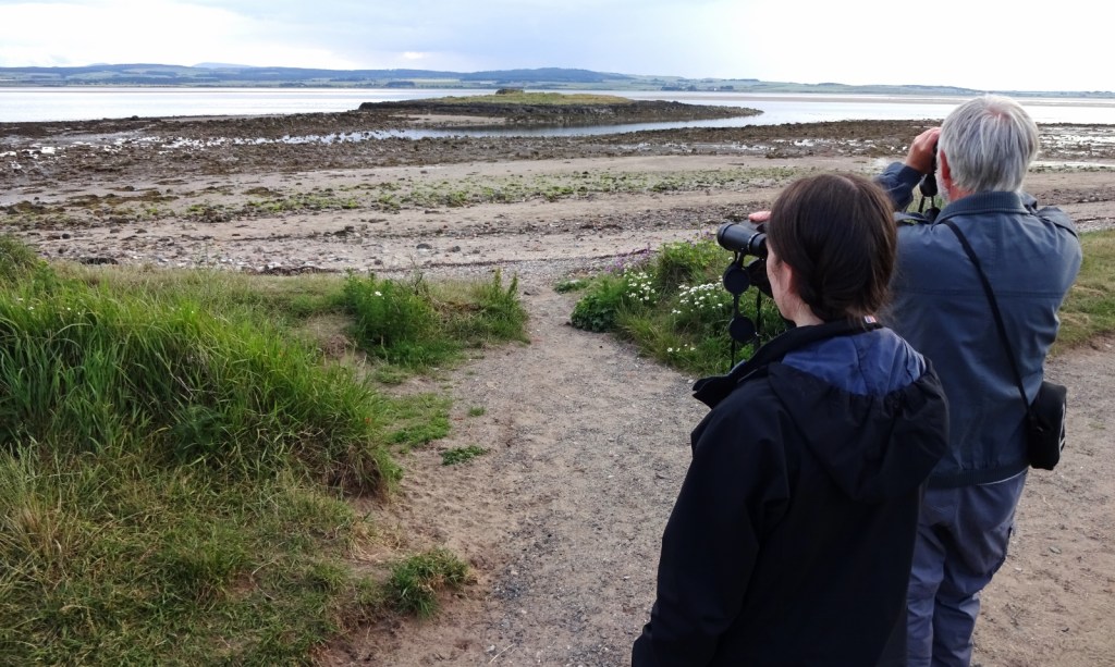
Now, I’ve written about Lindisfarne on this blog before – and the same is true of Wetherby, where I broke my drive up to Lindisfarne – so I won’t be writing a post about it, but I will tell you that I had a really nice time, going for walks, exploring the island, and relaxing in the cottage. While I’d visited Lindisfarne before, I’d never previously stayed during the period when the causeway is closed at high tide, which really makes a difference to how busy it feels! I made a veggie “fish” pie [1] for Vesper and her parents on the Thursday evening, which went down well.
I will leave you a few more photos from our stay on Lindisfarne, before proceeding to tell you of the rather undramatic events of the first new-to-the-blog map area I did visit on this trip: Berwick-upon-Tweed.


Vesper and her parents were leaving fairly early on the Friday morning for their drive back to Leicestershire, so I decided to do the same, so as to have most of the day to go for a nice chunky walk. Looking at my maps the night before – I own most of the maps of this region, having bought many while planning the Holy Island Trek in 2016, and a few more for this trip – I’d decided to do a circular walk up the Cheviot from Langleeford. However, I quickly remembered that I was a little ill-equipped for what would probably be a boggy, isolated, fairly strenuous, and plausibly phone-signal-free walk: I’d looked for my walking equipment when packing up for this trip a few days early, and had found some things (like my beloved walking poles [2]), but was missing some other important bits: principally, waterproof trousers, a compass [3], and a suitable shirt.
To explain the latter item on the list above: I’m rather set in my ways when it comes to clothing, and (as attentive readers may have noticed from photos of my on my blog) exclusively wear a selection of rather similar button-up short-sleeved linen shirts day-to-day, mostly bought from Marks and Spencer. However, the one exception to this is the fairly rare occasions when I’m on somewhat strenuous walks (this being pretty much the only exercise I ever do, beyond walking around town day-to-day). On such walks, my usual shirts have the big disadvantage that they very quickly get wet from back sweat under my rucksack, which isn’t too bad while walking, but which feels absolutely horrible after a break when I have to put my rucksack back on. I therefore have a few t-shirts specifically for walking (these being the only t-shirts I own, as my pyjamas are the shirt-y kind too), namely sporty types bought from outdoorsy shops, with the useful property that they dry extremely quickly. It was such a shirt that I’d not been able to find to bring with me on this trip.
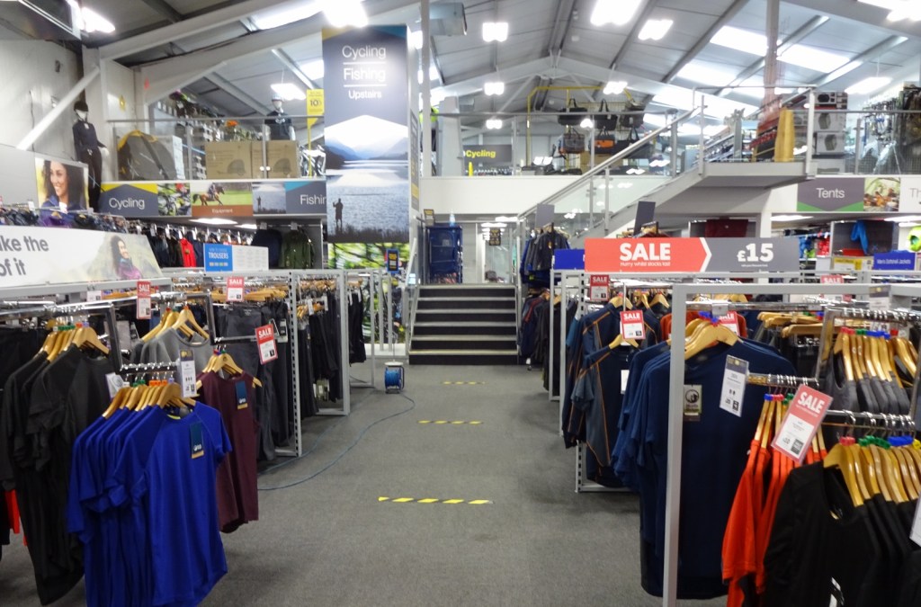
However, I wasn’t going to be held back from my first opportunity to get into the hills since nearly a year ago just by a few missing items, so I decided to buy these necessities so that I could go ahead. This took me on a small detour from Lindisfarne before I proceeded to the Cheviot: namely to the nearest outdoors shop I could find, a branch of Go Outdoors on the outskirts of Berwick-upon-Tweed. I arrived just before the 9am opening time, but was able to go in after a short wait, at which point I found out that the shop was huge: the biggest outdoors shop I’ve been in by a long way.
I soon found what I wanted – in addition to the items listed above, I also took the opportunity to buy some better gaiters and some water – and was off fairly quickly, mission accomplished. I then proceeded to Langleeford to start my walk – about which see my next post!
Previous visits
My previous experience with Berwick comes entirely from the Holy Island Trek, the attempt that Vesper, Erithacus, Millicent, Queenie and I made to walk across Scotland from Lindisfarne to Iona in summer 2016, and which as featured on this blog many times before. Berwick wasn’t on the route that we walked, however this didn’t stop me from ending up in Berwick three times, for reasons entirely to do with it being the nearest town to Lindisfarne, rather than any of its intrinsic merits. All three of these trips are actually mentioned in my Lindisfarne post, which gives a much more joined-up account of the first few days of our holiday.
The first of these outings was to collect Vesper from the train station on the first day of the trip: Queenie, Erithacus and I had driven up from my parents’ Northamptonshire home, and we’d collected Millicent on the way in Doncaster, but Vesper had been with her family in the North West, and so arrived by train. The second was the next day: as we planned to walk across Scotland, there was no place for a car in our plans, so the car had to be left behind somewhere. The drop-off location of choice was a space on someone’s driveway in Berwick that I’d rented on ParkLet: I drove over, parked the car, and got the bus back to our campsite in Beal, just over on the mainland from Lindisfarne.
The third trip was several days later, after we’d completed the first two full days of our walk, to Town Yetholm just over the border in Scotland, and then had a lazy rest day which included travelling to Jedburgh, where we planned to camp the next few nights. As I told in my Edinburgh post, at this point we made some significant changes to how we’d do the rest of the trip: Queenie and Erithacus would be travelling back home, while Millicent, Vesper and I would do the rest of the trip in “drive between campsites and do day walks” mode, rather than a continuous walk, carrying everything on our backs. It was for this reason that I joined Queenie and Erithacus on the bus from Jedburgh back to Berwick, where they got the train back southwards, and I collected the car.
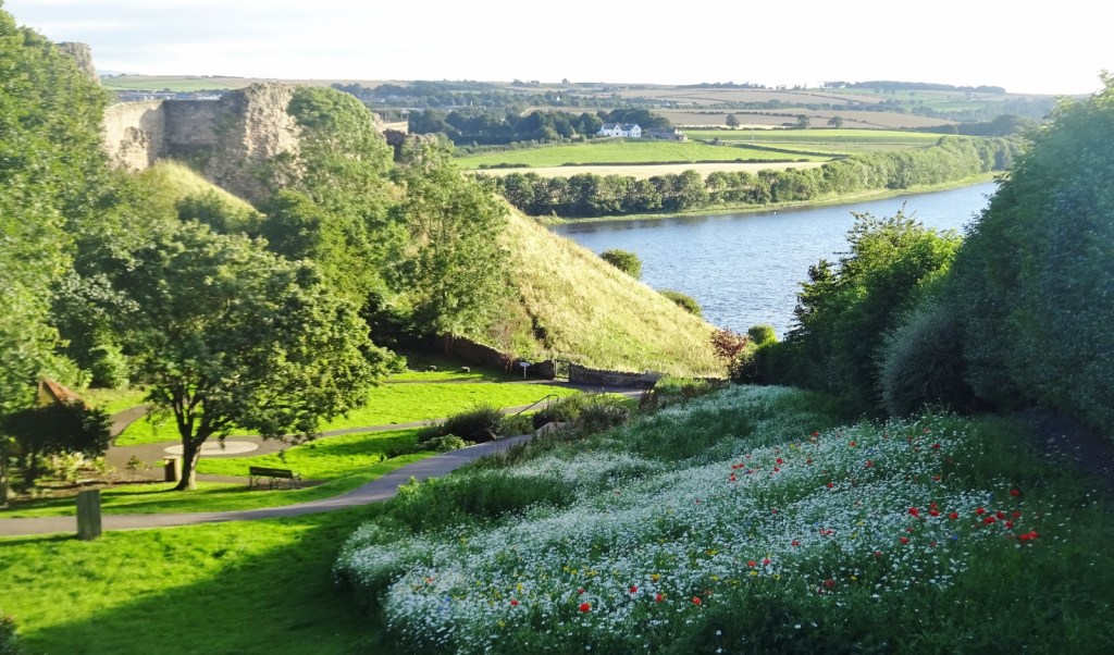
This means that, despite having visited three times, I’ve never actually looked around Berwick. I would very much like to come back sometime as it’s a very pretty place – the railway viaduct is very impressive, and I spied the castle while walking for my bus on the third trip just long enough to take the above photo. It would be great to have a proper explore!
[1] I’d cooked this a couple of times before and knew it to be nice. I’m not normally one for using recipes a great deal, but I do use them for cooking new or somewhat more complex things occasionally; and this fish pie I made by combining elements of this vegan cullen skink recipe and this conventional fish pie recipe, and using smoked tofu instead of the fish. I’d never have guessed it, but the crushed seaweed and smoked tofu really successfully make the thing taste satisfyingly fishy!
[2] I need to use walking poles due to a little medical problem called chondromalacia patellae, which gives me knee pain if I try to walk up and down hills without them. However, I also think they just make the experience of hiking, especially on hilly, uneven or boggy ground or off-path, so much easier generally – I don’t know why most people don’t use them when hiking. I’ve had multiple experiences of going on hikes as the only pole-user, when some poleless individual – who in some cases had declined my offer of lending them some spare hiking poles at the start of the trip – would get tired or mildly injured, I’d lend them one or both of my poles, and they’d comment astonished at how much difference they make! This problem is especially acute with Father Dearest, who always declines poles out of some misguided masculine bravado, and always ends up needing them when his knees or hips start to ache!
[3] I had my walker’s GPS device with me as well as the relevant bits of mapping downloaded onto the OS Maps app on my phone, and it would be those I’d be using to navigate. However, I always like to have a physical map and compass as backup in case of device failure (especially if I’d have no phone signal to call for help in a sticky situation).

4 thoughts on “346: Berwick-upon-Tweed”