OS Explorer map 330, Moffat & St Mary’s Loch: Megget Reservoir – I own this map, but had not visited it before starting this blog. Visited for this post 10th July 2021. This is the fourth of six posts about my trip to Wanlockhead in Dumfries and Galloway with my school friends Cabbage, Joystick and Climbing Programmer, including time I spent in Northumberland and the Scottish Borders alone on the way there.
Google Maps location links: St Mary’s Loch, Grey Mare’s Tail, Capplegill
My previous post told you of the one-night stay I made in Hawick, before I’d travel over to Wanlockhead the next day to meet my school friends for our holiday there. On Lindisfarne a few days previously, I’d spent some time looking at maps, to try to find a fun walk or two for the couple of days between my two stints with other people. This resulted in the Cheviot walk I did immediately before my night in Hawick, but I was also looking for options for the next day, since I wouldn’t need to be in Wanlockhead until the late afternoon.
One option I identified, which seemed pretty exciting, was to head to the Grey Mare’s Tail waterfalls in Moffatdale, and do a circuit from there of the hills that surround Loch Skeen. However, this would definitely be at the strenuous end of things, being about eight miles and including around six different summits, and after my Cheviot walk I was feeling like something more relaxed. Looking at my map again in my Hawick accommodation, something caught my eye. Regular readers may have caught on that I do like visiting places with silly names – see, for example, my Crackpot holiday. In this case, I spied a feature on my map labelled “Goat Prison”.

The map wasn’t particularly revealing as to what the Goat Prison was – it was marked in the same font used for individual farmsteads, tiny villages, and random little features like cairns and sheepfolds; and was just located on a stretch of hillside, next to a little river and near a waterfall, with no buildings or similar around. However, some internet digging led me to a resource I’d never found before: scotlandsplaces.gov’s digitised Ordnance Survey name books – these being handwritten records from the time of the first OS mapping, providing information about features listed on said mapping. The relevant sheet for us can be found here, and tells us that the Goat Prison is:
A deep black-looking hole on the Burdsbeck Burn, having a waterfall in the centre, and surrounded by rocks and steep banks
Sounded nice! I therefore had my loose plan for the day: I’d have a wander around Hawick and buy myself some lunch to eat later, then make my way slowly over to Wanlockhead during the morning and afternoon, with plenty of stops. Specifically, I’d drive via the A708 between Selkirk and Moffat, which takes in the length of St Mary’s Loch and Moffatdale, so I thought might give plenty of opportunity for pretty stops, including the Goat Prison as one.

This all went very well! The road alongside St Mary’s Loch was very well-provided with lay-bys and stopping places, which were well patronised at the time – it was a summer Saturday, so there were plenty of people about fishing, picnicking and the like. I stopped at one of these and had a wander along the loch’s pebbly edge. St Mary’s Loch is really pretty, with hills all around it, and also very big. It seems just as good to me as many Highland lochs; I’m surprised it’s not more well-known. Despite the number of parked cars I passed, the size of the place meant the density of people was still very low: I passed one father-daughter duo poking at a disposable barbecue, but otherwise had the stretch of shoreline to myself; it was very peaceful.
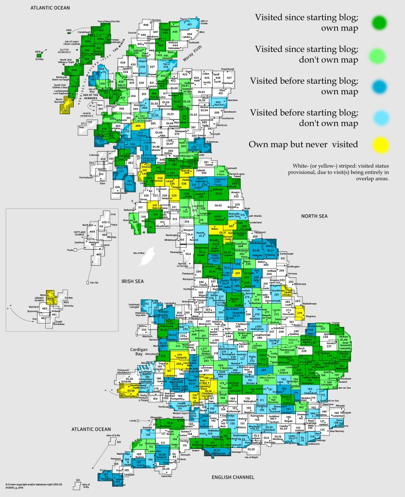
From there, I continued into Moffatdale, and initially planned to stop at the Grey Mare’s Tail, just to see the waterfall rather than to do the long walk I’d eyed up before. However, the car park was packed, as I probably should have expected for a known beauty spot on a summer Saturday, so I moved on. I soon parked up in the village of Capplegill, and began my walk up to the Goat Prison!
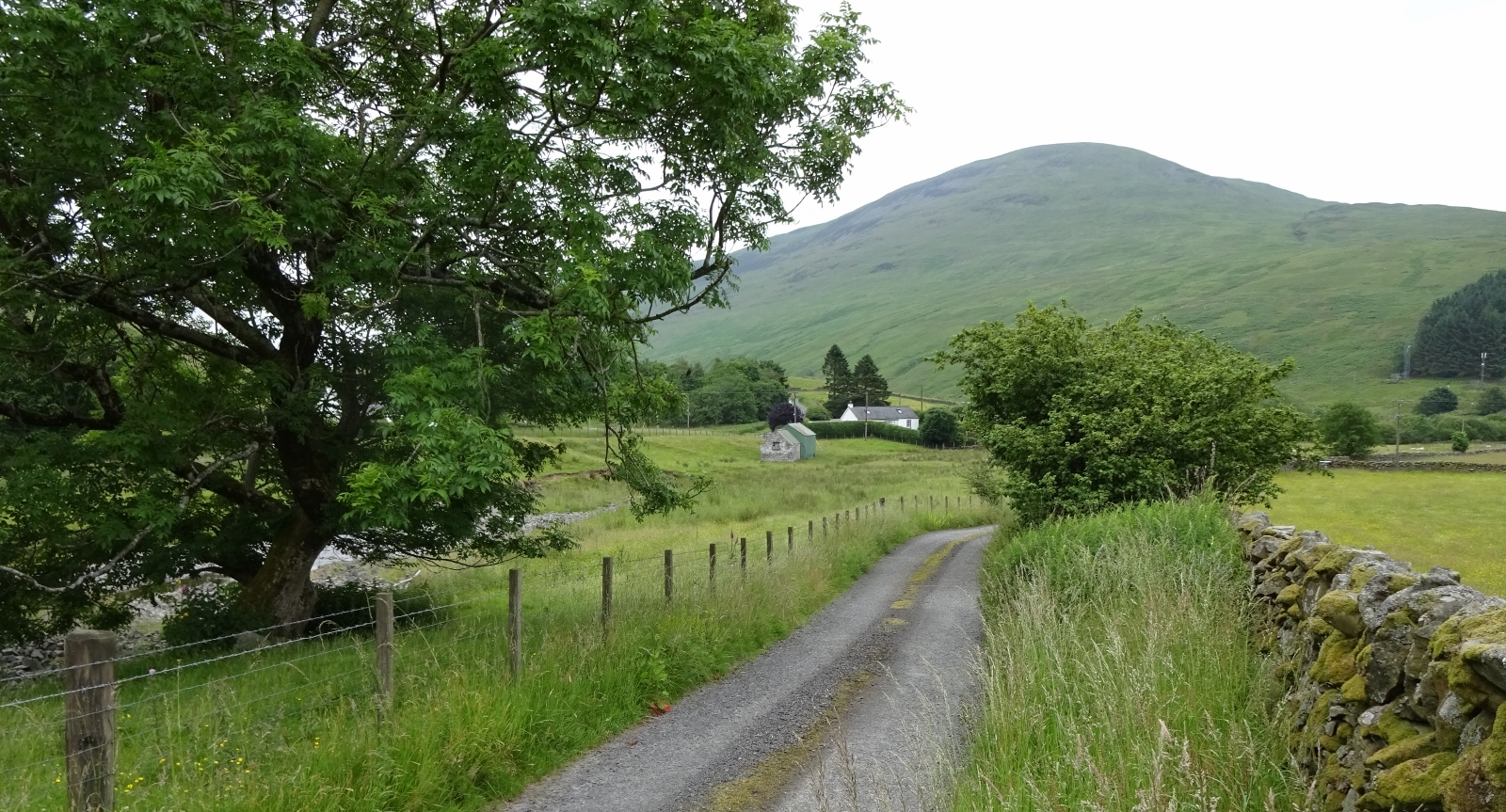
The short walk was very nice, taking me first to the farm of Bodesbeck, which I skirted around in a field, and then up the hillside a little way on a farm track – which if I stuck with for a couple of miles would take me over the ridge to meet the Southern Upland Way near the top of the valley of Ettrick Water. To get to the Goat Prison itself, I had to leave the track, hop a fence, and push through armpit-deep ferns for a little way, out of which the Prison appeared perilously suddenly. It was rather larger than I’d imagined: I found myself standing atop a sudden steep drop of a good twenty metres, the Goat Prison being a bit where the Bodesbeck Burn’s little canyon sort of widens and deepens into a big round deep hollow. The hollow was full of trees, but the Burn could just about be seen at the bottom of it. I have to say, I don’t think it would be a very effective prison for goats: while I might have trouble getting out of it, goats can do some pretty spectacular acts of climbing, and I don’t think they’d have much trouble!

I considered trying to visit the Brownies Cave, which was also marked on my map, right in the Goat Prison and just over on the other side of the burn from where I was. The OS Name book had to say of it that it’s:
A cave situated on the farm of Bodsbeck, used as a hiding [place] by the Brownies of Bodsbeck, [during] the time of the Solemn League [and] Covenant.
Which sounds rather enticing! But in the end, it seemed like it would be a faff to get around to it, and plausible that it would be inaccessible, so I decided to give it a miss, and walked back to the car.

I sat in the car and ate my lunch, then drove off towards Wanlockhead to start my stay with my friends. Details of those next few days in their company will follow in my next post!