OS Explorer map 288, Bradford & Huddersfield: East Calderdale – I own this map, and had visited it before starting this blog. Visited again for this post 16th August 2021. Google Maps location links: Milner Field As regular readers may know, when driving to and from distant parts of Britain, where possible I like to … Continue reading 288: Bingley
Category: Maps I’d been to pre-blog
331: Hawick
OS Explorer map 331, Teviotdale South: Hawick – I own this map, and had visited it before starting this blog. Visited again for this post 9th July 2021. This is the third of six posts about my trip to Wanlockhead in Dumfries and Galloway with my school friends Cabbage, Joystick and Climbing Programmer, including time … Continue reading 331: Hawick
OL16: Cheviot Hills

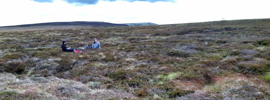
OS Explorer map OL16, The Cheviot Hills: Jedburgh & Wooler – I own this map, and had visited it before starting this blog. Visited again for this post 9th July 2021. This is the second of six posts about my trip to Wanlockhead in Dumfries and Galloway with my school friends Cabbage, Joystick and Climbing … Continue reading OL16: Cheviot Hills
346: Berwick-upon-Tweed
OS Explorer map 346, Berwick-upon-Tweed: Eyemouth, Duns, St Abb’s Head & Cockburnspath – I do not own this map, but had visited it before starting this blog. Visited again for this post 9th July 2021. This is the first of six posts about my trip to Wanlockhead in Dumfries and Galloway with my school friends … Continue reading 346: Berwick-upon-Tweed
308: Durham
OS Explorer map 308, Durham & Sunderland: Chester-le-Street & Peterlee – I own this map, and had visited it before starting this blog. Visited again for this post 8th May 2021. Google Maps location links: Durham, Langley Park, Hill Top, Bearpark As you'll know from my last few posts regarding my trip down to Dorset … Continue reading 308: Durham
118: Wimborne Minster

OS Explorer map 118, Shaftesbury & Cranborne Chase: Poole, Wimborne Minster & Blandford Forum – I own this map, and had visited it before starting this blog. Visited again for this post 5th May 2021. This is the last of three posts about a trip to Dorset with Vesper, also meeting Mother Dearest. My previous … Continue reading 118: Wimborne Minster
116: Bridport & West Bay

OS Explorer map 116, Lyme Regis & Bridport: Chard – I own this map, and am unsure whether I've been here before – see "Previous Visits" below. Visited for this post 30th April 2021. This is the second of three posts about a trip to Dorset with Vesper, also meeting Mother Dearest. Google Maps location … Continue reading 116: Bridport & West Bay
340: Lindisfarne

OS Explorer map 340, Holy Island & Bamburgh: Wooler, Belford & Seahouses – I own this map, and had visited it before starting this blog. Visited again for this post 28th August 2020. Google Maps location links: Lindisfarne, The Barn at Beal, Wooler My previous post oncerned mine and Vesper's journey up to the Isle … Continue reading 340: Lindisfarne
OL57: Aviemore
OS Explorer map OL57, Cairn Gorm & Aviemore Loch Morlich – I own this map, and had visited it before starting this blog. Visited again for this post 13th August 2020. Google Maps location links: Aviemore, Cairn Gorm car park As the attentive reader may know, for a year from summer 2019, I lived in … Continue reading OL57: Aviemore
OL1: Langsett & the Dark Peak
OS Explorer map OL1, The Peak District Dark Peak Area: Kinder Scout, Bleaklow, Black Hill & Ladybower Reservoir – I own this map, and had visited it before starting this blog. Visited again for this post Sunday 2nd August 2020. Google Maps location links: Pleasant Place in Kegworth, Langsett, Outer Edge, Castleton My previous post … Continue reading OL1: Langsett & the Dark Peak
