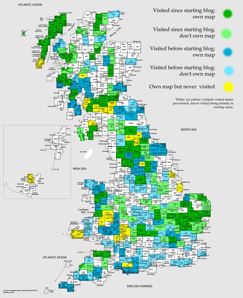
OS Explorer map OL1, The Peak District Dark Peak Area: Kinder Scout, Bleaklow, Black Hill & Ladybower Reservoir – I own this map, and had visited it before starting this blog. Visited again for this post Sunday 2nd August 2020.
Google Maps location links: Pleasant Place in Kegworth, Langsett, Outer Edge, Castleton
My previous post told you of a day trip to Mersea Island with my housemates Vesper and Erithacus, the first trip any of us had made significantly away from home in a long while, due to the travel restrictions stemming from the coronavirus pandemic. We were all of us feeling like we’d like to get into the hills though, and feel a bit of that good wildernessy feeling, so four weekends later, we did another, slightly more ambitious trip, this time to go walking in the Peak District. [1] It’s around a two-and-a-half hour drive from Cambridge to the nearest bits of the Peaks, so we actually decided to go the night before our walk – after Erithacus finished a Dungeons and Dragons session and we had a dinner of onion soup I’d made, we set off on a Saturday evening, driving to a rented cottage in the Leicestershire town of Kegworth, to stay the night.
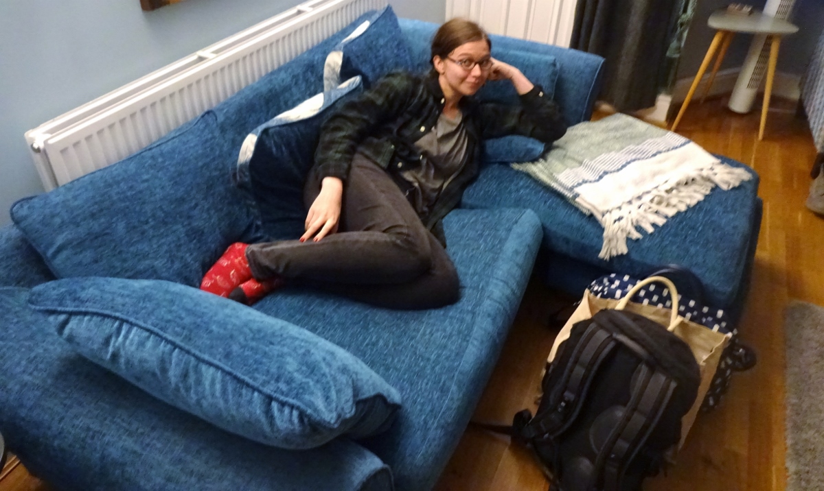
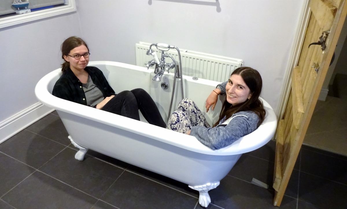
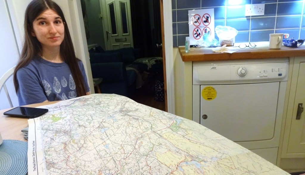
Kegworth is very close to Vesper’s parents’ house and childhood home (in map area 225, which I’ve visited before), so that was a little odd for her! The house we were in was a fun little place: a 2-bed mid-terrace on the very narrow (and charmingly named) street Pleasant Place, which is accessed through a tiny turning off the town’s High Street that looks more like it should lead to a shop car park than another road. The house had a very high degree of colour co-ordination in each room, and to our delight had a big old claw-foot bath – I really like claw-foot baths, not least because they’re sometimes even long enough for me to properly fit in! We arrived at around 9pm, so after a short while of looking at this map to plan our walk options for the next day, it was off to bed reasonably quickly.
The next day, we had a breakfast of some vegan croissants that I’d been very excited to find in Sainsbury’s at the start of that foodspan – as we like to call the 9-day period between our regular shops – and were back on the M1 by around 8:30. I never did look around Kegworth – another time!
Now, it being the middle of a pandemic, we ideally wanted to go somewhere that wasn’t going to be heaving – which, it being a Sunday in August in the Peak District, was admittedly rather an ask. Vesper got a selection of recommendations from some friends-of-a-friend-of-her-uncle, but they all being quite far from the high heathland that we wanted to experience, we ended up ignoring them, and picking a walk up into the moors from Langsett, at the north-eastern edge of the Peaks. I’d come up with a couple of other options that seemed more likely to be quiet than this one, but we decided to stick with this one since Erithacus didn’t have her walking boots, and it looked like it’d have better paths.
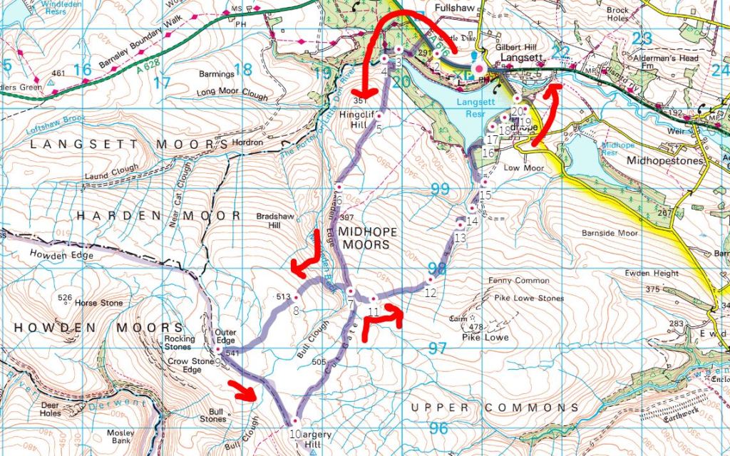
The route had us park by Langsett Reservoir and walk around it, before taking a bridleway up into the hills. We’d go off the bridleway on a path that was marked on the newest Explorer mapping on the OS maps website, but which my older paper map (and the digital map in my handheld GPS decide) didn’t know existed, and neither did the Landranger. That footpath seemed like the best bet at some good isolation, but if it looked too boggy we’d stick to the bridleway. The path would take us to the peak “Outer Edge”, from which a footpath led south-east back to the bridleway, which we could then follow all the way back to the reservoir and circuit around its other side back to the car – or if the ground looked good, we could take another new footpath to avoid the repeated section in the middle.
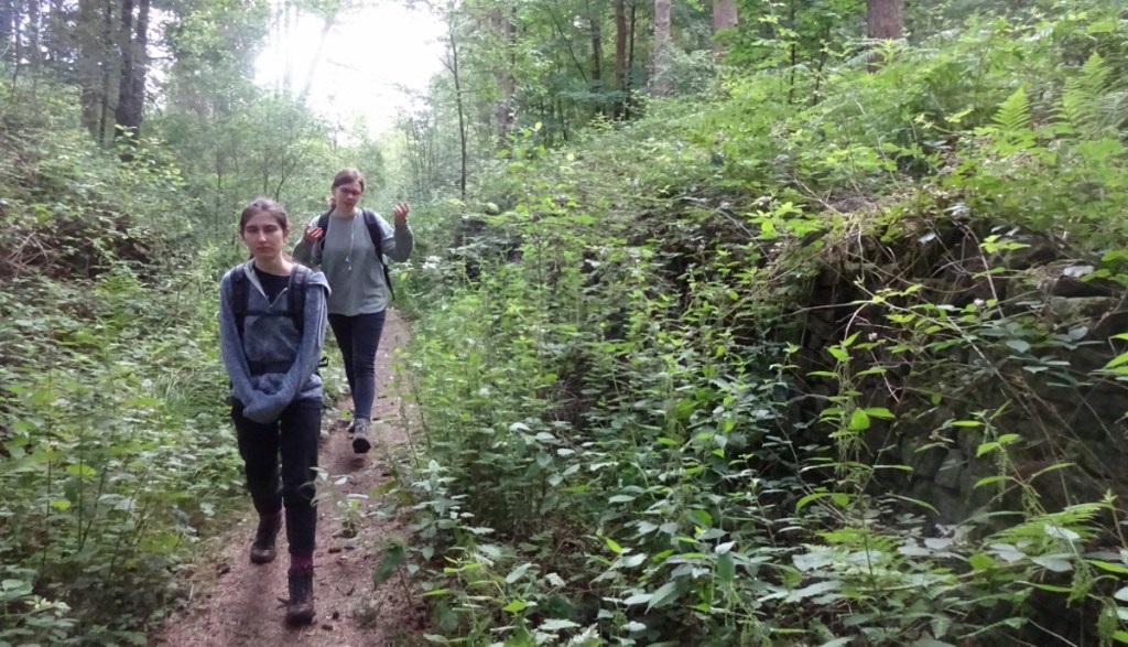
We arrived at Langsett around 9:40am, and parked in a large lay-by on the A616, since the little car park for the Langsett woods was heaving. Our walk started pleasantly as we made our way through the woods along the northern side of the reservoir, discussing the age-old “horse-sized duck or hundred duck-sized horses question”. There is a lack of clarity, I feel, in that it’s never clear whether the resized animals have been re-sized a moment ago, and so don’t yet know how to use their newly-sized bodies very well yet, or have lived this way for a while. Would the horse-sized duck, for example, attempt to fly and just fall over, or would it know that it can’t?
After a little while of that, we crossed a bridge to reach the start of the bridleway that would take us up onto the moors. The path did indeed ascend onto the moors quickly, and the views rapidly got nice on all sides. Unfortunately it seemed I’d somewhat miscalculated on the trying to find a place that wasn’t too busy. The bridleway wasn’t heaving, but there were a good few people around, which wasn’t what we’d been hoping for – finding a place that would give that good isolation feeling was something Erithacus was particularly craving.
I was hopeful though, because most of the walkers around us didn’t seem kitted out for an all-day hike, in jeans, skirts and trainers without packs that looked like they had lunch in – after one turn-off quite early on, the bridleway continued up onto the moors for several miles without turning into an obvious circular walk, so I thought they’d mostly mostly turn back soon. This turned out to be pretty correct, and after a turning shortly up the footpath, there were indeed not many walkers around.
However, I’d missed one important factor – bridleways, unlike footpaths, can be used by cyclists, and cyclists are very able to casually take on 15- or 20-mile round trips. After the first couple of miles, we were seeing regular clumps of cyclists, and what with still keeping 2 metres away from others at that point, we were having to climb up into the scratchy heather every time one came by, which was a little demotivating. On the plus side, though, the views held up, and the path was very good – not boggy at all, so Erithacus’s non-walking-booted feet had no trouble.
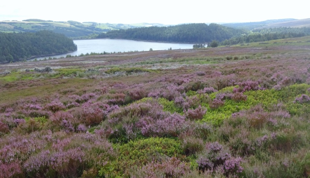
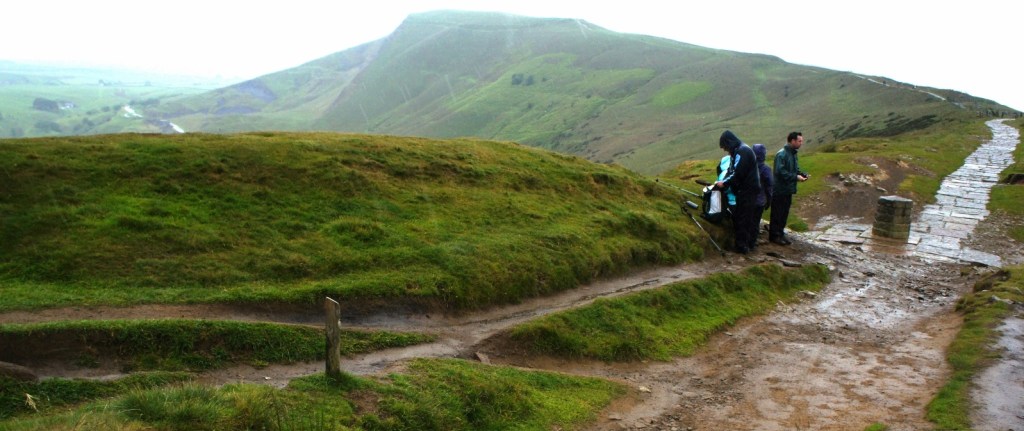
A while in, we turned off to the right onto the aforementioned footpath marked only on the newest Explorer mapping, which took us down into a valley and up the other side, before crossing the moors to the trig point at Outer Edge. Things got really nice here – we didn’t see a soul on this path (which seemed to have been made for quad-bikes) so Erithacus was satisfied, and we soon settled down for our lunch break on a heather-covered plateau. Somewhat randomly, I’ve been reading this blog about a 2003 Land’s End to John o’ Groats walk recently, which is very entertaining and rather inspiring, but I do have to disagree with the author in his dislike of moors. Admittedly I’ve never had to walk on them for a week on end, but I very much like moors; the feeling of wilderness and isolation and openness.
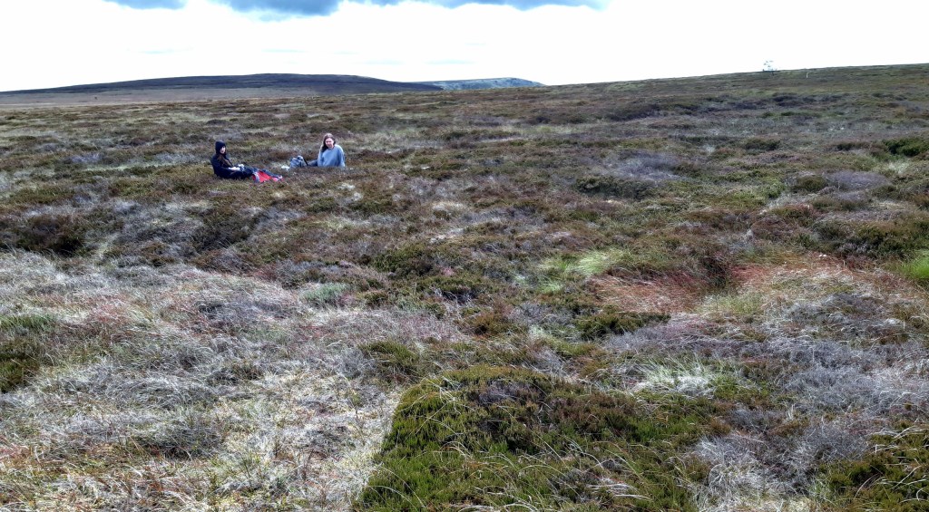
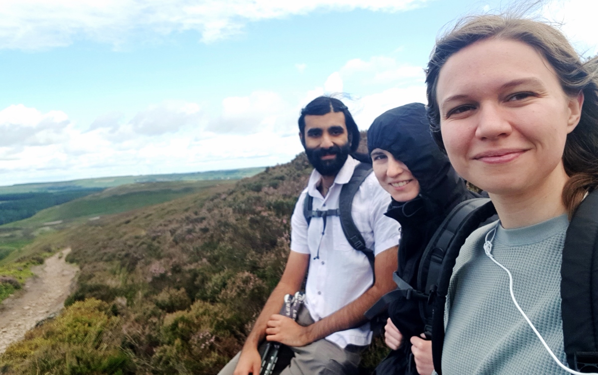
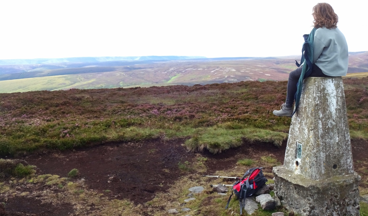
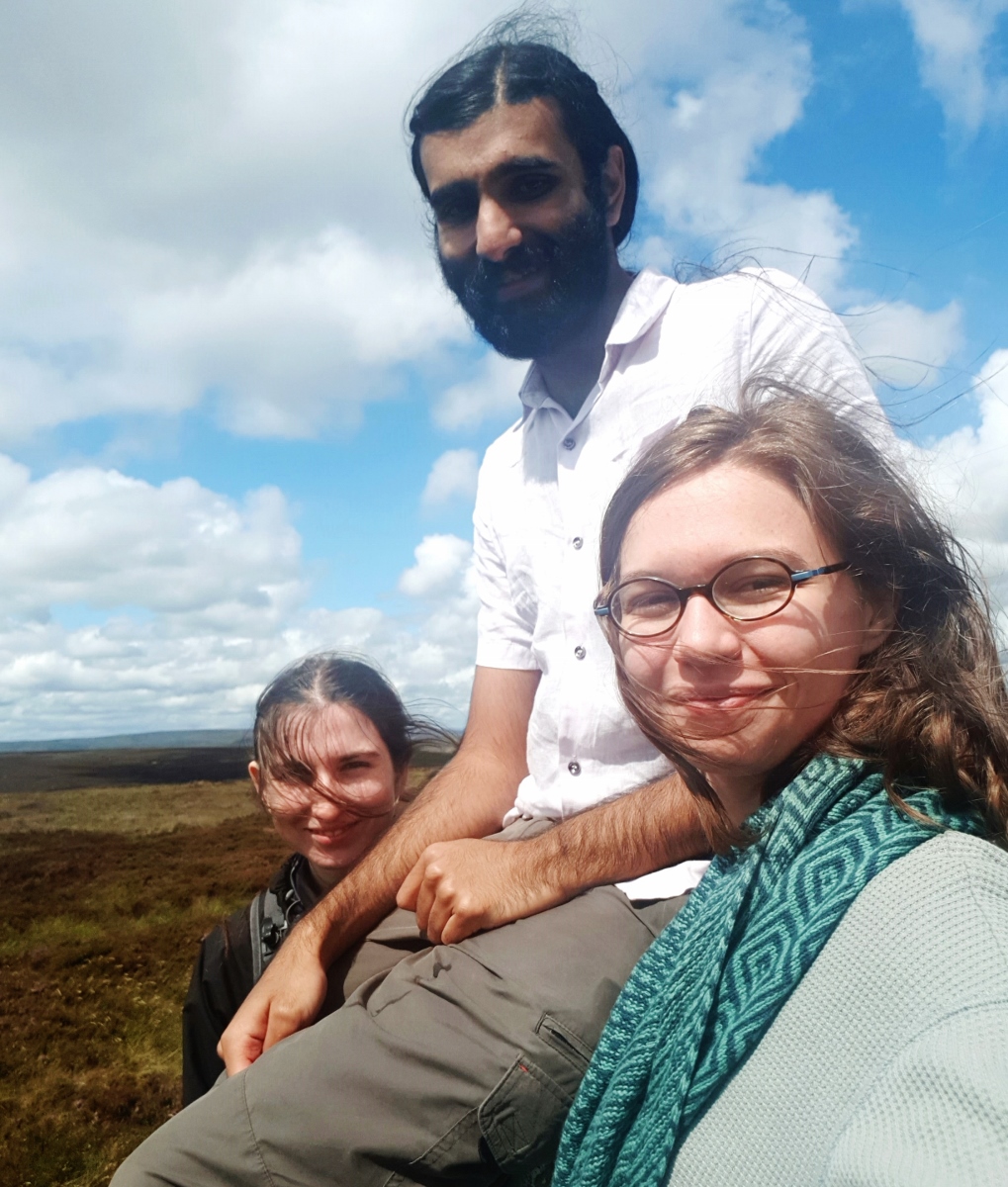
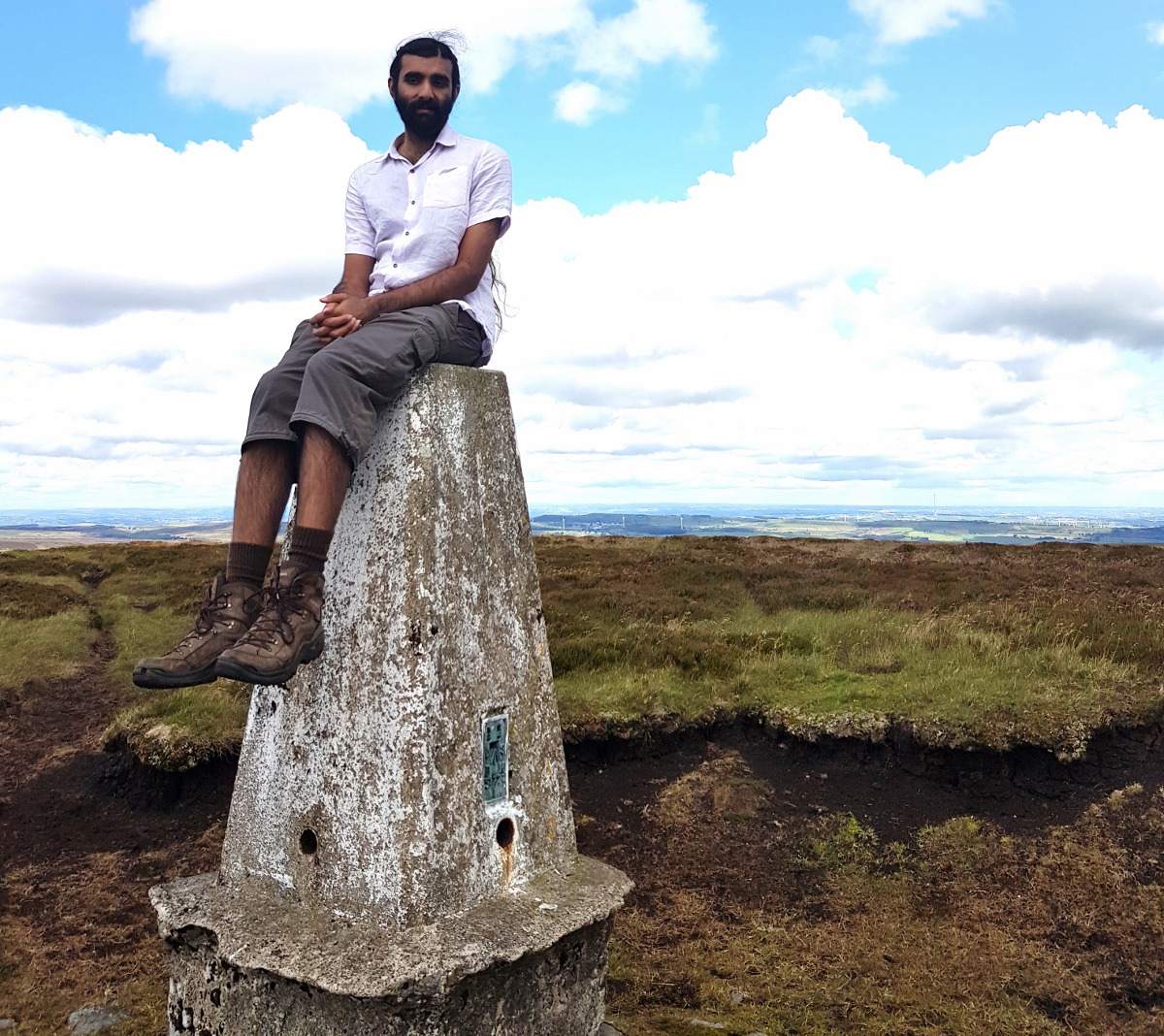
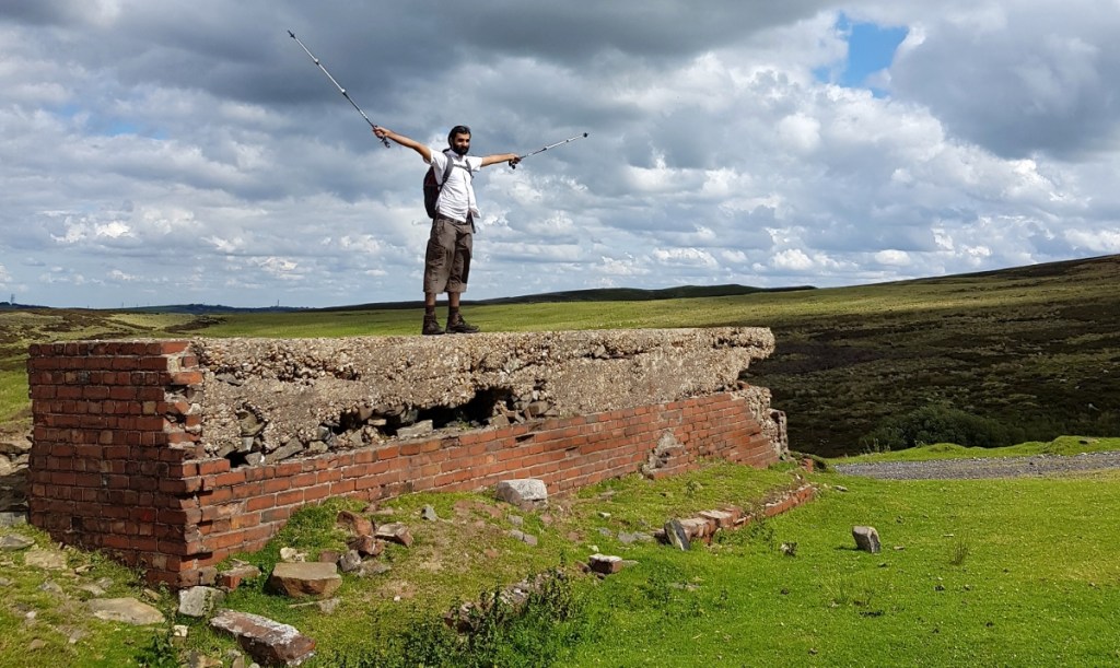
After our lunch stop and some adventures in wild weeing, we proceeded to Outer Edge, from where one could see down into the Derwent Valley. It was time to take turns sitting on top of the trig point and take some silly selfies!
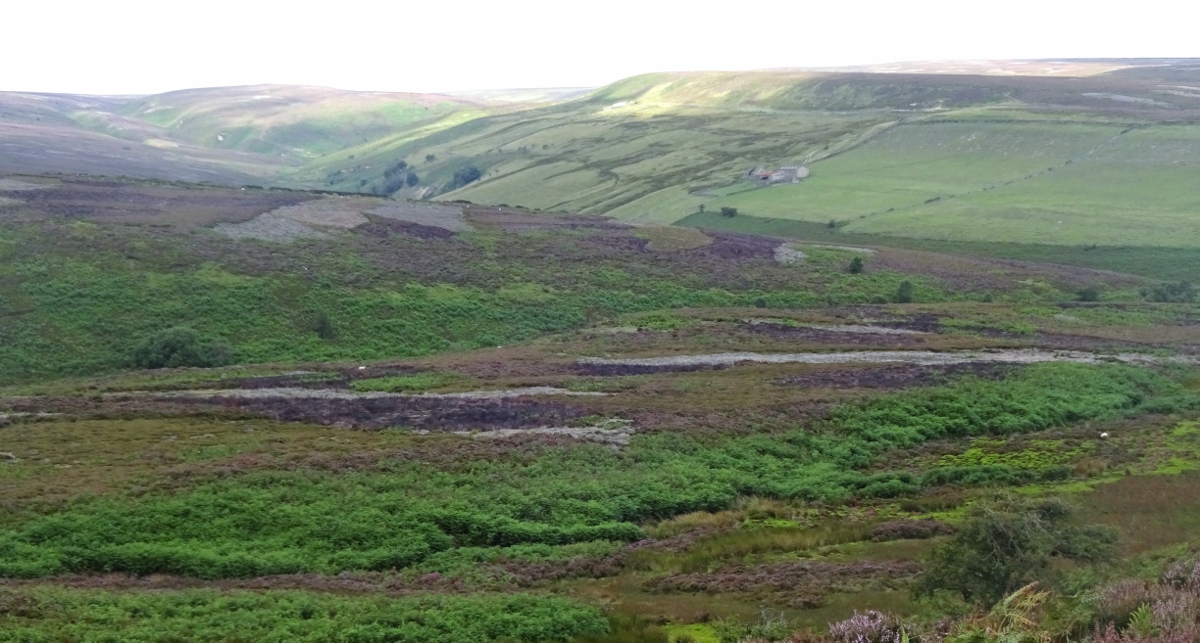
From there, we started walking southeast along the ridge, to meet our old friend the bridleway again and begin our journey back. It was on this section, though, that a minor calamity befell me when, walking confidently onto a muddy patch (the previous ones having been just a couple of inches deep), I sank immediately into bum-deep sludge. I was unable to extricate myself, so Erithacus had to make her way around to the other side and pull me out with the aid of my walking poles (while Vesper videoed us, naturally).
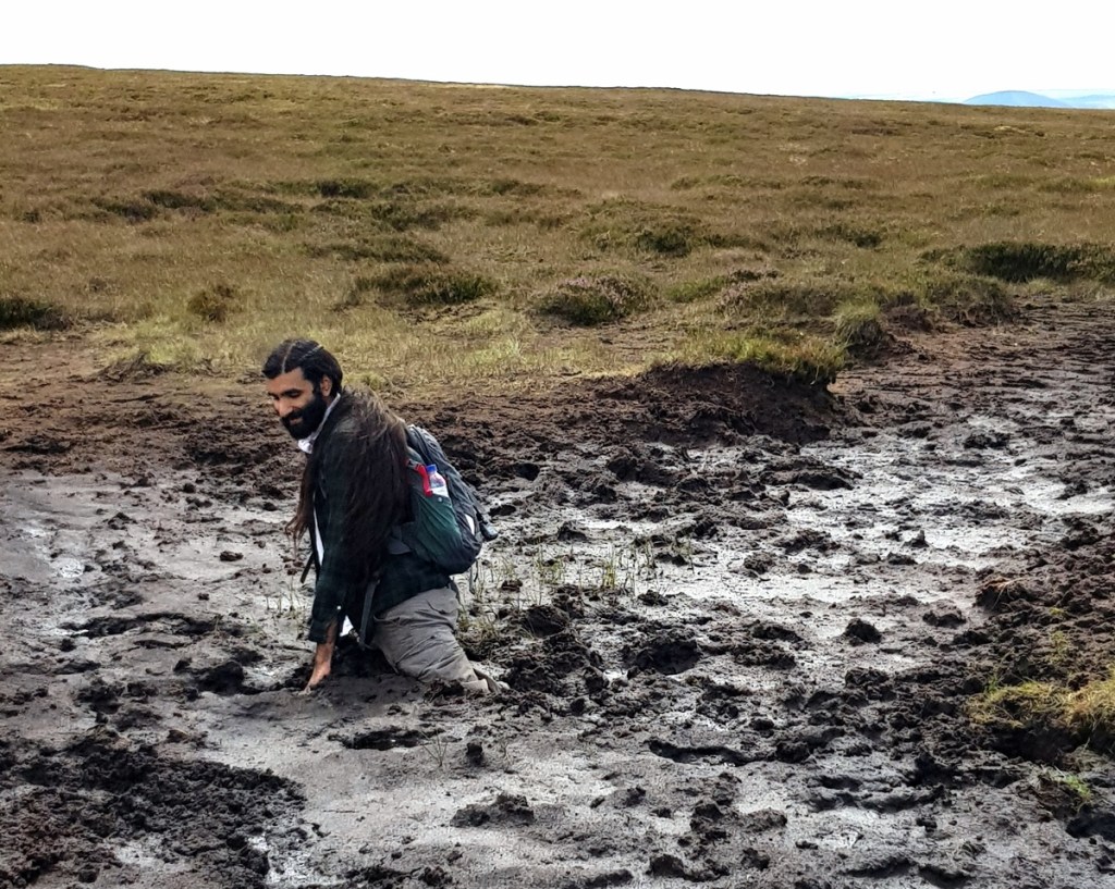
Fortunately it was actually not even an uncomfortable experience – the day was warm so I wasn’t cold; once I was in the mud was very firm so I didn’t feel like I was sinking further, and my phone and GPS device survived unharmed. If I’d sunk slightly further I’d have had wet underpants, which would’ve been uncomfortable, but it was only my boots, socks and shorts that were wet (and the latter dried off nicely over the next hour of walking; I didn’t even have to change to drive home). So while I looked a little like a bog monster for the rest of our walk, no damage done.
As a fun interlude, when I posted the video of my incident on Facebook, my old physics teacher from school left a comment asking where I was, and when I responded, it turned out that he’d walked the very same path just a couple of weeks before! (He managed to avoid the mud.)
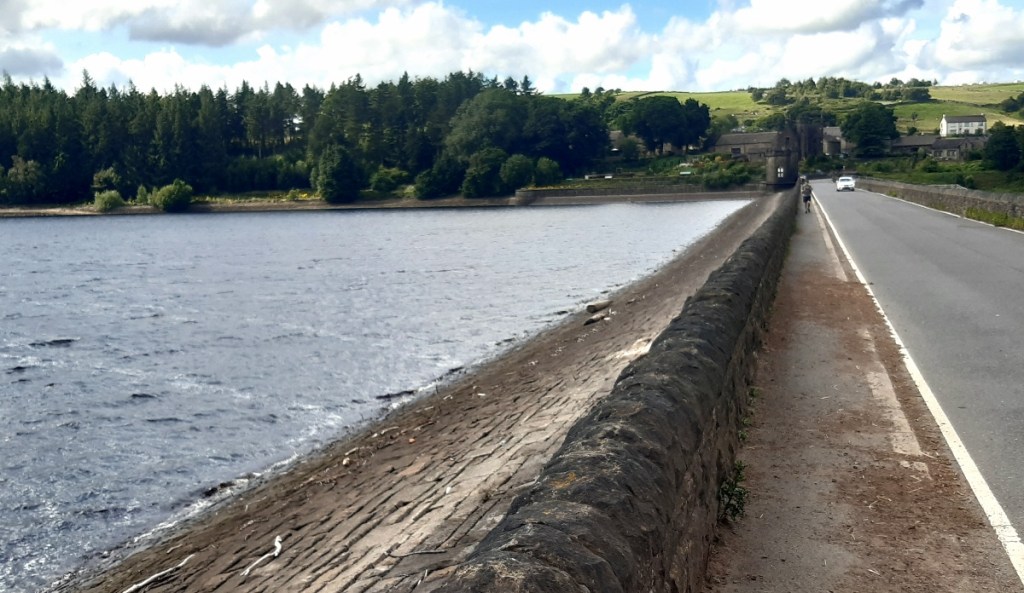
We soon rejoined the bridleway and saw our first human in a couple of hours, in the form of an enthusiastic cyclist who was repeatedly carrying his bike up a slope to ride down it again. (The way was much more sparsely furnished with cyclists this time.) After a while of this we kissed our previous track, turning back onto the quad-bike path in the other direction, and proceeded (not without a few sniggers) past several lines of grouse butts before we completed our descent back to Langsett Reservoir. There was then a very pleasant path through the woods before we walked across the dam to Langsett village, and returned to our car!
And so we were done! A very pleasant day out, and we were all glad we’d come. It’s only a two-and-a-half hour drive to here from Cambridge, so I don’t know why I don’t do this more often. (Well, I don’t have a car anymore, but I did for a long time!)
Previous visits
Somewhat surprisingly, given that I like hills and walking, and the Peaks are the closest properly big hills to much of central England where I’ve lived most of my life, I’ve visited this map area only once before. I’ve just usually ended up going elsewhere for my hilly holidays – Wales, Scotland, Yorkshire. (I have been to the Peaks a couple of other times, but those were visits to its southern half, the White Peak, further south than this map covers.)
My Blaenau Ffestiniog post from a little while ago told you the tale of how I ended up doing an expedition for the Duke of Edinburgh’s award with my school, and of the first part of our assessed expedition in summer 2011: a four-day walk, wild-camping overnight, in Snowdonia. A few weeks before the assessed walk, there was a practice walk of similar length. However, it seemed like I might need to get some additional practice in first, since at the time I was a complete foreigner not only to hillwalking, but at pretty much to any kind of exercise at all. (Admittedly the latter hasn’t changed all that much: other than a reasonable amount of walking I still do pretty much no exercise.) It was for this reason that I let my friend Geochunderer, who was already well accustomed to hillwalking due to regular trips with his family, choose a hilly day walk for us to do together, and so came up to the Peak District a couple of weeks before the longer official practice walk would take place.
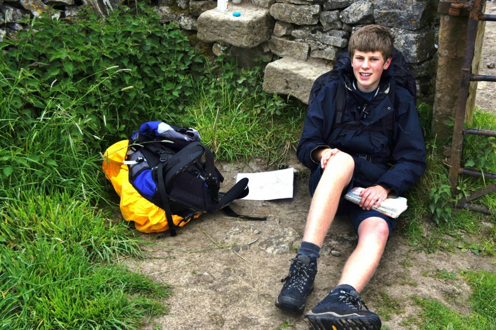
Working out where exactly we went on this weekend has been a bit of a challenge – I could find nothing of relevance in my text message or Facebook Messenger records, so I assume we planned the trip entirely in person; I thus have only my photos to go on, which are mostly bereft of precise location clues. My parents drove us up to the Peaks on a Saturday afternoon, and we stayed the night a hotel, and had dinner in a restaurant, which I haven’t been able to identify. However, the next morning, it seems like we drove to, and then had breakfast in, Bakewell, in the White Peak map area (OL24), so I’m going to guess the hotel was in that map area too.
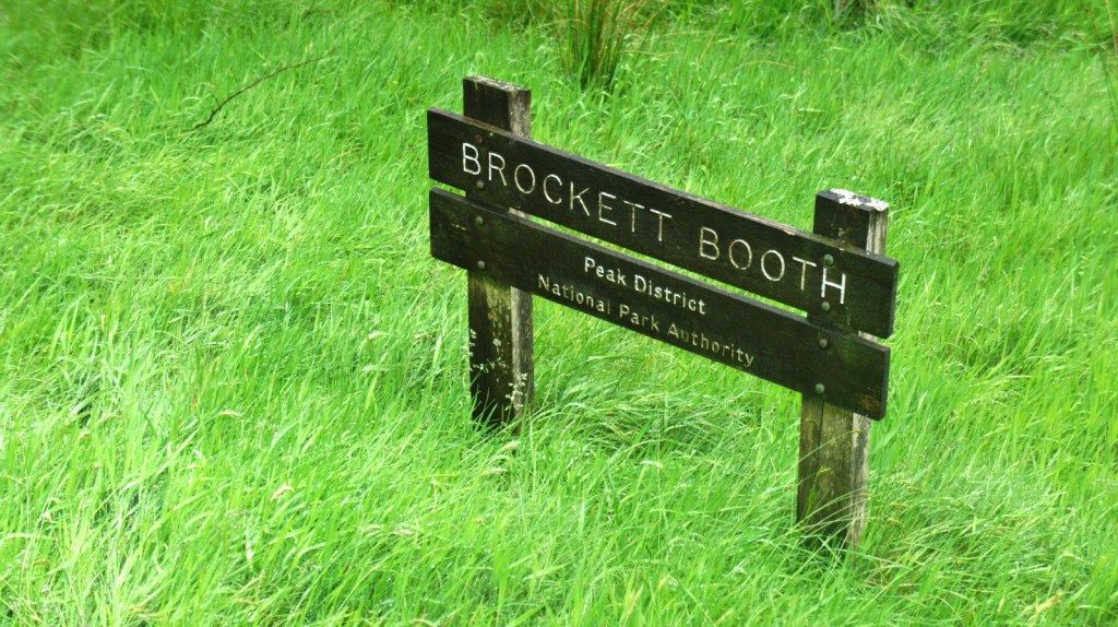
We then drove somewhere else to start our walk, which took through dry-stone-walled fields and quite dramatic, craggy (and sheepy) valleys up to a high ridge, and through a forest on the descent. It was that forest that let me find our location: I have a photo of a sign reading “Brockett Booth”.
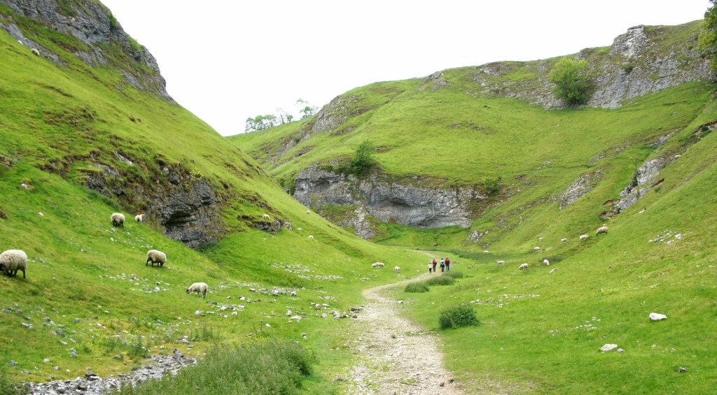
From there, matching up some other photos with Google Earth and street view was possible: it seems that we did a circular walk from Castleton, taking us up to the ridge to the east of Mam Tor, and returning through the aforementioned Brockett Booth woodland. The above photo of a valley I think was Cave Dale just to the south of Castleton, which given that the ridge is to the north means we must have circled around a fair bit.
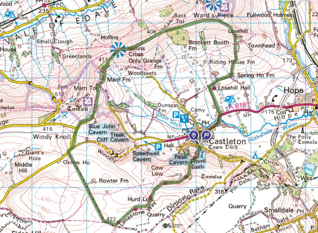
This would give a walk of around 7 miles, which seems roughly right for the roughly three-and-a-half hours it seems to have taken us!
In any case, it looks to have been a very nice walk in some respects, though I doubt I enjoyed it much at the time, especially given that I had a heavily loaded pack, to better emulate the longer walk I was preparing for. My photos show some beautiful scenery – I must explore the Peaks more thoroughly in future. Unfortunately, it did start raining really rather heavily after we’d crested the ridge. We returned to the car thoroughly sodden, I having made the classic mistake of neglecting to put on my waterproof trousers until it was too late, and I recall well changing into dry clothes in a lay-by before getting into my parents’ car for the drive home!
[1] Usually, Vesper, Erithacus and I would go on holiday every summer with our friends Millicent, Cheremy and Queenie – we’d gone on a walk across Scotland in 2016, to Paris in 2017, the Isle of Harris in 2018, and the Netherlands in 2019. In 2020 we’d planned to go to a cottage in Mid Wales, but this was unfortunately stymied by the pandemic meaning that it wasn’t allowed (or wise) for so many of us from different households to stay together. Furthermore, Millicent, Erithacus, Vesper and I had lived together for the past year, but were now going our separate ways – Milicent had moved back in with his parents in March, and was going off to Oxford after the summer to start a PhD, while Erithacus was off to the Netherlands in mid-August to start a masters course there. This was leaving just me and Vesper together from August onwards.(Erithacus did then move back in with me and Vesper a year later.) Vesper and I were off to Harris for a couple of weeks, which was rather unfortunate for leaving the others out – the three of us decided to do this day trip partly as a sort of last, more muted hurrah before Erthiacus left.

4 thoughts on “OL1: Langsett & the Dark Peak”