OS Explorer map 116, Lyme Regis & Bridport: Chard – I own this map, and am unsure whether I’ve been here before – see “Previous Visits” below. Visited for this post 30th April 2021. This is the second of three posts about a trip to Dorset with Vesper, also meeting Mother Dearest.
Google Maps location links: Bridport, West Bay, Eype Down
As you heard in my previous post, on this holiday down to Dorset, Vesper and I stayed in a holiday house near Shipton Gorge, very slightly outside this map area (116). However, I came over into map 116 several times that I can write about: both a few prosaic trips into Bridport to collect things, and a nice cliff walk.

Bridport was the closest town to our holiday house, so I went over several times during the trip, the first indeed barely half an hour after we arrived at the house, to collect a shopping order from Morrisons! Later occasions of me coming back included to get some cheesy chips with curry sauce from a local chip shop, and to pick up som pizza from Domino’s.
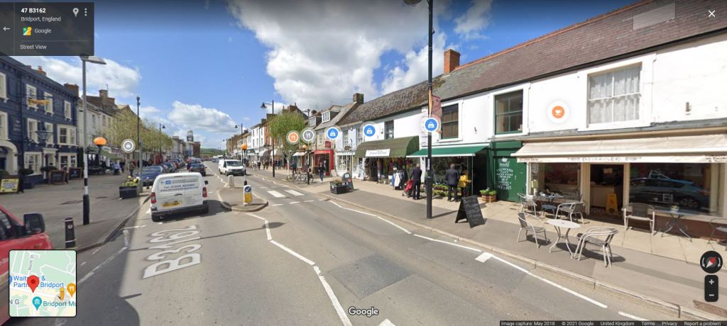
I really quite liked Bridport; it was just a pleasant small town. It had a good, busy high street, with lots of small shops, sort of nicely in the middle of being neither soullessly posh and cutesy nor grim and run-down. Things like dark little charity shops and branches of Peacocks and Spar were sat among little independent cafés, craft shops and a Waterstones. It was unfortunately very car-focussed – it’d be much nicer if they removed the large amount of unnecessary on-street parking and narrowed the road to add some planting and benches; but other than that it was great!
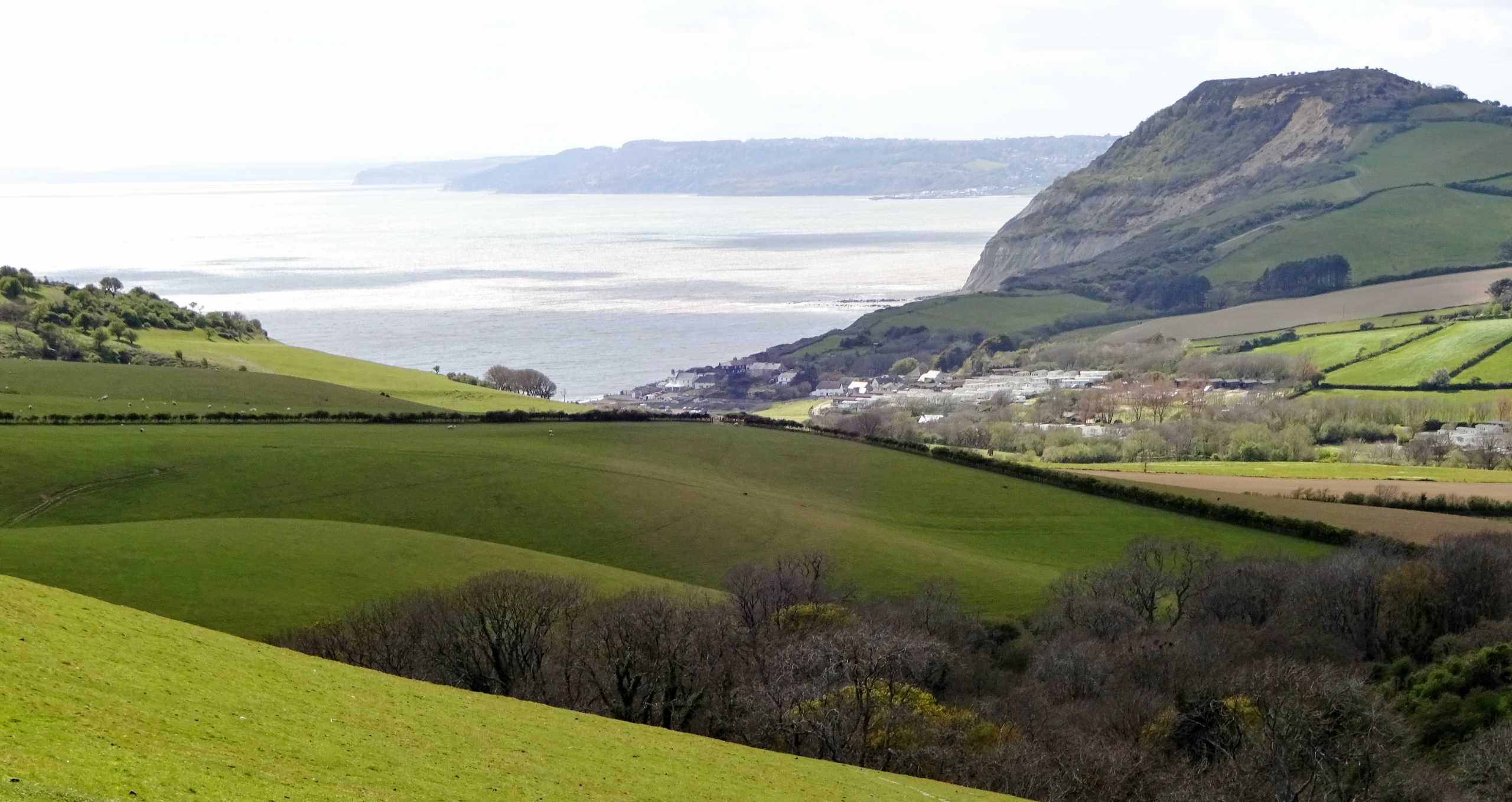
Much more notably than a few shopping trips, though, Vesper and I also came into this map area to go for a walk, on our last full day of the trip. We started out by driving to West Bay, from where the plan was that we’d walk out westwards through fields for a few miles, before coming back along the cliffs.

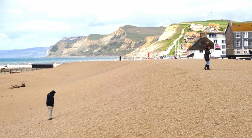
West Bay seemed like a classic small English beach resort town – lots of shops selling ice-cream, fridge magnets, plastic spades, fish and chips; an amusement arcade and so on. It was very windy when we arrived, but clear and sunny, and there were several brave souls sitting around on the beach. Our route took us up and out of West Bay via various residential streets full of fancy-looking holiday and retirement homes, after which the next couple of miles were pretty, hilly green countryside, with the sea occasionally showing through gaps in the cliffs.

As we were approaching the point where we’d want to walk towards the cliffs to start our way back, we passed through a really pretty little wood (marked Eype Down on my map), sitting on a slope and packed full of bluebells.


With the sun filtering through the branches it was just really beautiful – and it was in access land, so it would be a lovely place to come with a book on a sunny day, make one’s way to an isolated spot among the trees and flowers, and read for an afternoon. I’ll have to come back!

Once we left the wood, the sea came into view again quickly, and we made our way across to the coast path, passing some curious sheep, black of legs and belly, but white on their back and sides, almost burnt-looking. When we got to the coast path, it didn’t disappoint: the cliffs were indeed very dramatic!

And a couple of miles later, that was it! Returning to West Bay, Vesper and I sought out some well-deserved ice-cream, and sat eating it on the beach – somewhat disappointingly, the cone on my ice-cream snapped as I was walking, but fortunately I managed to catch the falling ice-craeam, leaving me with just one cold, sticky hand, rather than no ice-cream at all.

It was an enjoyable walk!
Previous visits
So as any hypothetical regular readers are aware, I keep track of which Ordnance Survey map areas I’ve visited, so that I’ll know when I’ve been to them all and so on. I count not only places I’ve visited since I started the blog in 2017, or longer ago when I started keeping track; but also places I’ve been to earlier in my life. Now, naturally, I don’t have a perfect memory from the moment of birth, so this earlier record is not watertight: mainly it just results from a session or two several years ago when I spent several hours with a map, and asked my parents various questions, to try to work out everywhere I’ve ever been.
Now, in my records, I have this map area down as visited before. However, I can’t work out when this happened, nor find any evidence of it in my photo collection and so on. I don’t think I’ve ever been to Bridport or Lyme Regis; I’ve been to Dorset before but always further east, and to Devon but always further north. So either I marked down wrongly that I’ve been here before, or I have been here and I’ve forgotten when. Oh well, I’ve definitely been here now!


4 thoughts on “116: Bridport & West Bay”