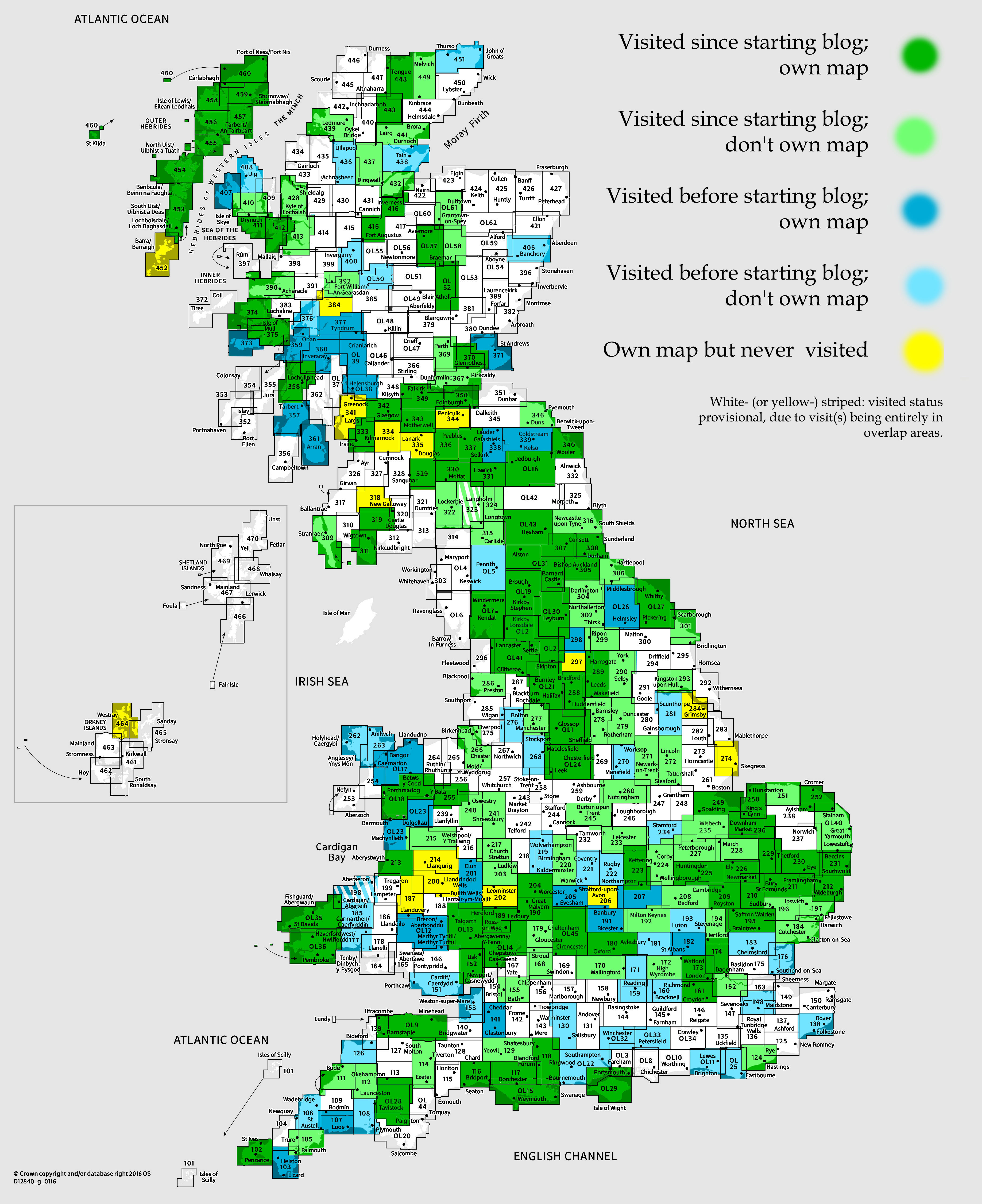
OS Explorer map 249, Spalding & Holbeach Long Sutton & Kirton – I own this map, and had not visited it before starting this blog. Visited for this post 14th April 2023.
Google Maps location links: King’s Lynn, Sutton Bridge, Fosdyke, Wyberton, Boston
My previous post concerned the first stage of the walk from London to Cambridge I’d decided to do in early 2023, doing a day’s walk whenever I had a free weekend day and felt like it, and getting the train home to Cambridge to later resume from the same point at a later date. When complete, this would join up to the walk from Cambridge to Hunstanton I’d done in 2021-22, making a line from London up to the Wash coast – as you can now see complete on my walks map.

A few months later, in April, I realised that I had no plans for the easter weekend, which given the double bank holiday could be a good opportunity for a few consecutive days of walking. At this point, I was over half-way done with the London to Cambridge walking, having reached the Hertfordshire town of Puckeridge, so one option would be to do two days’ walking to complete that walk. However, I’d rather use the longer consecutive trip for something further afield, so I decided I’d extend the northern end of my London-Cambridge-King’s Lynn-Hunstanton line. One possibility would be to turn eastwards from Hunstanton and continue around the Norfolk coast, but in the end I decided I’d instead go northwest from Kings Lynn, walking along the southwestern coast of the Wash into Lincolnshire – that way, if in future I ever decided to continue further on, I’d be getting further and further north rather than circling back towards London, which felt less appealing.
I therefore traded in the Easter bank holidays to instead take off the following Thursday and Friday, and early on Thursday morning got on the train up to King’s Lynn to start my walk!
The Wash, the big square-ish bit of sea between Norfolk and Lincolnshire, is more or less a diagonal square, of which I’d be walking along the southwestern edge, and then a little northwards to Boston. There are three rivers pouring into the Wash along this edge, all originating in the Midlands: the Great Ouse enters the Wash at King’s Lynn in the southern corner, coming from Bedford and Ely (where it’s joined by the Cam from Cambridge). Halfway along this coast comes the Nene, flowing from my childhood home of Northampton and Peterborough; and at the Wash’s western corner is the Welland, coming from Market Harborough, Stamford and Spalding.

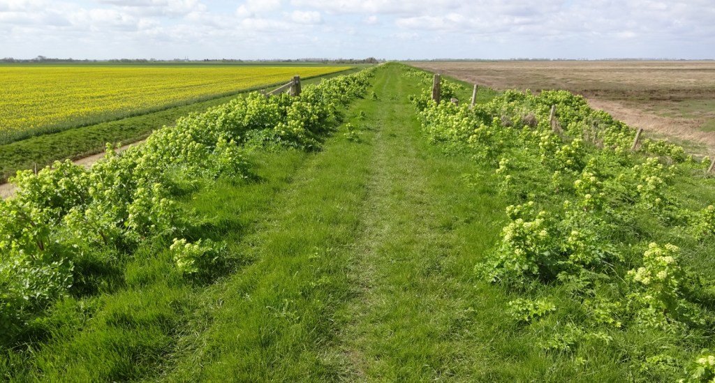
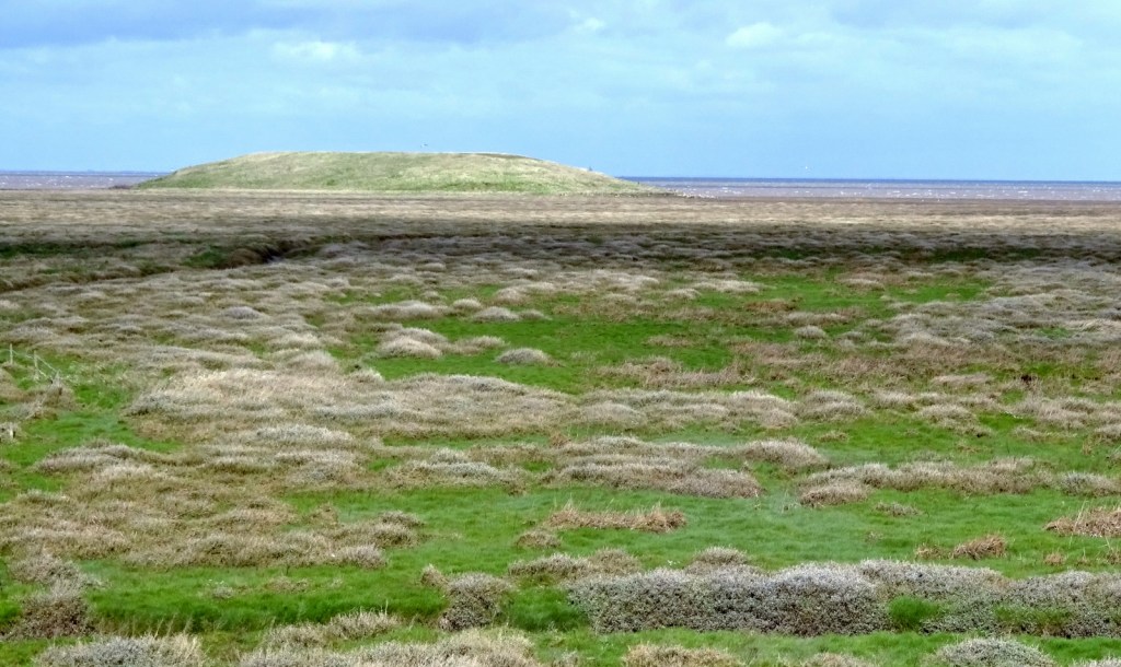
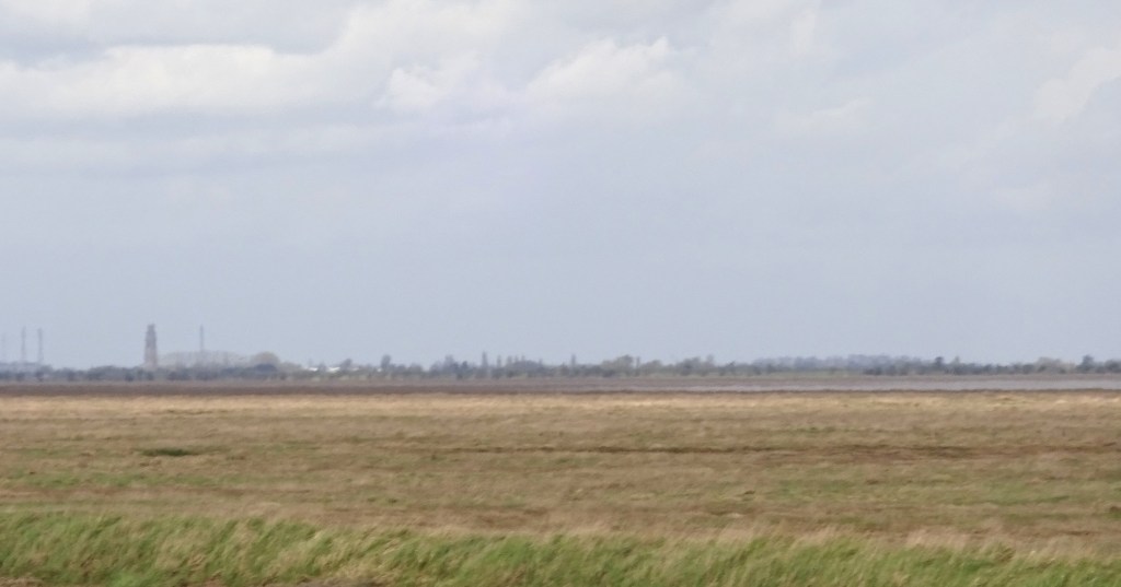
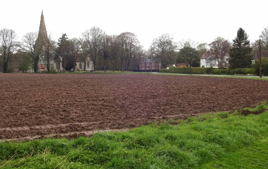
The coastline in this area is mostly huge expanses of salt marshes, and the solid land around the edge is extremely sparsely populated, just miles and miles of raised banks and sea walls, enclosing pancake-flat fields on the inland side, with endless muddy marshes on the right. There are some small towns / large villages in the area – Sutton Bridge, Holbeach, … – but they’re a little further inland.
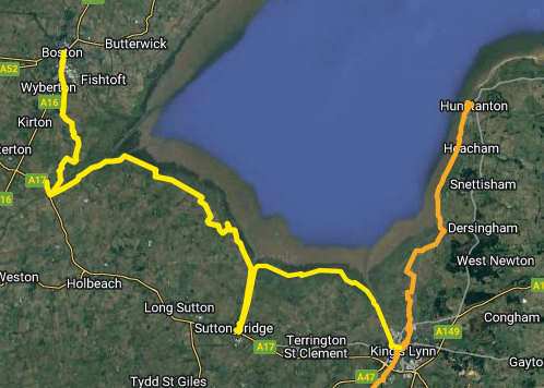
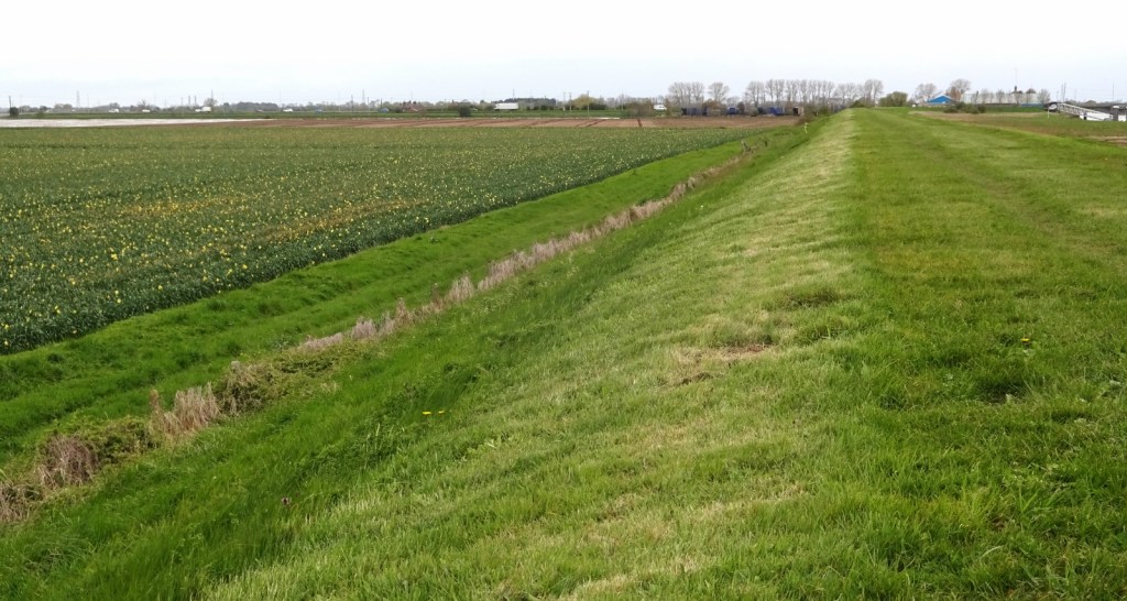
Due to this environment, it isn’t really possible to walk along this coastline in a straight line. The raised banks provide a great walking route, but the three rivers each have their final crossing point only several miles inland; and, since I wasn’t planning to wild-camp, I’d need to come inland anyway to find accommodation and transport routes. My route was therefore in a couple of big U-shapes, heading out along the coastline during the day and then back inland to overnight.

Day 1
Arriving into King’s Lynn at around 8:30am, my first task was to get the little pedestrian ferry across the Great Ouse to West Lynn. (There is a bridge, but it’s a mile or so further inland.) The ferry was about to depart when I arrived, so I duly hopped on and was whisked across. It’s a small, open motorboat seating around 10, and an enjoyable, if brief, crossing.

Unfortunately, upon going to pay, I discovered that I had no cash and they don’t take card. Asking the driver whether there was anywhere nearby in West Lynn where I could get cash, he directed me to the Co-op, and assured me I’d be able to catch him soon afterwards to give him the fare, as he’d be back and forth across the river pretty continuously for a while. Rushing into West Lynn – which was a very nice village – I soon found the Co-op, but was told that they can only do cash after the Post Office opens at 9:30, and they couldn’t do cashback with a purchase. Fortunately, though, the kind souls at the butcher’s shop next door were willing to give me £5 cash in exchange for charging me £5 on their card machine, without me even buying a piece of fruit as I offered to do! So I gave a few coins to the boat man and was ready to start walking.
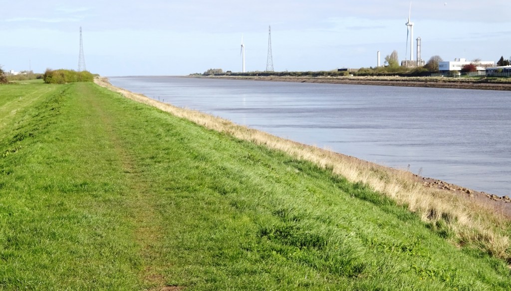
From West Lynn, I headed northwest along the left bank of the Great Ouse for a few miles, before reaching the start of the sands and turning left to walk along the coast; the path at this point ascending onto a raised sea wall, as it would be for most of the next two days. The coastline here is really isolated. Not being a beauty spot, and several miles from most any settlements, it seems like no-one really comes here, though the sea walls make very natural paths. On both days of my walk, I barely passed anyone other than in the few miles at the start and end of each day.

From here, I could see clear along the southeastern side of the Wash over to the cliffs at Hunstanton – though I couldn’t make out where the sands turned to water in the middle!
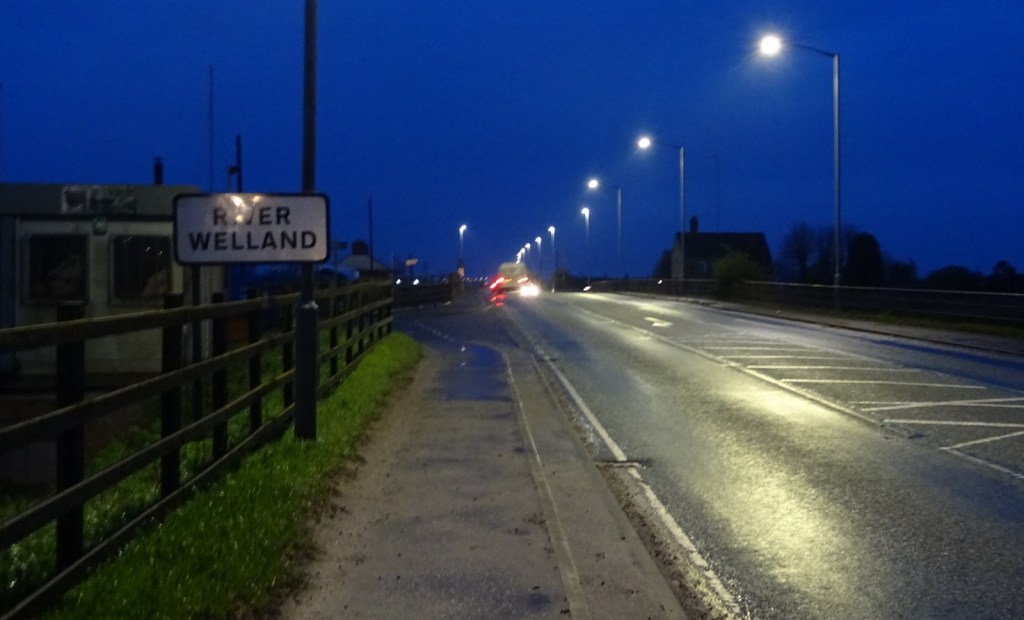
The next several miles were very same-y, before eventually I reached the mouth of the Nene, and turned southwest once more, to head inland to the river’s lowest crossing – and my accommodation for the night – at Sutton Bridge.
Just a little in from its mouth, the Nene is flanked by twin lighthouses which I duly passed, around this point passing other walkers for the first time since I’d left the Ouse behind.

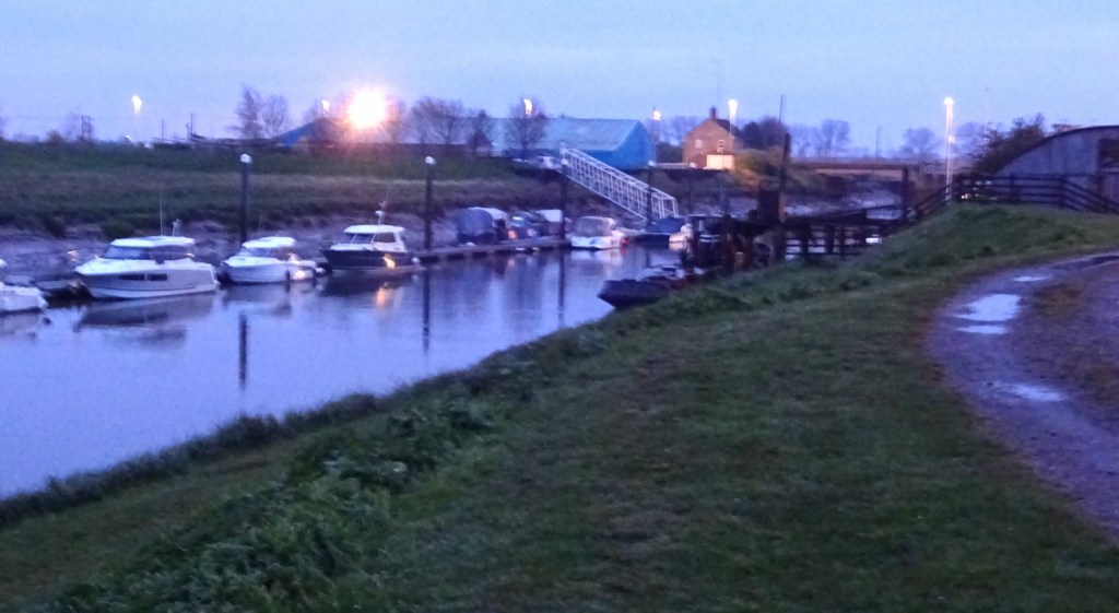
The bridge at Sutton Bridge, known as Cross Keys Bridge, is quite cool. A swing bridge, able to rotate out of the way to admit shipping, it has two adjacent decks: initially, a railway was carried on one and single-track road traffic on another; nowadays with the railway being long closed, both are used for traffic, allowing a lane in each direction. I crossed the bridge to enter the village, and checked into my accommodation for the night, a perfectly serviceable pub-with-rooms setup.


While this first day was about 14 miles of walking, I’d made good time through the pancake-flat terrain, and arrived at Sutton Bridge at only about 2:30pm. With so much of the day still left to me, I came up with a plan: there’s a very regular bus service between Sutton Bridge and King’s Lynn – specifically, the half-hourly 505 route between Lynn and Spalding – so after picking up a cheese and onion roll from the local shop for a quick snack, I hopped on that bus, and went into Lynn to go to the cinema!


In particular, I watched the then-new Dungeons and Dragons: Honour among Thieves, which was very enjoyable. The cinema itself – the Majestic Cinema – was interesting too; it was an independent one, [1] clearly decades old, which charged me only £5 for my ticket, and had very cool ceiling plasterwork in the screening rooms!

After my film, I got the bus back to Sutton Bridge, and bought dinner from a nearby pizza/kebab shop, namely a vegetable pizza and some breaded garlic mushrooms, which I accompanied with some salad and raspberries from the nearby Co-op. I was interested to see that the menu catered for vegans both with pizzas with vegan cheese, and pizzas with no cheese – normally if they have vegan cheese that’s the only explicit option; so it’s nice that there are default options for dairy-avoiding vegan-cheese-dislikers to pick too! From there, I headed back into my hotel room, ate my dinner, and was soon to bed!
Day 2
The second day of my walk started with a bit of an adventure, as I left the hotel at around 8am to buy some breakfast and lunch in Sutton Bridge’s shops before heading off. I went into the Co-o first, and bought various snack bars and some easy-peel oranges, but was a little disappointed to find the the only substantial ready-to-eat food I could have for lunch was a rather plain-looking cheese and onion sandwich roll. I then headed over to the other little shop to see if there was anything more appealing for breakfast. All I could find was a cheese and onion pastry roll, so I duly bought that to make it a very cheese-and-onion-y day!
Now, the Co-op easy peelers came in rather a big pack of seven or so, which I wasn’t terribly keen to carry all day, so I’d made the questionable decision to deposit a few of them in the box of loose oranges for sale in the other shop, thinking they could sell them again. However, after I headed off with my purchases, I was chased after and grabbed by the shop assistant, who looking at the CCTV saw me with my hands in the oranges and assumed I stole one. I explained the situation, but he did make me take my oranges back; fair enough I suppose.

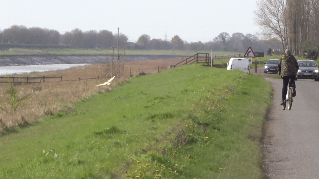
After sitting and eating my breakfast, I headed off for my day’s walk. The first three or so miles of this took me back out along the River Nene, on the opposite bank to the one I walked the afternoon before. There were a few dog walkers about, and exctingly, a little white owl flew by at one point, which I managed to catch on camera!
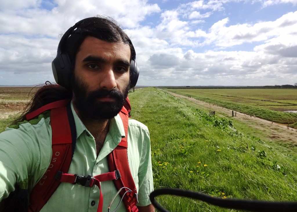
I was soon past the end of the river and back on the sea banks, where I’d be for most of the rest of this very long day – at 20 miles, this would be the longest walk I’ve ever done, I think!
A few miles of this section of coast is used as a military firing range and was marked as a danger area on my map, so I wasn’t certain whether I’d be able to walk through on the public footpath or need to divert around.
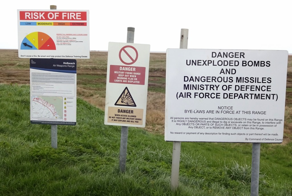

When I arrived there, a sign let me know that I shouldn’t walk through if a red flag was showing; and indeed it was, so I detoured a little way inland through some fields and minor roads. I was a little suspicious, though: further on, I could see another flagpole which had no flags flying, and I saw someone else walking their dog up on the bank in the military area, and there was no sign of military activity. Indeed, when I sat down for a break and did some searching on my phone, I found the Ruth’s Coastal Walk blog: Ruth writes that on this stretch she’d been in the same situation exactly, until a local lady told her that the military often leave the flag up by mistake, so she walked on through. I turned back towards the coast and did the same!

I soon sat down on the sea bank for my lunch break, feeling surprisingly perky for having walked eleven miles before lunch. Continuing onwards, I eventually turned left again to head down the River Welland towards the bridge at Fosdyke. On this stretch, Icould see both sides of the Wash, and the town of Boston had become visible across the river and plains – in particular I could make out the “Boston Stump“, the giant medieval tower of its church. (For more on Boston, see my next post, where I visit the church!)
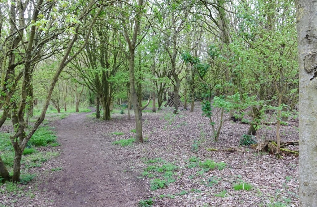
Once I was walking along the Welland, the sea banks were broken up at one point by the Moulton Marsh nature reserve, which was very nice – I walked through an area of woods with real trees, which I’d barely seen all day! A little while after that came a field of daffodils, which was jolly.
Now, I’d had a bit of trouble working out what I’d do for accommodation at the end of this second day. I didn’t find anything promising in the village of Fosdyke where the first bridge is over the Welland, nor very nearby. I could get a taxi into the nearby town of Holbeach, but was loath to spend the £50 or so I’d need to on the round trip. And there were no promising bus routes I could find to use: the helpful 505 route I used the night before turns off the A17 road before this point, to head into Spalding.

However, fortunately I discovered that this area of Lincolnshire is currently covered by a demand-responsive bus service – i.e. a government-subsidised minibus service which, for a bus-level fare, you can book to collect and drop you throughout the area. I therefore duly booked a journey for myself from Fosdyke to the village/Boston suburb of Wyberton to the northeast, at 6:20pm. As a bit of a transport nerd, I think demand-responsive buses are a pretty silly idea in most cases; being usually funded on time-limited transport grants by officials looking for something shiny, but usually far worse-patronised than the established bus routes they replace, hugely costly for the low number of passengers they attract, and inevitably cancelled when the trial funding runs out. But in this case, it was very convenient for me!

By this point in the day I was doing pretty well timing-wise, so called to see whether the bus could collect me any earlier. And indeed they could, so my collection was moved to 5pm, which I’d have just enough time to meet!

After crossing Fosdyke Bridge, I walked into the village, and the bus turned up as planned – a little early in fact!

The driver was chatty, and let me know that he doesn’t get many walkers in the area at all. He dropped me off outside a shop in Wyberton – just outside this map area, but I’ll continue my narrative here – and kindly let me photograph his bus before he drove off. I bought myself some supplies, then walked to the travelodge where I’d be spending the night. Dinner was a burger and onion rings from the Burger King across the street, plus some salad I’d bought in the Co-op!
Day 3
For the final day of the trip, I only had about nine miles to walk, from Fosdyke through to central Boston. And I had an early start. Extremely early.
You see, a few days before I’d booked the demand-responsive bus to bring me to Wyberton at the end of day 2, but there was no availability to return me the next morning, at least not until inconveniently late. A taxi was an option, but it would’ve been £30, which I’d rather avoid. There was, fortunately, one other option: there is actually a direct scheduled bus route between Wyberton and Fosdyke Bridge, but it’s a rather odd service: the B2 bus runs three times daily from Boston to Bakkavor, which isn’t a town or village, but rather a small collection of industrial buildings in the middle of fields, seemingly mostly catering businesses. It does two return trips from Boston per day, the first at a blisteringly early 5am, the second around 5pm – so a 4:30am wake up it was for me – but then also a final Boston to Bakkavor service at 8:30pm. Why there is no final return service is mysterious to me – I’ve no idea what the bus does after it terminates in the middle of nowhere; if it returns to Boston where it’s presumably based, why don’t they let passengers ride on it for that trip? I assume the route is probably subsidised by the companies at Bakkavor and aligned to their shift times or something; I can’t see why else it would exist.
I got on the bus as planned, having dined on a pot noodle for breakfast courtesy of my hotel room kettle. There were a fair few people on the bus, some in chunky boots, one quite formally dressed; and who all stayed on longer than I did, supporting the “employer at the end of the route” theory. The driver kindly dropped me off right at Fosdyke Bridge rather than at the nearest specific stop, and I started my walk in the twilight half an hour before dawn.
The final day’s walk was much more diverse than the previous two; very normal countryside walking rather than the isolation of the past couple of days. It was still on sea banks for the first few miles, but I msotly stuck to the “Old Sea Bank”; smaller, more overgrown and between fields on both sides, rather than the larger, newer one out to sea. After that, I was on more normal roads and footpaths, and even went through a couple of villages!
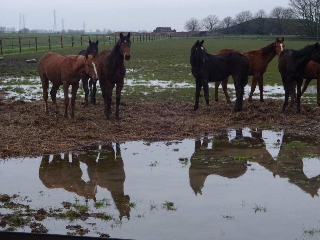

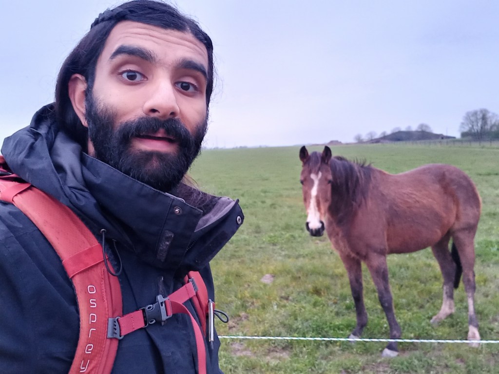
Dawn, when it came, was very nice; really loud birdsong all around, as well as several cockerels. There were also a lot of animals around; I passed fields of sheep and lambs; horses and foals, and saw a deer. At one point, the air became distinctly pongy, explained shortly afterwards when I passed two truly enormous mounds of rotting onions – they must have been 50 feet long and 20 wide; they were huge.


And that’s it! After the village of Frampton, I left this map area, and a scant couple of miles later I entered Boston itself, where I’d end my walk. I’ll describe Boston in my next post!
[1] Now, I’m not normally one to overly lament the loss of independent shops and services – if big companies are dominating and independents disappearing, that seems okay to me as long as the big companies are competing fairly: presumably they’re dominating because people are choosing to shop there over the independents, which is presumably because the big company is providing a better, cheaper, or more convenient service. It seems fine for the services available to come to reflect consumers’ choices in this way.
But as my experience here shows, there is a lot of fun distinctiveness to be had with independents, and there really is something lost when they disappear – I love wandering a fun, poky second-hand bookshop as much as the next person. Still though, I value them as much as everyone else does, which is to say, enough to enjoy them, but not enough to actually shop there most of the time when they’re more expensive and less convenient – so lament the downsides of their passing I will, without saying it’s overall a bad thing.
However, if the Majestic Cinema really is profitable, providing lower-priced tickets than the chains and a fun distinctive environment, then that seems the best of all worlds. Long may it succeed!
