OS Explorer map 379, Dunkeld, Aberfeldy & Glen Almond – I do not own this map. I have already visited it and posted about it since starting this blog, but accidentally wrote this post not realising (details below). Visited for this post 12th July 2025. This is the first of three posts about my trip up to the Isle of Harris with Vesper in July 2025.
Map area link. Google maps location links: Ashgill Force, Alston, Dunkeld Hermitage, Uig, Isle of Harris.
As the title and opening spiel will have clued you in to, this is a bit of an odd post. I came to this map area, this time, as a stop-off with Vesper on the way up to spend a couple of weeks on the Isle of Harris, in my parents’ holiday cottage there which regular readers will be well familiar with, trips there having featured on this blog many times before. I merrily got much of the way through writing up this post when, looking through past posts to add a reference, I found that I’d posted about Dunkeld before!
That old post was, until I corrected it just now, entitled 369: Dunkeld, which is odd, since Dunkeld isn’t in map area 369, it’s in 379. But the post was titled 369, and 369 is the one coloured in in all my past “maps of maps”, up to and including the one at the bottom of my previous post. As far as I can tell, I just made a mistake in 2018 about which map area Dunkeld was in. I’ve now corrected the old post, and my future maps of maps (including the one below).
Of course I wouldn’t normally post about visiting a place I’ve posted about before. But I’m well stuck in to writing it now, so here it is! This post is therefore the third ever re-visit post, and made for a different version to the previous two – those being cases where, due to my rules about how I treat visits solely in the overlap areas in multiple maps, it’s possible for a map to become “un-visited” then need to be “re-visited”. See those posts for details! Now, let us continue.
The earlier trip
As mentioned, I came to this map area with Vesper as a stop-off on a journey up to the Isle of Harris. This was to be a pretty long trip, with just under two weeks on Harris itself, plus a couple of days each for the trip up and down.
Now, since January 2024, Vesper and I have had our two excellent little cats, Astrid and Polly. So far, when we go away, we’ve always arranged catsitters to stay in our house – normally mine or Vesper’s parents are happy to come for a little holiday in the Cotswolds, staying in our house. This time, though, we were trying out something different and taking the cats to my parents’ house to leave them there. I’d been wanting to try this for a while since, if it went well, having that as an option would give us much more flexibility for longer trips.
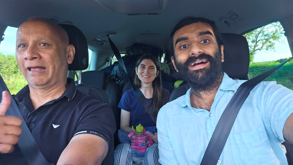
So this trip started on a Tuesday evening, 8th July, when Father Dearest came by after Vesper and I had finished work, to collect us and the cats and drive us to my parents’ Northamptonshire home. Vesper and I stayed there for three nights in case it helped the cats get settled, working remotely from there on the Wednesday and Thursday, before starting our drive up to Harris on the Friday.
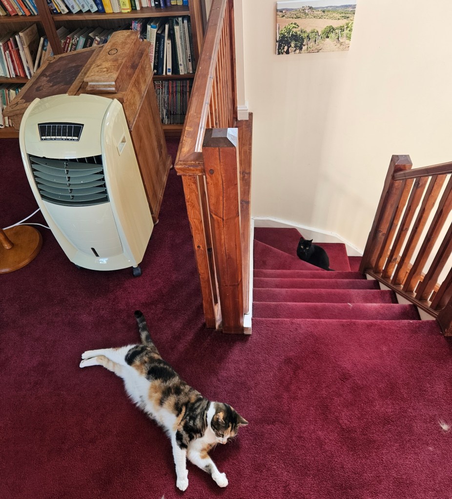
I have to say, leaving the cats at my parents’ house went very well! We, especially Vesper, were apprehensive because the cats were very withdrawn for a good week or so after we first adopted them, spending a lot of time hiding under the bed, so we thought they might do that every time they’re moved house. But, while they clearly didn’t enjoy the journey, they were basically back to their usual selves within an hour or so of arriving, so that was very good! It’ll be nice to have the option for future trips, and it’s one less barrier to my probably never-to-be-fulfilled vague ambition to spend 6 months living in another country sometime.
On the Friday morning, we set off for our drive Northwards, borrowing one of my parents’ cars for the two weeks. The plan was to take it over two days, staying the night in-between with my friend Geochunderer and his wife Aspirant Bookseller just northwest of Glasgow.
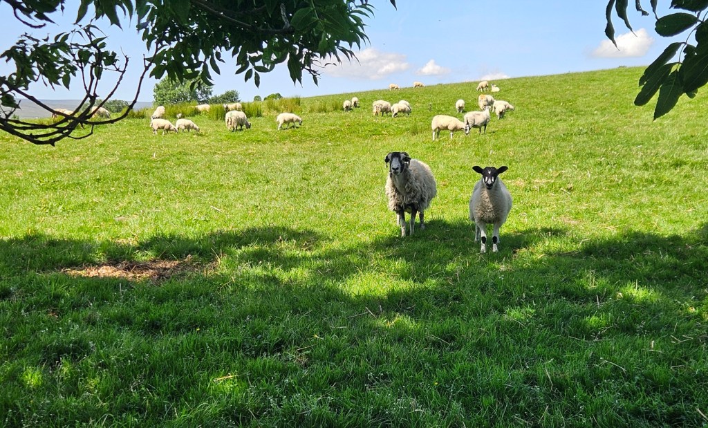
As ever for long drives, I like to take a route with some interest on the way – partly that will let us have some interesting stop-offs, and also ideally some variation to the driving, like some good views or smaller roads or little towns rather than just motorway the whole way. This time we went up the M1 and A1, past York and so on before turning off at Scotch Corner. But rather than taking the A66 over to the M6 at that point, which is a nice route already, I took us through the North Pennines so that we could come to the M6 near Carlisle via some nicer scenery on smaller roads.


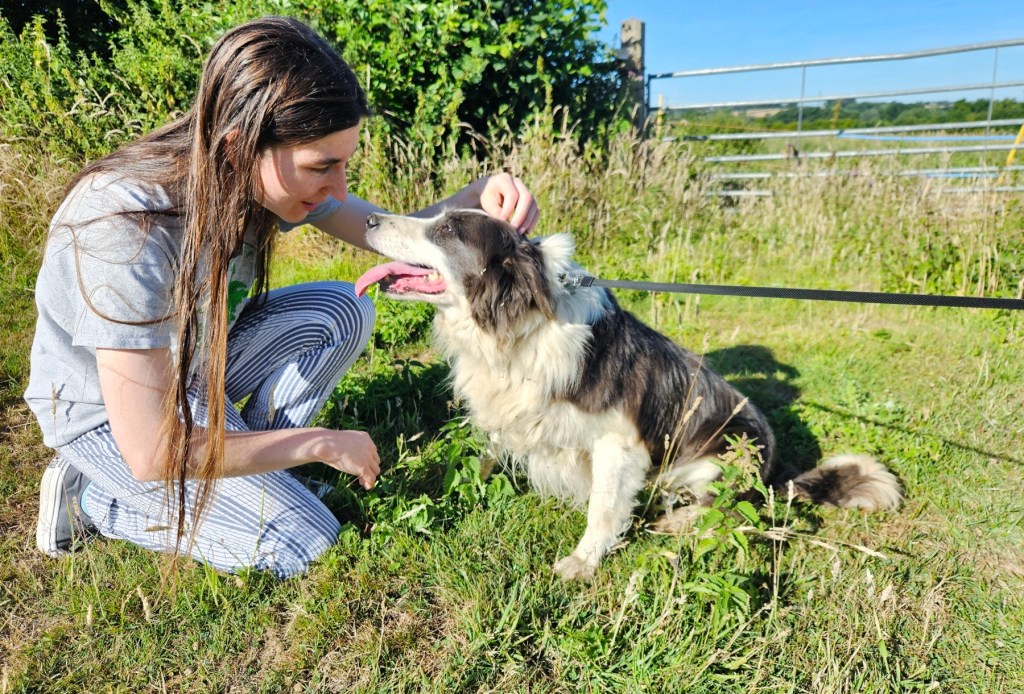
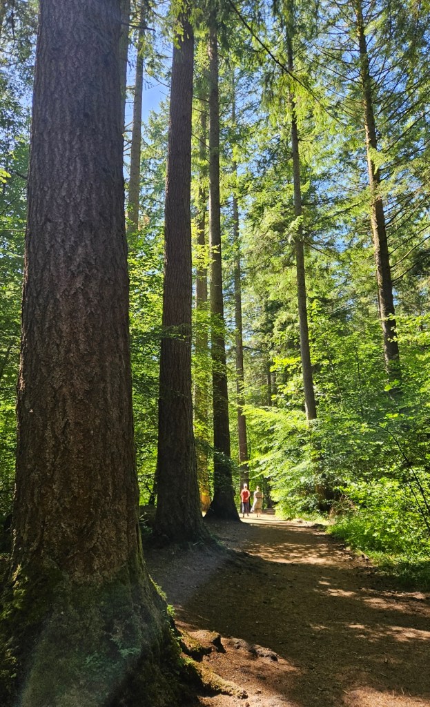
In particular, we made a stop at Ashgill Force, [1] a waterfall just outside the village of Garrigill, a few miles out from Alston on the Teesdale road, and in map OL31 which I’ve posted about before. It’s close to the road, but not very obvious how to get down to it – arriving and parking up by the bridge, we first ended up walking down the wrong side of the wooded cleft it’s in, but had a nice enough time admiring the sunny views and cute sheep. Back at the car, we encountered a Geordie pair who let us know the right way, and walked down the other side.
I’m really glad we came, because Ashgill Force is great. It’s very three-dimensional – to get down to the base of the waterfall, you come down a steep path through the woods from the road. It splits in two at one point, with one way taking you down a fairly normal, if a bit muddy, path; but the other takes you through a cave – a little, narrow, steeply descending cleft, which is very cool.

Then when you emerge at the bottom, you can see the waterfall properly. At the top of your view is the high bridge with the road on it, and then underneath the arch of the bridge the river comes out and falls down into a big pool.

But this waterfall is most notable to me because it’s possible to walk all the way behind the waterfall and stand behind it, which is just great! I’ve done that once before in Iceland, but I’ve never seen it in the UK before. We had a jolly old time walking around and exploring behind the waterfall. So that was great – I’d say Ashgill is now my favourite waterfall in England or Scotland, though I’m not sure it beats out Pistyll Rhaeadr in Wales. We were, unfortunately, in the middle of a heatwave at the time, but I’d chosen the North Pennines partly because things weren’t too bad there, around 26C in the early afternoon when we were there. It was warm, but I managed.
From there we got back in the car and drove on just a few miles to the town of Alston, and had a poke around. It was very nice, with a little market square in the middle with cute old houses. We didn’t end up finding a café where we wanted to eat lunch, but we did buy some gifts for Geochunderer and Aspirant Bookseller in the little deli there.

We drove on, and finally made a very late lunch stop at a Starbucks in Gretna shopping village – not the most exciting of locations, but we were hungry! We arrived at Geochunderer and Aspirant Bookseller’s house, in map area 349 which I’ve posted about before, in the late afternoon. We had a very pleasant evening with them, sitting around and chatting, and going for a late evening walk once things had cooled down. Geochunderer had made some tofu in his air fryer for us with roasted veg and couscous, which was very nice and strengthened my desire for an air fryer, and Vesper was enamoured by their nicely done-up guest bedroom.
This map area
The next morning we’d be driving up to Uig on Skye to get the ferry across to Harris. It was, unfortunately, looking like a scorcher of a day, with temperatures in the end getting up to a wild 30C that day in Scotland. (It’d fortunately be fine on Harris once we got there. Given that, we wanted to do any stopping we’d do in the morning while things were still a sociable temperature, and Geochunderer recommended the Dunkeld Hermitage as a good place, about an hour or so into our drive. So that was what brought us there!
I’m glad we stopped there, because it was very nice. The Hermitage is a National-Trust-owned site jusut outside Dunkeld, being an area of woodland, with a river, the waterfalls Black Linn falls, and the Hermitage itself, a C18th folly sitting in a dramatic position overlooking the falls and bridge.
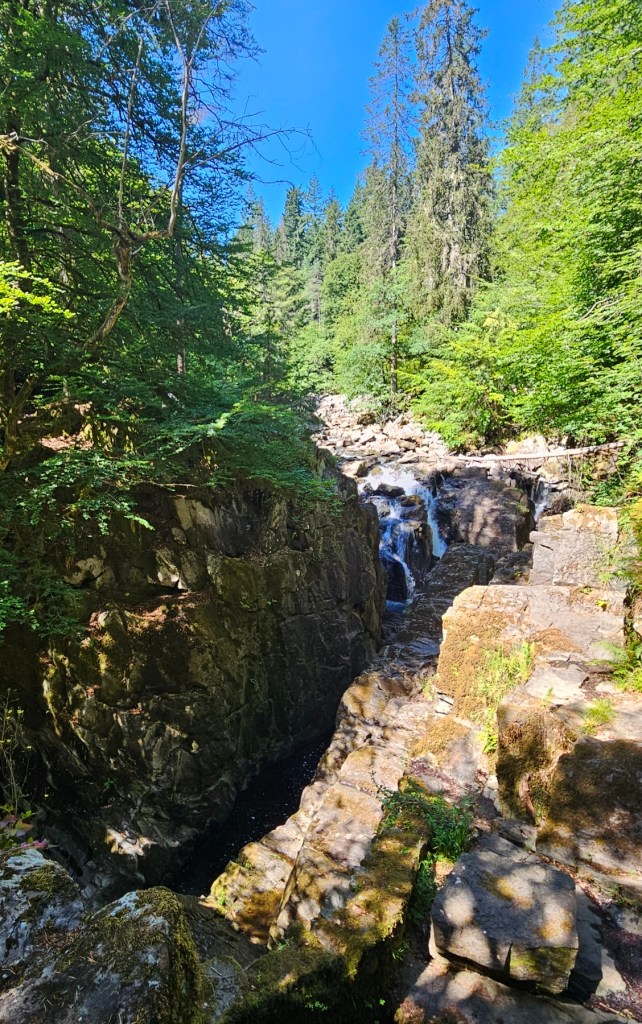

It was pretty popular – not a place you’d go for a quiet, lonesome walk necessarily – but it was just a nice place: good woodland paths, big dramatic waterfall, folly to look at, and rocks to clamber around on. We stopped there for twenty minutes or so, sitting on some rocks by the falls to eat some snacks and having a brief wander. A nice stop!

And that was that for this map area From there we carried on up, sheltering in the air conditioning of the car with just brief forays out to get supplies and so on, catching the ferry from Uig in the late afternoon and getting to Harris the same day. I have another two posts to do about stops we made on the way back down, so I’ll leave a few notes or photos about our Harris weeks at the start of that post!

[1] Force is a Norse borrowing, with fors or foss still meaning “waterfall” in modern Scandinavian languages. You get it borrowed in Gaelic names in Scotland too, e.g. this one.
