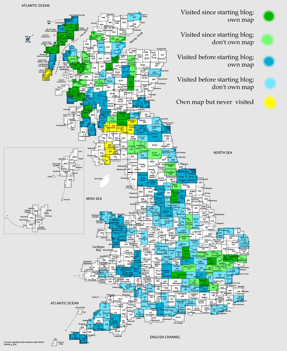
OS Explorer map 349, Falkirk, Cumbernauld & Livingston: Linlithgow, Bathgate & Kilsyth – I own this map, and had visited it before starting this blog. Visited again for this post 5th July 2018. (This is the third of fourteen posts concerning my July 2018 trip to Harris and Galloway with my Cambridge friends.)
From Ravensworth, the five of us continued northwards, joining the M6 at Penrith, and stopping for a supermarket session near Carlisle. [1] This map area was where we’d be ending our travels for the day, at a house we’d rented for the night on Airbnb, as a rest stop before continuing on to Harris the next day. Before going to the house, though, we had one other stop to make in this map, as we collected our final person, Cheremy, from Blackridge train station. He’d had a long day of travelling too, having come from the Faroe Islands, where he’d been on a choir tour!
It was at the station that I realised that we had a slight problem with regards to the house for the night, in that we didn’t know exactly where it was, since the Airbnb host hadn’t sent me the address yet; she didn’t pick up the phone, so we headed on to the right village, Slamannan, without a precise location. Fortunately, she replied to a text once we were in the village, and we soon rolled in and went into the house. Vesper did the cooking that evening, a relatively easy but very pleasant meal of pasta and vegetables since we’d been travelling.

The presence of only four places at the dining table meant that we ate in a creative around-the-corner arrangement. After dinner, and after appreciating the chickens in the back garden, we withdrew to the living room, which, complete with church pews, provided surroundings in which we lazed around for the evening, generally catching up on each other’s lives.

Before we departed the next morning, a ray of fluffy sunshine entered our lives for a little while as we were graced by the company of a most wondrously friendly cat, whom the house’s owner informed us was named Prince Harry.

This was the day that we’d be reaching Harris, where we’d be staying for most of two weeks, but it would be a long day of travelling before we’d get there – our ferry, from Ullapool to Stornoway, wasn’t until 5:30pm. We’d decided that on the way we’d stop at Dunfermline to have a look at the abbey there, so that will be my next post!

Previous visits
I’ve been to this map area once before on the Holy Island Trek, the mostly-partly-walking-trip from Lindisfarne to Iona I did with my Cambridge friends in summer 2016. Vesper, Millicent and I visited this area at the end of the trip, on 9th September, our first day travelling back towards home, having spent the previous night camping on Iona. It had been a dramatic day. There were storms about, and we’d taken the ferry over to Mull from Iona earlier than we wanted as there was an announcement it might get cancelled. We drove across Mull, and took the Fishnish-Lochaline ferry rather than the Craignure-Oban one, as it looked more likely to be running. Some driving through some remote parts of the Highlands got us to Fort William, where we had an extremely late lunch, as described in my Fort William post.
Our plan after leaving Fort William was to drive an hour or so southwards and then camp at one of the sites in Tyndrum. However, as recorded by the annal, our collaborative diary from that trip (which we continued in Paris the next year, and on this Harris trip this year):
Driving through Glen Coe in steadily worsening rain and visibility, we arrived at Tyndrum to find that, due to waterlogged ground, neither campsite was offering camping, and the hostels (one of which had hobbit-holes), were full both there and at Crianlarich.
After being turned away at the last hostel, we sat in the car park on our phones, having trouble finding anywhere to stay nearby. Finally we found and booked a room in a Travelodge in Cumbernauld, another hour and 20 minutes away – not ideal as we’d already been driving for four hours and taken two ferries that day.
As we drove, we became truly thankful that we weren’t camping as the heavens, already fully open, activated the warp drive. Our pleas to St Maelrubha having failed, we turned to Þórr, but in vain. Oceans battered Hilda’s windscreen as we made our slow way along the A85 and A84. At long last we reached Cumbernauld at 10pm.

An incident occurred upon arrival at the Travelodge that has provided occasional giggle material ever since. I’d booked one room for the three of us, with three beds. The fellow behind reception, though, seemed confused by this – “are you sure you want three separate beds?”, he asked. We’ve never worked out which two of us he thought were a couple. He didn’t seem to know what was going on more generally, in fact, as later, we had a knock at the door – he’d forgotten to ask us for money…
Our plan the next day was to take it fairly slow, and only drive as far as Cumbria somewhere, then get home the day after that. We picked a few places to visit that day as we’d have the time. Dumbarton, the Govan Stones and the Ruthwell Cross came later in the day, but our first stop was closer: the Antonine Wall (the further north of the two Roman walls across Britain, made mostly of earthworking rather than stone like Hadrian’s Wall) which runs very close to Cumbernauld.
We intended to visit the wall at Croy Hill, where there’s a particularly well-preserved fort on the wall, but due to some misreading of maps on the tiny screen of our walker’s GPS unit, we accidentally went to Bar Hill, a little to the west, instead – which we only realised once we’d parked and walked up the hill to the site. Nevertheless, it was an interesting place, and also the ruins of a fort; Historic Scotland had placed helpful signs around the place.

Walking down to the Wall itself, we took a photograph of Millicent standing dynamically on top of it, joking that when he’s a history lecturer in thirty years’ time, he can put it in his lecture handouts – a joke based on the presence of such holiday pictures from days past in the handouts given to us by our Anglo-Saxon history lecturer, Simon Keynes.

From there, after Millicent had a slight incident with some mud, we returned to the car, and drove towards Dumbarton!
[1] Hmm, that supermarket stop in Carlisle should count for a map post, actually, since we did get off the motorway a littl ebit to go to it, and I haven’t posted about Carlisle (map 315) yet. We revisited Carlisle two and a bit weeks later on our way back down south, and when I was preparing the maps-of-maps for this series of posts, I forgot about the way-up stop, and only shaded it in later, on the way down. Since it’s a lot of effort to go through changing the colour of that square on the maps-of-maps for all of these, posts, I’m just going to post about it when I get to that point; my apologies for the inconsistency!

One thought on “349: Slamannan”