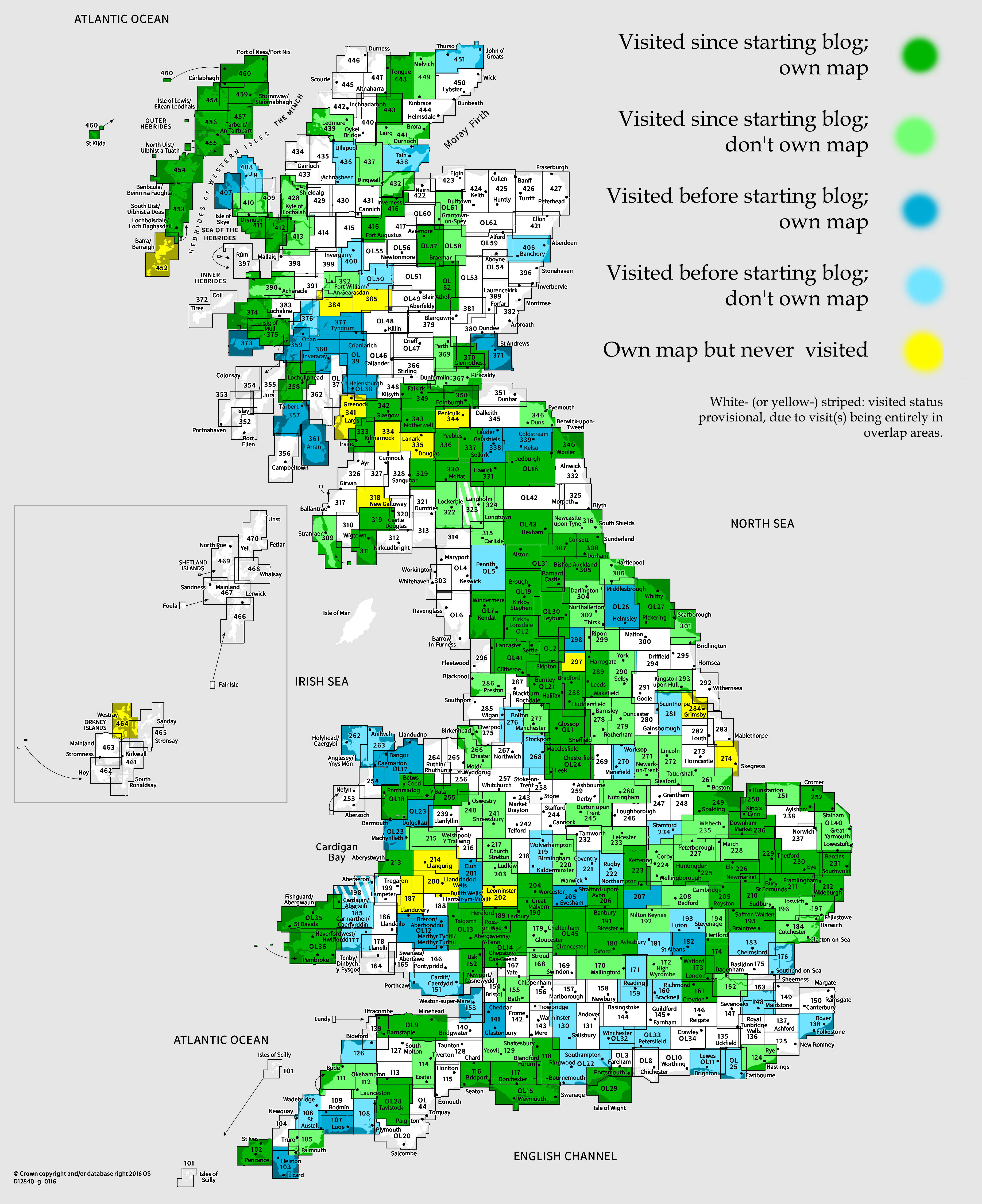
OS Explorer map 206, Edge Hill & Fenny Compton: Badby, Kineton & Middle Tysoe – I own this map, but had not visited it before starting this blog. Visited for this post 30th September 2023.
Google Maps location links: Nether Heyford, Chipping Warden, Middle Tysoe, Moreton-in-Marsh
Intro
Over the last couple of years, I’ve come to enjoy doing piece-by-piece long-distance walks – that is, walks where I’d go out, do a full day’s walking, come home; then on some later date when I next felt like a long walk, return to the same point and continue from there, gradually building up a long line across the map. While I lived in Cambridge, I’d walked from London to Cambridge, and on from Cambridge up to Hunstanton and Boston, as you can see in my map of walks.
In my previous post I told you about how, in August 2023, I moved house from Cambridge to Moreton-in-Marsh. So after the move, I naturally was thinking about what long-distance walk I’d like to start on next. In the end, I decided my first route would be from my parents’ Northamptonshire home to my new home in Moreton-in-Marsh. It’s not overly long at about 44 miles, so I could do it in 3 days comfortably enough; and there are lots of options for how I could extend it in future: I could walk from Cambridge to my parents’ house (~4 days), linking up those routes. If I did that, then adding in Oxford to Moreton (3-4 days) would mean I’d have walked between everywhere I’ve ever lived, which could be fun; or walking southwest from Moreton through to somewhere like Chepstow (~4 days) would mean I’d walked coast to coast between the Bristol Channel and the Wash (though not all sections in the same direction).

To address this map area, I’m not surprised I’ve never visited before despite how close it is to my childhood home, since it’s a bit of an odd one. There are several biggish places around the edges of the map, such as Daventry, Stratford-upon-Avon, Towcester, Brackley or Banbury – the latter partly inside the map area, but mainly covered by map 191 – but there’s nothing actually inside the area that’s bigger than a middle-sized village. Fenny Compton, one of the two place from which it takes its name, has a population of a measly 808! (The other, Edge Hill, I assume is included for the hill rather than the tiny hamlet of the same name.)
However, the map area is pretty central to my walking route! I’ve now completed the full walk from my parents’ house to Moreton, on three days in September, December and February; and most of day 1, all of day 2, and the first third of day 3 were within it. The walk was pretty great! And since the only other map areas I visited during the walk were ones I’ve blogged about before – 223 on day 1, then 191 and OL45 on day 3 – I’ll tell you about the whole thing here!
Day 1: Nether Heyford to Chipping Warden
A long initial digression
I love learning languages; however I’d never successfully done any since leaving university, six years ago now. I’ve tried now and again, trying italki a couple of times, and signing up to an in-person Arabic course in Cambridge in early 2020 which I gave up after two weeks. In January 2023 though, I tried again, booking onto an online Norwegian course, which I chose on the basis that if I can stick to anything, I can stick to that: I’ve previously studied Icelandic, Old English, the history of the Germanic languages, and have some very random bits of German, so there should be a lot of stuff I can just recognise already; plus Norwegian has really simple grammar in a lot of ways. It’s an online course run in the UK so probably aimed to be accessible for monolinguals with no language-learning experience – given our country’s pathetic bar for language education in schools. So taking all that together, hopefully I’d find it pretty easy and could keep up even if I only really attended the classes. And it worked! Over a year on, I’m still doing the course. I’m enjoying it and have a good sense of progress; equally it’s not been very taxing so I’ve not had trouble continuing.
In mid-September 2023, I had an exciting trip planned: one person on my course was living in Norway, having got a job there at the start of the year, and invited me to visit. I’d turned that weekend visit into a long plan: I got myself an Interrail pass, and planned to travel from home to Norway slowly on the trains for a few days, taking some time to explore in Belgium, Germany and Denmark on the way. The first few days of the trip were great; I saw some great things including the medieval cathedrals at Tournai and Aachen, and had an enjoyable afternoon wandering around Hamburg. I also stayed with a family in rural Belgium, whom I’d met once before in the UK and who had invited me over if I ever wanted to come – that was a bit brave for me, but ended up being really nice!

However, disaster struck in Copenhagen, as I arrived fairly late on my train from Hamburg not feeling great, switched from my booked pod hostel thing to a real hotel room, and woke up in the morning feeling properly flu-ey. I mustered the motivation to go out and get some supplies including a covid test and, alas, it was positive. After some thinking, I decided to abandon the rest of the trip, and got on a flight home the same day. So I never reached Norway. Oh well!
Getting back to England, I didn’t go back to my house, because Vesper was going to America a few days later and didn’t want to get covid herself and have to cancel. So instead I went to my parents’ house, and stayed in their little granny annexe, which is pretty convenient for an ill person keeping to themselves, having its own little kitchen and so on, and being unoccupied since my grandmother moved to a nursing home.
The illness wasn’t too bad, as I felt bad only for about four days, by which point Vesper had flown off to America so my parents let me borrow their car to drive home. A week later, I was fully recovered, and drove back to my parents’ house on a Friday evening to return their car. I stayed the night, and the next day, did the first day of my walk from there back to Moreton!
The actual walk
I was, of course, starting this walk on home territory, and I set out from Nether Heyford, going through a couple of fields before joining the Grand Union Canal towpath, a staple of walks from my parents’ house.

I followed the canal only for a short way into the village of Weedon, most notable to me as the place where I used to go to the doctor in my childhood.
Now I only really got into walking well after I moved out of my parents’ house, so I actually haven’t explored further than a couple of miles from their house on foot in most directions. When I left Weedon, therefore, heading out into fields aiming for the next village of Everdon, I was already in new territory! Or at least, areas I new vaguely from the map and from having visited individual places by car; rather than knowing the shape of the area intimately. Between Weedon and Everdon, I also entered this map area!
After Everdon, which was a pleasant village, things got a little hillier as I moved on towards Fawsley. I always think of my parents’ house as being in a flat area, but I don’t think that’s fair – it won’t win any hilliness awards, it’s true, but the countryside is pleasantly rolling at least, and there are some small but real hills around. (Though maybe it’s just that living in Cambridge for eight years lowered my standards…)

I soon passed Fawsley Hall, well known to me as the posh hotel/fancy restaurant near my parents’ house which I’d been to a few times. It’s a posh country house hotel, much like the hundreds of others around the country, but it has an amazing great hall in the middle with huge high ceilings – it feels like an Oxbridge dining hall, but is much more light and airy, and is stuffed with squishy sofas and armchairs for people to sit around on and be served afternoon tea. There’s also a church which feels a bit odd for just sitting in the middle of the Hall’s parkland, when it looks like a normal village church that should be in a village.

It seemed to be a popular day for weddings that Saturday: they were setting up for an outdoor wedding as I passed Fawsley; then on the road a little further on a carful of dressed-up wedding guests asked me for directions, and turning off the road, my route took me through the middle of another wedding venue called “the Granary at Fawsley”, where I walked through a car park of wedding guests, feeling rather underdressed as a sweaty, shorts-wearing walker!

The next few miles of countryside took me past Church Charwelton into the large double village of Hinton and Woodford Halse. Approaching the village, I was interested to see a sign pointing to “Woodford cum Membris” – cum mebrīs would be Latin for “with (its) limbs”, and I thought, did they really name a village this, maybe because it has some smaller outlying hamlets or something? It turns out this is exactly the case – this is the name of the parish that combined Woodford Halse, Hinton and the hamlet of West Farndon. Definitely going on my list of place names with silly bits of Latin in, along with the Regises, Magnas and Parvas. (Doesn’t beat Sheepy Magna for sheer silliness though.)

These villages, more or less one agglomeration now, are divided by the route of the old Great Central Railway; a fast, straight main line built very late in Britain’s railway history, at the end of the 19th century, to connect London to the North – and a bit of a favourite of closed-railway complainers and high-speed rail naysayers. Woodford has turned the big bit of railway land between the two villages into a very nice little wooded nature reserve, where I sat down and had my lunch.


From there, it was just a few miles more to Chipping Warden, where my walk for the day ended. There was, though, a final railway-related obstacle: just outside Chipping Warden, my route crossed that of the new under-construction High Speed 2 railway, meaning that a few of the footpaths marked on my map were diverted. Unhelpfully, they’d put a giant sign reading “FOOTPATH CLOSED” at the point where the diversion happened, but the sign above it detailing the diversion wasn’t possible to read without coming right up to it – so a lot of people probably see that and turn back, not knowing you just need to turn left to get through.


I soon got to Chipping Warden, which was very pretty, with dark yellow stone and thatched cottages all over the place. There, my parents kindly met me in their car and drove me back to Moreton!

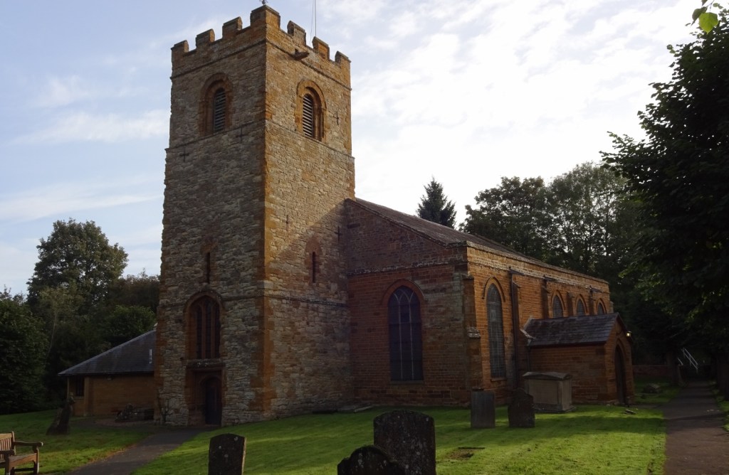
Day 2: Chipping Warden to Middle Tysoe
I returned to Chipping Warden to do the second stage of my walk some three months later, in fact on Boxing Day – I’d spent Christmas with my parents, and had the day free, before I’d go on holiday to the Scottish Borders with Vesper on the 27t. Now I’d chosen Chipping Warden and Middle Tysoe as my break points between days because they’re both accessible by public transport, served by buses between Daventry and Banbury, and Banbury and Stratford-upon-Avon respectively. However, there were no buses on Boxing Day, so I borrowed my parents’ car to drive to Chipping Warden in the early morning – they’d kindly agreed to come to collect me from Middle Tysoe at the end of the day in their other car, and we’d pass Chipping Warden on the way back to collect the first car.
I’ll be a bit less detailed about these latter two days, since this is getting long, and day 1 is my first visit to the map area, so the one that caused me to do this post!
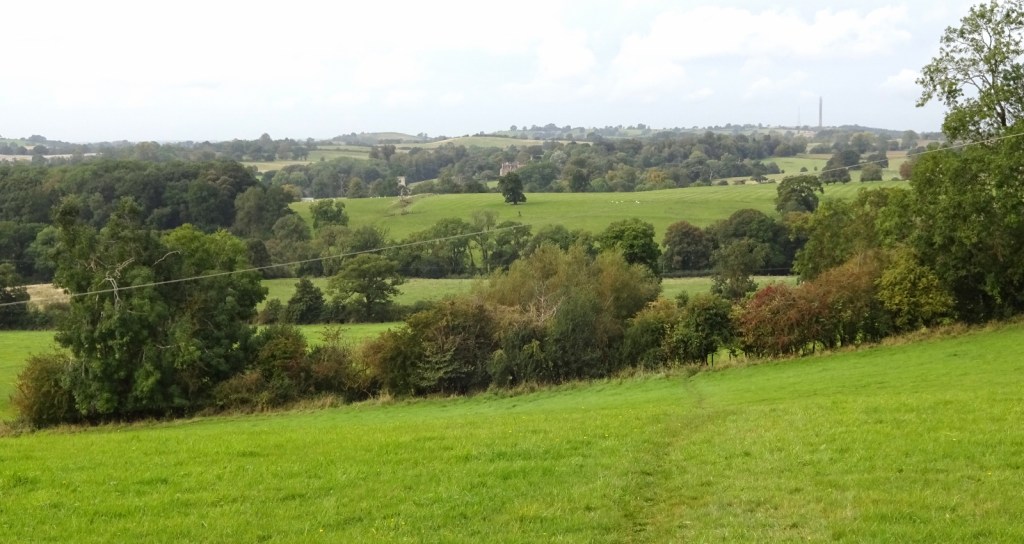
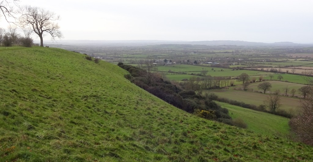
My route for the day would take me through the villages of Cropredy, Mollington, Warmington and Ratley before I arrived in Middle Tysoe, and would also take me up and along Edge Hill, an escarpment a few miles long, and forming the far north-eastern end of the long Cotswold escarpment, which runs for some 50 miles down to near Bath and defines the edge of the Cotswold hills.
I have to say, the villages I passed through were beautiful. This may be controversial, but I think the villages of South Northamptonshire and adjacent areas of Warwickshire and Oxfordshire might actually be prettier than the Cotswolds. The local stone is a much darker yellow, which I prefer, and the villages are just as nice in many other ways. Cropredy and Warmington especially were very nice; and I really like the villages one passes through driving from Banbury to my parents’ house, like Litchborough and Moreton Pinkney.


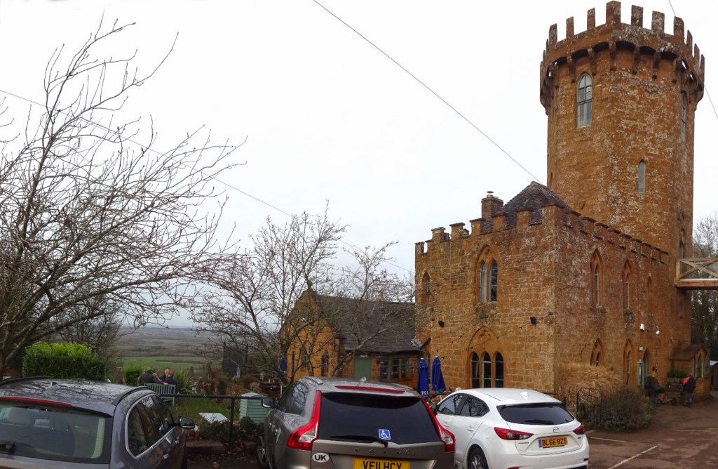
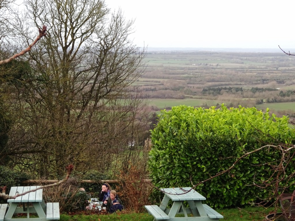
On Edge Hill itself, I came across The Castle at Edgehill, an 18th-century mock castle built right on, well, the edge, with amazing views down across miles of flat countryside towards Stratford-upon-Avon, which has now been turned into a pub restaurant.
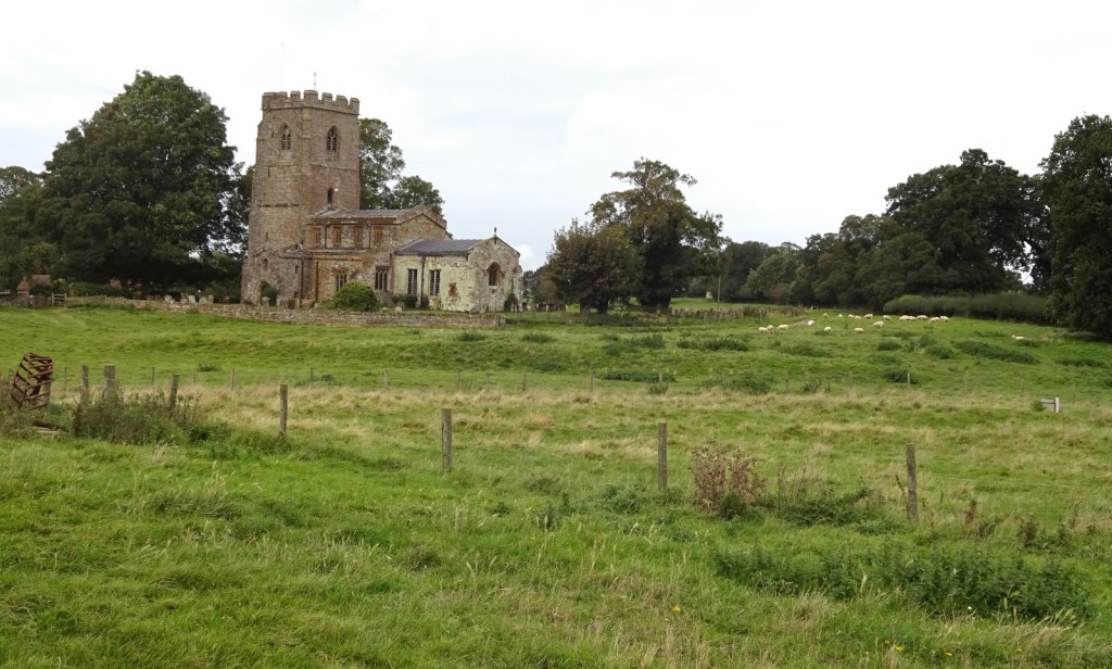
After the Castle, I walked along thr Edge Hill ridge for a few miles before descending into Middle Tysoe and meeting my parents as planned. Another nice walk!
Day 3: Middle Tysoe to Moreton-in-Marsh
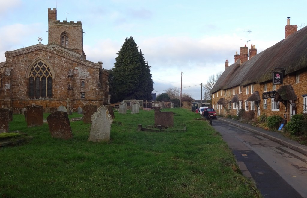
I returned to Middle Tysoe to complete my walk on 3rd February, when I next had a Saturday free and felt like it. It was a bit of a trek to get there from Moreton on public transport, involving first a bus to Stratford-upon-Avon, a fifty-minute wander around town there while I awaited my next bus, then a second bus to Middle Tysoe itself – not too bad, and it all went smoothly, but I did leave home at 7:30am and not start walking until 9:50.
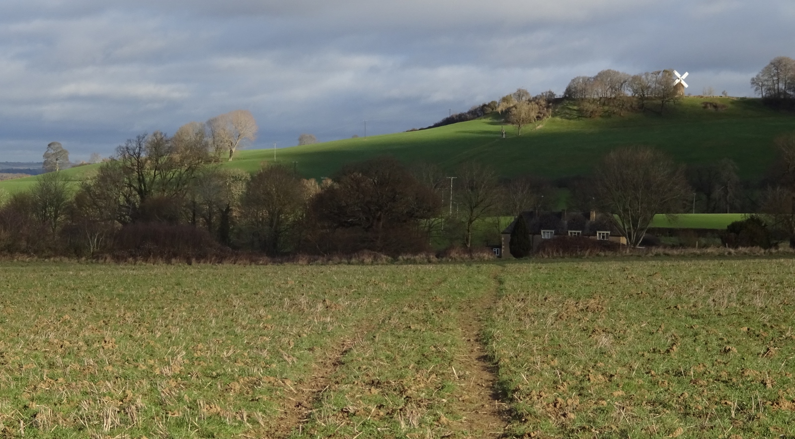
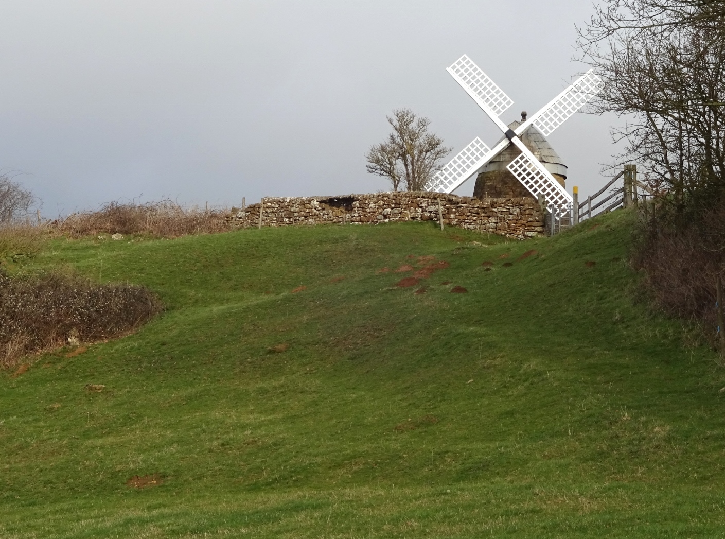
The first leg of the walk took me from Middle Tysoe to Lower Brailes by way of Windmill Hill, named very logically for the windmill that’s right on the top and visible for miles around.
I made a bit of a tactical error at this point: there were two paths heading south out of Tysoe more or less parallel, and I chose the one that, on the map, was marked as ending at a church just short of a road I’d need to get through to. No problem, thought I, even if it’s not a proper public right-of-way from the church to the road, surely it is in practice open to the public, since people need to get to the church. But alas, partway along, I was informed by a sign that it was definitely a no through route, ending on the private Compton Wynyates estate – who, one got the impression from the sign, are none too pleased with the idea of people walking through their land for some tiny distance. It might have been fine, but I just nipped across a field to the other path and avoided it.

Just before Brailes, I left this map area, having walked the full distance across it, which is nice! After Brailes, the rest of my route was through countryside for several miles, and mostly avoided villages other than Wolford a few miles before Moreton. It was pleasant country, consistently hilly now that I was entering the Cotswolds proper, and it passed quickly as I made my way through something like five episodes of the first series of the Empire podcast, on the British in India, which I was really engaged by at the time. I do listen to podcasts or audiobooks while walking occasionally, but usually only for an hour or two during an all-day walk; but in this case I was just really into it so did it for most of the day!

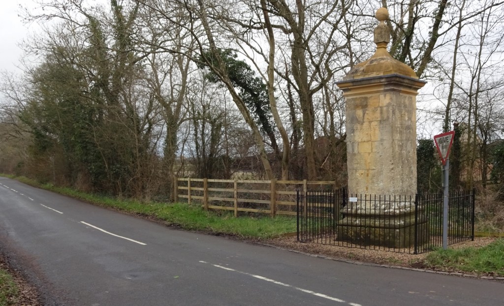
After Wolford, my route took me through Wolford Wood just to the northeast of Moreton, which I’d been meaning to visit, and I made a very slight diversion on the outskirts of Moreton to see the Four Shires Stone, a local landmark indicating the point where, until English county borders were made a little more sensible in the 20th century, all four of Oxfordshire, Worcestershire, Gloucestershire and Warwickshire used to meet. It was fine.
And that’s it! I’ve walked from my parents’ house to Moreton, which makes a nice new line on my past walks map. I really enjoy having such a detailed sense of the distance between these two places where I’ve lived.

lord of the rings style walks
LikeLiked by 1 person