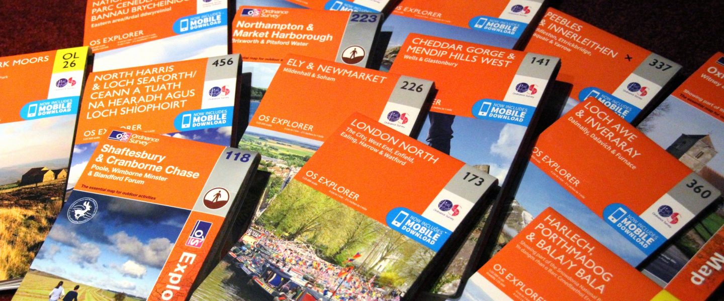
OS Explorer map 220, Birmingham: Walsall, Solihull & Redditch – I do not own this map, but had visited it before starting this blog. Visited again for this post 19th September 2022.
Google Maps location links: Centenary Square, Kenrick Park, Smethwick Galton Bridge
I visited this map area as part of my All Line Rover trip in September 2022, for which I did day-by-day blog posts already, and am now going through doing my regular posts about the new map areas I visited. The main content below will therefore be just a lightly edited version of relevant parts from my post about Day 3 of the trip; for a more connected narrative I recommend taking a look there instead. The Previous Visits section will be new though.
I arrived in Birmingham on this Monday morning on a train from Bristol, having decided to travel on to my later destinations of the Borderlands Line and Merseyside via Birmingham rather than following my original plan of coming via the Welsh valleys. That way, I’d get to make a trip on the West Midlands “Metro”, Birmingham’s tram system, as one idea I had for the trip was to go on every British tram or metro. From central Birmingham, the tram line runs out westwards to Wolverhampton, conveniently paralleling the railway line I’d need to take to head on towards Wrexham to change for the Borderlands line. My plan was therefore to get on the tram, and join a Wrexham train a little further out of the city centre.
Things were a little chaotic on the trains that morning: it was the day of the old Queen’s funeral, when naturally a lot of people would be wanting to go into London, but unfortunately the lines into London Paddington were completely blocked that morning due to an issue with the overhead wires. A chap got on my train bound for Luton Airport, having no better option than going via Birmingham, adding several hours to his trip.

Now, Birmingham is not that far away from my childhood home in Northamptonshire, and I’ve been there fairly often for functional reasons. However, I’ve not really ever looked around the city centre before. I wanted to get on with my day’s travel, so I didn’t take the time for a thorough explore of the city – which I’d very much like to do at some point – but I did decide that, rather than immediately getting on the tram outside New Street station, I’d walk just a couple of stops along the line first, to Centenary Square.
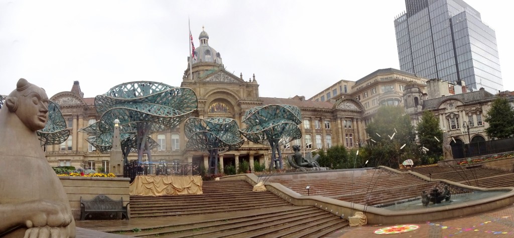
The area I was walking through was very much the “museums and civic buildings” part of town, and was pretty impressive. I enjoyed the slightly odd giant tree sculptures that were up in front of the Birmingham Museum in Victoria Square. Unfortunately, just after this, there was an onslaught of sudden heavy rain – I got out my raincoat and put it on but still got rather soaked from the waist down. [2]

When I arrived in Centenary Square, I found that there was a big screen up on the side of the very impressive Library of Birmingham, showing a live feed of the Queen’s funeral in progress in London, with a crowd braving the rain to watch in the square. I’d missed a fair bit of it, but I joined the crowd for the forty minutes or so that remained. At one point, a load of police vans pulled up behind the crowd and fifteen or so police piled out, which was momentarily alarming, but then it turned out they were just there to observe the one minute’s silence as part of the funeral.

I’d heard good things about the Library of Birmingham, so tried to have a look after the service finished, but unfortunately it was closed, so oh well. Following that, I walked to the tram stop at the other side of the square, and got on my tram!

As mentioned, the tram route parallels the railway line from Birmingham to Wolverhampton. I could’ve stayed on the tram all the way to Wolves, but to save a little time rode only around a third of that distance, getting off after around four miles at Kenrick Park, from where I then had a 15-minute walk over to Smethwick Galton Bridge station.
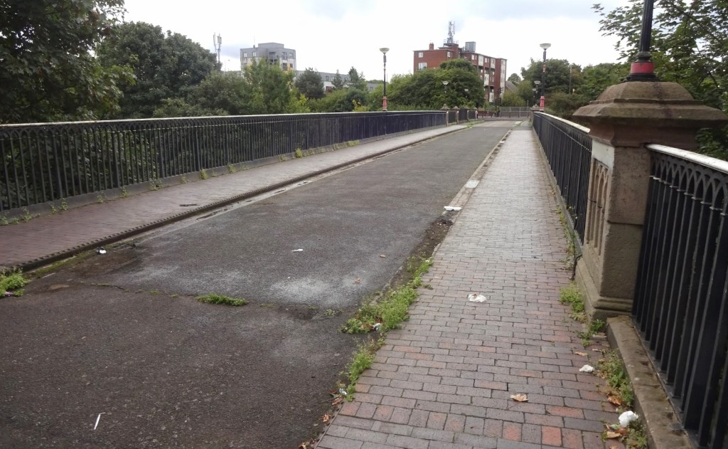

I popped briefly into the park itself, which seemed pretty unremarkable, after which I passed through a mostly industrial area before crossing the rather impressive Galton Bridge itself. The nearly 200-year-old iron bridge passes very high over the canal below, and is quite pretty to look at from below, but the top of the bridge, now part of a little-lo bridge deck, now used only as part of a cycle path, is rather unloved.
Arriving at Smethwick Galton Bridge station, I had a little time before my train and was in need of lunch. The only shop I could find nearby was a huge Indian supermarket, where I’d happily spend twenty minutes browsing through their selection of spices, sweets, snacks and the like, but where the ready-to-eat food options were sadly limited. I therefore ended up sitting on the platform eating a rather floppy cheese-and-red-onion sandwich and a tin of peas!

My uninspiring lunch aside, I really liked Smethwick Galton Bridge station: it’s an interchange station, sitting where the lines out of Birmingham New Street to Wolverhampton cross those running from Birmingham Snow Hill down to Worcester. The former runs parallel to the canal, while the latter crosses it at right angles, with the platforms actually on a bridge over the canal. It’s therefore an intereting split-level station: from street level, you enter higher than either set of platforms, then have to go down one level for the Worcester line, or two for the Wolverhampton!
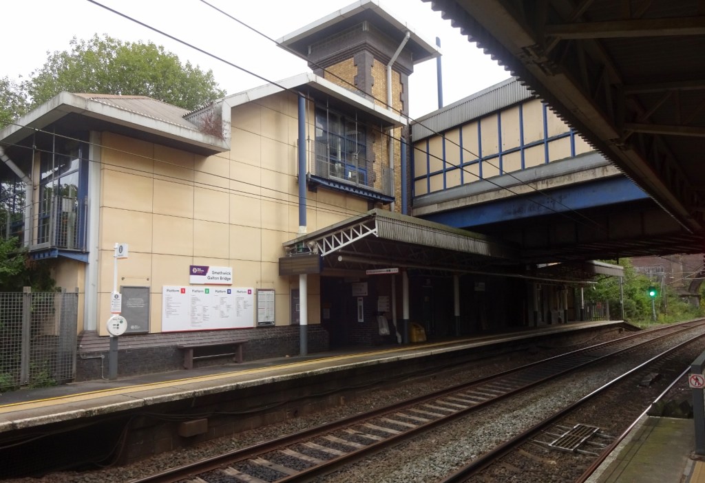

A Transport for Wales train soon showd up, and whisked me off towards Wrexham, and out of this map area.
Previous visits
As mentioned, I’ve been to Birmingham fairly often in the past, despite having never hada good explore of the city centre in recent times. My Northamptonshire childhood home is not far away, and for most of my childhood Father Dearest used to work in Birmingham, for several years staying there during the midweek and coming home at weekends, and later just going in only more occasionally. He had a rented house and later a flat there, which I visited several times. My family are of Punjabi origin and Birmingham has a big Punjabi community, so sometimes my parents would go there to go to restaurants, buy clothes for weddings, things like that.

It was also from a dealership in Birmingham where I bought my last car, Hilda, who served me faithfully from 2016 to 2020.

This map area doesn’t only include Birmingham. For my 18th birthday in January 2013, my parents took me and my school friends on a weekend trip to a rented cottage in Anglesey, which hasn’t yet featured on this blog. On the way, they decided that we’d stop for lunch at the very exciting-looking New Hall hotel in Sutton Coldfield, which is in this map area. The hotel is a medieval manor house, with a moat with a cool old wooden covered bridge over it.

Finally, I also travelled through this map area as part of the Chase Game in 2019, when Climbing Programmer was chasing me around the country wiht a GPS tracker. However, I only changed from a bus at New Street Station to an overnight coach at Digbeth Bus Station down the road, so I didn’t count it as a map visit at the time.

Footnotes
[2] I still haven’t found a satisfactory solution for my long-standing desire for a high-performing raincoat – lightweight, windproof and waterproof to a high standard – that is also long enough to prevent a wet bum, as I really dislike sitting down in trousers that are wet above the mid-thigh. There are long men’s raincoats, but they tend to be some combination of formal, insulated and hoodless. Men’s mountain-wear rain shells always seem to be waist- or at best hip-length only. I’ve talked before on this blog about my next-best solution, namely wearing a separate hood with a longer, more formal raincoat, but that’s rather heavy so I didn’t bring it on this trip. Fortunately on this occasion the rain let up fairly soon and I was able to dry off!
