OS Explorer map OL13, Brecon Beacons National Park: Eastern Area – I own this map, and had visited it before starting this blog. Visited again for this post 29th December 2021. This is the second of three posts about my trip to the Wye Valley with the Dearest Progenitors.
Google Maps location links: White Castle, Cwmyoy, Llanthony, Hay-on-Wye
In my previous post, I told you of my short post-Christmas holiday with my parents, to a holiday cottage near Ross-on-Wye. While for the great majority of that trip we stayed in that one map area, one outing did take us further, when, having crossed into Wales and lunched in Monmouth as I already described, we headed further westwards in search of some castles.
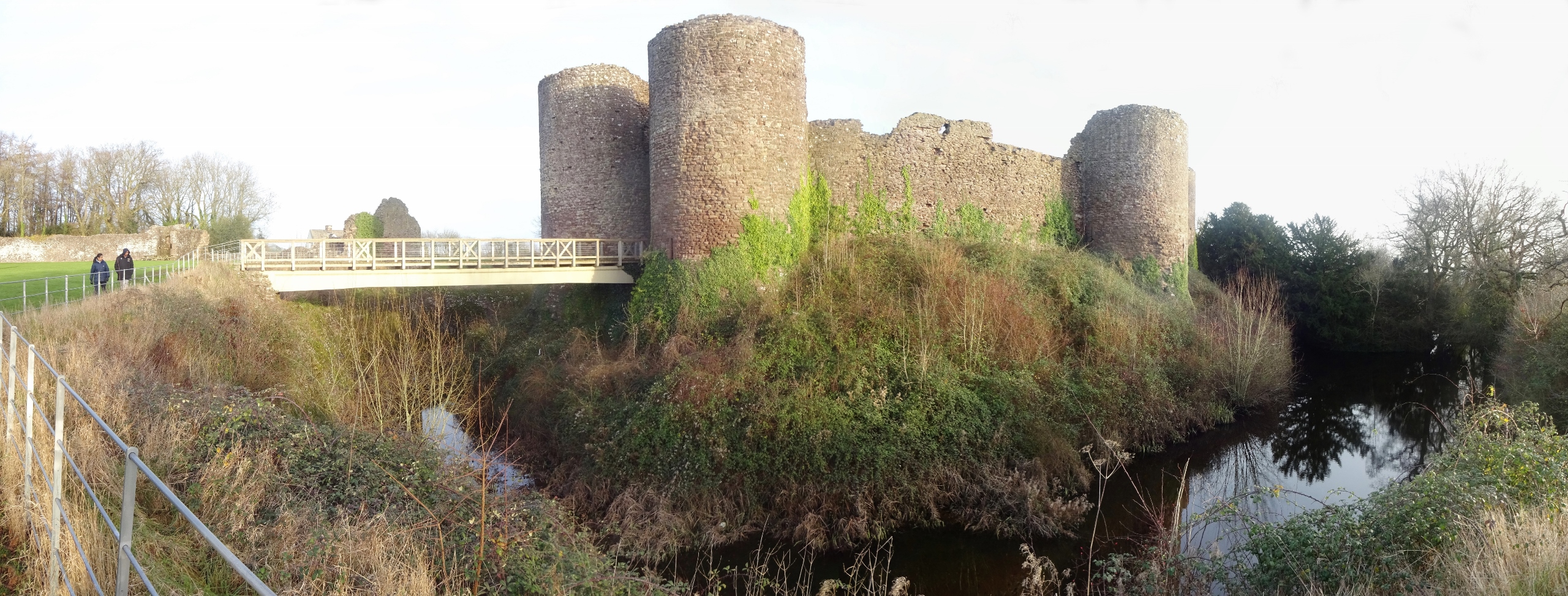
The countryside got hillier as we drove from Monmouth in the direction of the Black Mountains, passing through one pretty village after another as the roads got smaller and smaller. It wasn’t long, though, before we reached the first of our two castles of the day, and the one that brought us to this map area: White Castle.
It could only be in a place so full of castles as the Welsh Marches – we had no shortage of options to pick from for this afternoon – and so comparatively isolated and away from the busiest tourist areas, that a place as amazing as White Castle could exist and yet be unvisited enough to just sit there at the end of a tiny lane, unstaffed and free to enter, [1] with just a small gravelly area next to a house for its only car park. Because it’s a really great castle!
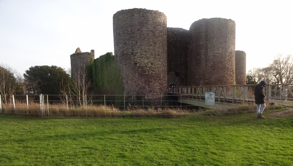
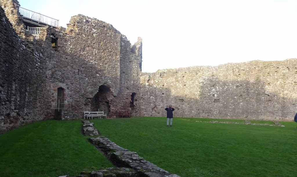
As well as just being pretty intact as medieval castles go, the castle sits in a deep, dramatic, and still water-filled moat, requiring crossing a bridge to get to it, which is always fun. There’s a giant, walled outer ward too, which you have to cross into before you can even find the bridge across the moat. It was just generally big, impressive, and a great place to lose yourself for half an hour!

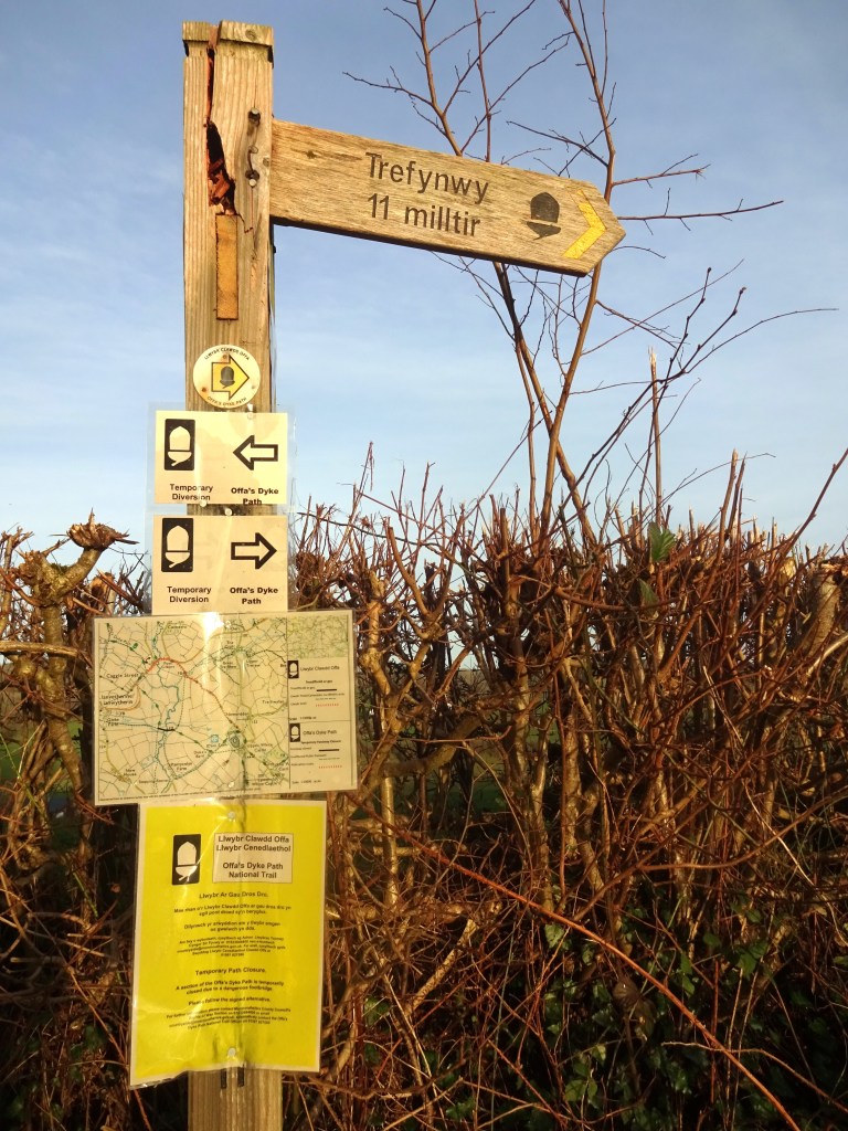
The Offa’s Dyke Path, which you can read more about below, goes right past White Castle – and indeed I wandered down it a little way before we drove off, to find a wild wee spot. The castle is also on the Three Castles Walk, a 20-mile walking route linking White Castle to the nearby castles at Grosmont and Skenfrith – which were built at more or less the same time, and which for a while formed a single “Lordship of the Three Castles“. That’d be really fun to walk someday!
After White Castle, we proceeded to another of the Three Castles at Skenfrith – but this took us into our third map area of the trip, so you can read about that in my next post!
Previous visits
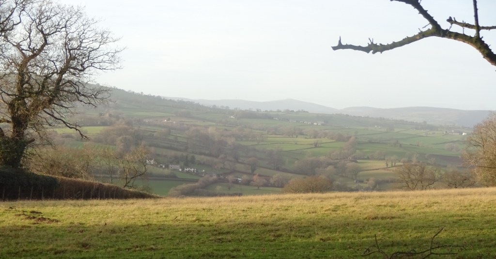
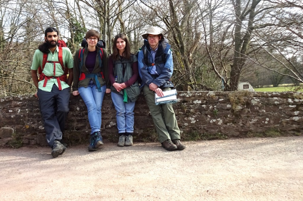
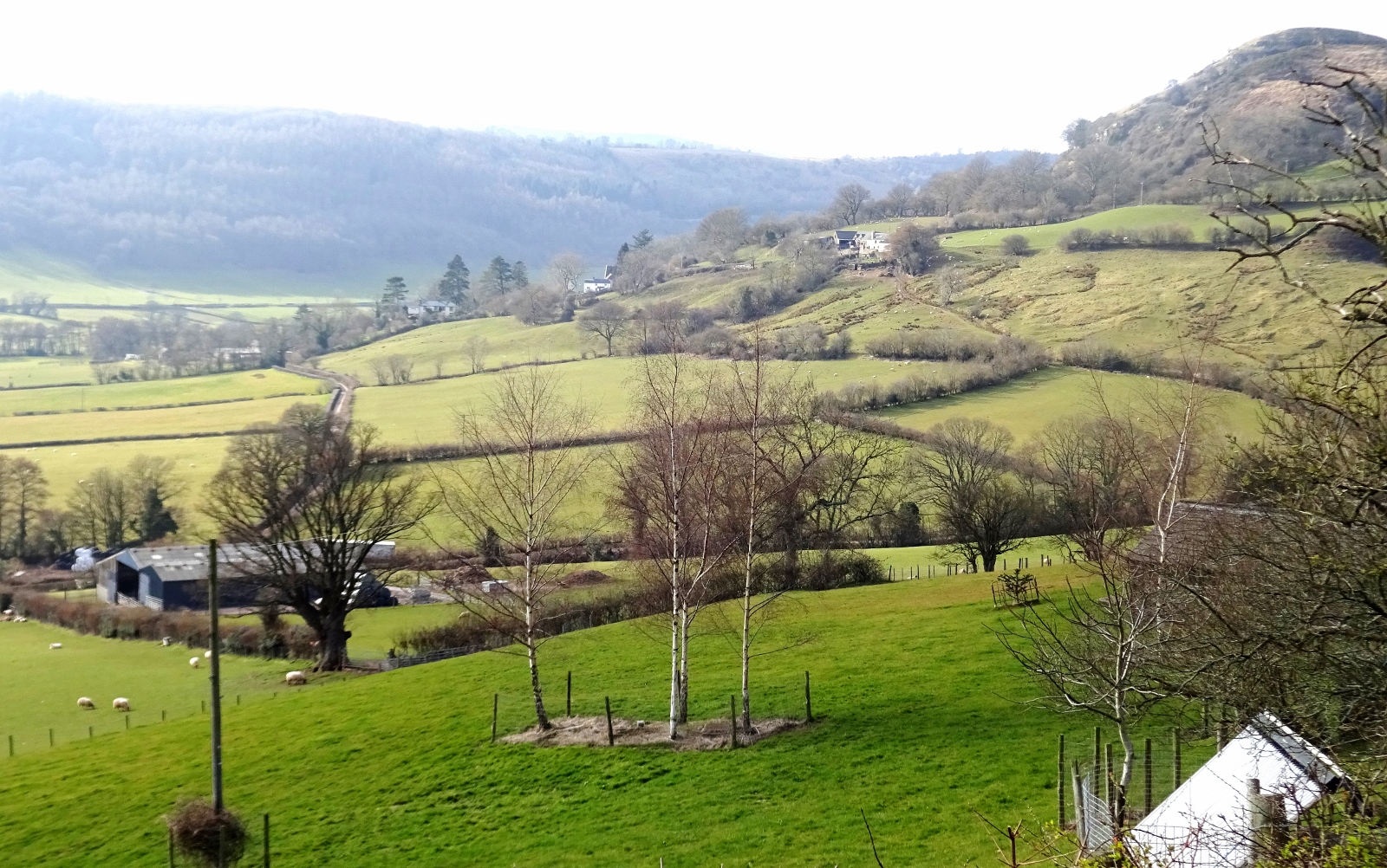
This map area contains the eastern half of the Brecon Beacons, which I’ve visited previously, most notably on a short walking holiday with my friends Millicent, Erithacus and Vesper in March 2016. Now, these three feature regularly on my blog, being close friends to this day, but we first met just six months or so before this walk, when we all arrived in Cambridge to study the gloriously weird undergraduate degree that is Anglo-Saxon, Norse and Celtic. Having become friends a few months into this period – together with Cheremy and Queenie, who couldn’t join us for this walk – we came up with the idea for the Holy Island Trek, with which regular readers will be very familiar: this was the attempt we made in summer 2016 to walk across Scotland from Lindisfarne to Iona, which has featured on this blog several times before.
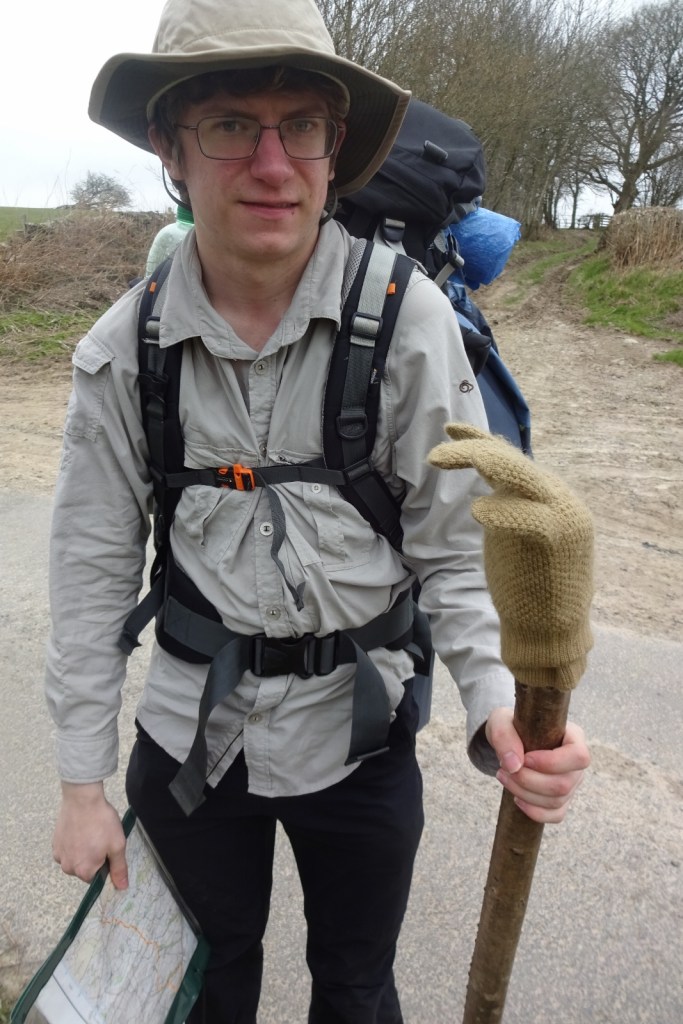
However, we didn’t want to leap straight in to trying a 300-mile walk in the summer holidays, having never walked together at a group at all, and some of us never having done a multi-day walk before. For this reason, we decided to do a much shorter trip in the Easter break as a little test, and we ended up choosing a section of the Offa’s Dyke Path – though unfortunately a section without any of the actual Dyke extant – starting in this map area to walk through the Black Mountains up to Hay-on-Wye, and continuing on to end at New Radnor. After the walk I wrote up a little report to send to my friends, thinking about how the walk went and what that meant for our summer plans. Conveniently, I started off this document with a narrative of the walk itself, so the rest of this post will consist mainly of a lightly edited version of that narrative, interspersed with some photos!
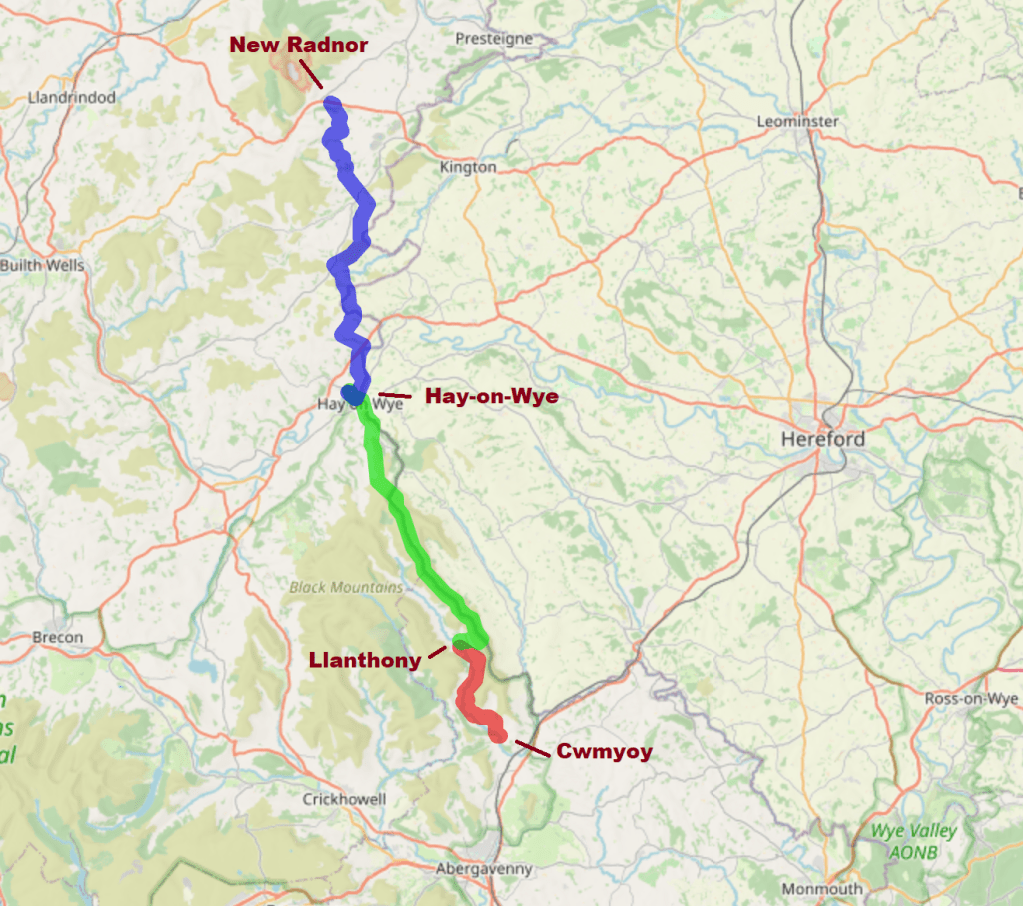
Our trip started as I, having driven over from my parents’ Northamptonshire home, collected the others at Abergavenny’s train station. From there, we drove to the Queen’s Head pub near Cwmyoy, a village near the bottom of the Vale of Ewyas, at the southeastern corner of the Black Mountains, where we started our walk.
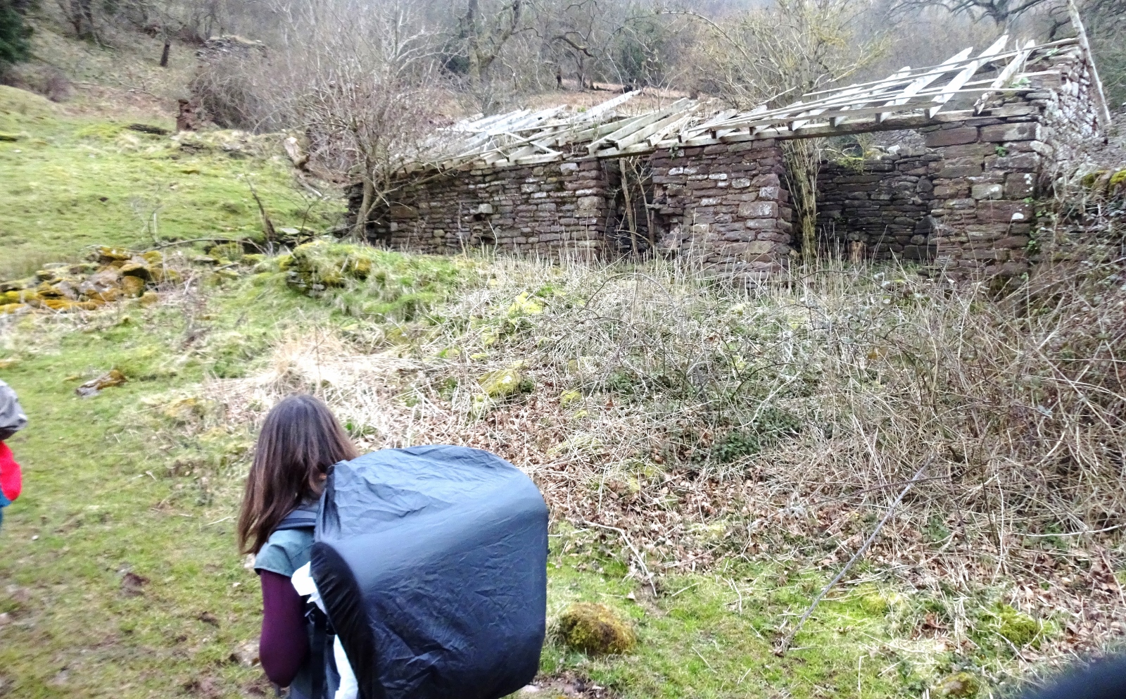
The first mile-and-a-bit to Cwmyoy village passed quickly enough under the gaze of what we decided was “the magic hill”. We found our first mud, sheep, cows, stiles and then stopped for a rest in Cwmyoy’s delightful churchyard. Continuing along the valley, we passed a few farms without incident, before encountering what looked like it could be a druidic altar, probably somehow foreshadowing the collection of vicious bulls directly blocking the path where it narrowed to pass between barns. Backtracking somewhat and attempting to find another led to our encounter with a friendly local Scotsman, who kindly allowed us to pass through his garden to avoid the aforementioned bulls belonging to his “nutter” of a neighbour. He then shouted directions at us when we missed a turning a little later.
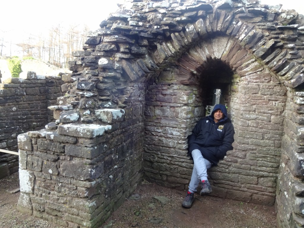
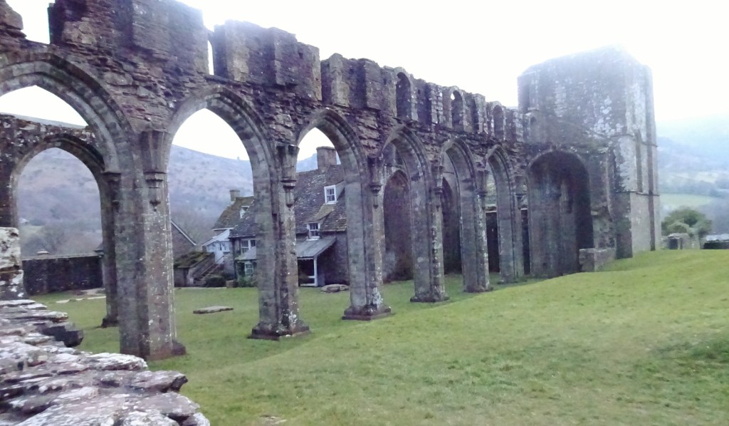
After that a wonderfully well-signposted path led us without further incident to Llanthony, our home for the night, where some wandering found us the campsite, consisting of a tap and bin-shed in a field and a couple of school D of E groups. We pitched up and had a walk around the ruined Priory, as well as a good puzzle over what a “slype” might be. Returning, there came the cooking our first camp-stove meal; with a lot of juggling between pans we eventually managed to assemble some pasta, mushrooms, and a jar of sauce. Finally we tramped off, mercifully unladen, to the nearby pub, where cards and drinks and chatting happened, as well as an encounter with a fellow who had been in the car-park pub and was unimpressed with our progress so far.
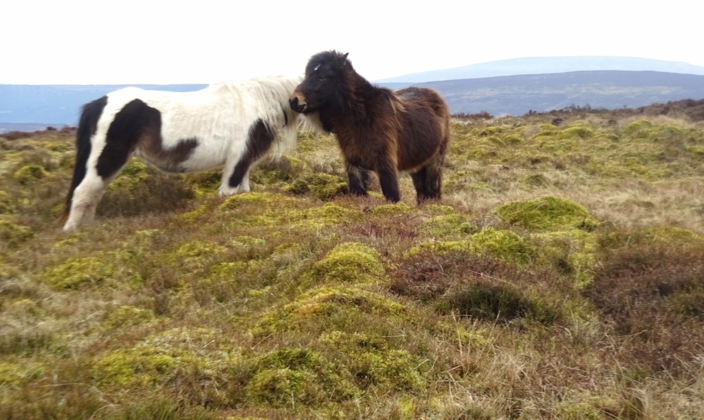
Our first full day began with an attempt at a 7am awakening and some cooking of bacon, which was largely successful, though washing up proved to be tricky since we’d forgotten to bring any soap. Then off we went, choosing a somewhat longer route to ascend the ridge that would be much of our day’s walk in order to avoid any very steep inclines. On top of the ridge we eventually joined the Offa’s Dyke Way for the first time, and followed it for a good long while, encountering one fellow couple of walkers and many ponies who may or may not have been wild (that conversation was inconclusive).
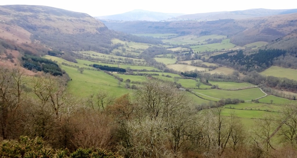
Our main impediment consisted of many annoying enormous sacks of rocks and gravel that had been inconsiderately helicopter-dumped in the middle of the path – for its maintenance, one assumes, but rather inconvenient as they had not yet been spread out. A minor source of amusement came from the fact that the path was here also the England-Wales border, allowing us to talk to each other from different countries.

Several miles later began our descent from that ridge, together with a view to the amusingly-named hill “Lord Hereford’s Knob”. Lunch happened under a tree, and then we were off again. All went well for a mile or so, when a path-diversion sign lured us into leaving Offa’s Way altogether, leading to much confusion, our first use of GPS, and in the end to us taking an alternate route into Hay-on-Wye to avoid having to ask for directions. An unfortunately steep descent caused a few problems, but we were compensated by the discovery of a wonderfully sturdy walking-stick for [Millicent], ensuring that he looked suitably hobbit-like.
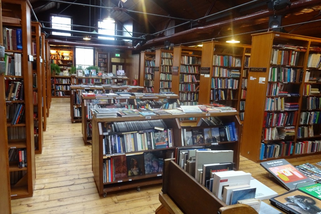
We finally arrived in Hay-on-Wye and asked directions to a food shop from a somewhat overenthusiastic fellow doing his recycling – detailed routes to three different establishments were lengthily acquired. A stint in a convenience store for provisions was followed by the agony of having to pass bookshop after bookshop without making any purchases. We finally arrived at what it transpired was not the planned campsite, but it was a campsite nevertheless. Pitching, cooking, and pubwards-decamping proceeded once more.

Hay-on-Wye is, of course, Wales’s book town – much like Wigtown for Scotland – with new and second-hand bookshops all over the place. While we didn’t get to explore the shops much on that occasion, I had been twice before – it’s a wonderful place, and I’m always ready to return!
And that’s it! The next morning, we continued walking northwards from Hay in the direction of Radnor, but soon left this map area, so I’ll leave the rest of the narration of our Offa’s Dyke Path walk for another time.
[1] There was, though, a fun little donation point attached to a wall in the car parking area: it was a box that had a contactless card reader on it, whereby if you tapped your card on it it would donate £3 to Cadw, which I found very innovative. I donated happily!
I really appreciate it when places have information boards around with interesting information about history, nature, strange local quirks and so on. You get this all the time in managed historical sites like this one, nature reserves and the like, but I enjoy it when you get them even just in town centres, random streets, parks and so on. When I see these, I often wish that there was a way to show my appreciation. If there were one of these contactless donation points on every random sign, allowing me to donate 50 pence or something, I’d do that frequently!

One thought on “OL13: White Castle & Brecon Beacons East”