OS Explorer map 215, Newtown & Machynlleth: Llanfair Caereinion – I do not own this map, and had not visited it before starting this blog. Visited for this post 25th May 2019.
Over the long weekend of 25th-27th May 2019, my friend Climbing Programmer and I played a somewhat odd game. The basic premise of this game was that, for those three days, I had a GPS tracker placed on me to which he had access. We both had an equal budget to spend on transport for the weekend, and with me having a 4-hour headstart. His mission was to catch me; mine to not be caught.

Now, I did a full writeup of this game in the one-off post Special: Chase Game 2019. This post is just a lightly edited version of the section of the longer writeup that relates to this map area. I’m writing it mostly for completeness, and I’d recommend that, for entertainment value, you’re probably much better off reading the full post.
Beside this map area, during the Chase Game, there were two others that I visited for the first time since starting the blog, those being 350 (Edinburgh), and 443 (The Crask Inn). I’ll write about Edinburgh next, but I’m going to delay 443 by a couple of posts, because I went back there in August 2019 and did some things I’d really like to write about.
I visited this map area close to the beginning of the Chase Game – under the rules, I was allowed to set off from Northampton station at 9am, and had a four-hour headstart before Climbing Programmer started moving at 1pm. When I left, I made straight for Caersws, a village in Mid Wales with a railway station. Gerring there required only one change in Birmingham, and I arrived in Caersws as planned at 1212. Now, Climbing Programmer couldn’t even leave Northampton until 1pm, and I’d worked out that he couldn’t arrive in Caersws until past 5pm, so my plan was to hang around for a few hours, before getting on a bus back towards Shrewsbury for the next stage of my plan at around 4pm.


It was therefore time to relax a little, and explore what Caersws had to offer! Caersws was once home to a Roman fort, the earthworks of which are clearly visible from just by the railway station, so I admired those for a moment before walking into the village proper.
The village was very pleasant, and there were plenty of lunch options to choose from, which makes my choice of a veggie burger and chips, cheese and curry sauce from the chip shop perhaps slightly unacceptable. But in any case, it was very nice – I walked half a mile or so along a footpath out of the village to a quiet grassy spot next to a stream to have my lunch. I then stayed there for over an hour lying around on the grass reading my book!

I then went into town to investigate the bus stop I’d have to get to later, and to do the other thing that had attracted me to Caersws (other than its bus timetable…) – I’d seen from the Wikipedia page that the church in Llanwnnog had a notable medieval rood screen still in place, and my friend Millicent having beaten a love of such things into me, I thought I’d better give it a look. However, it was only when faced with the modern block of a church in Caersws that I realised that Llanwnnog’s church was, as I should rather have expected, not in Caersws, but in Llanwnnog…
Fortunately I had enough time left before I’d have to get moving again to walk to Llanwnnog and back, and so that’s what I did! I secreted my pack away in some nettles in a field and walked the couple of miles to Llanwnnog easily enough.

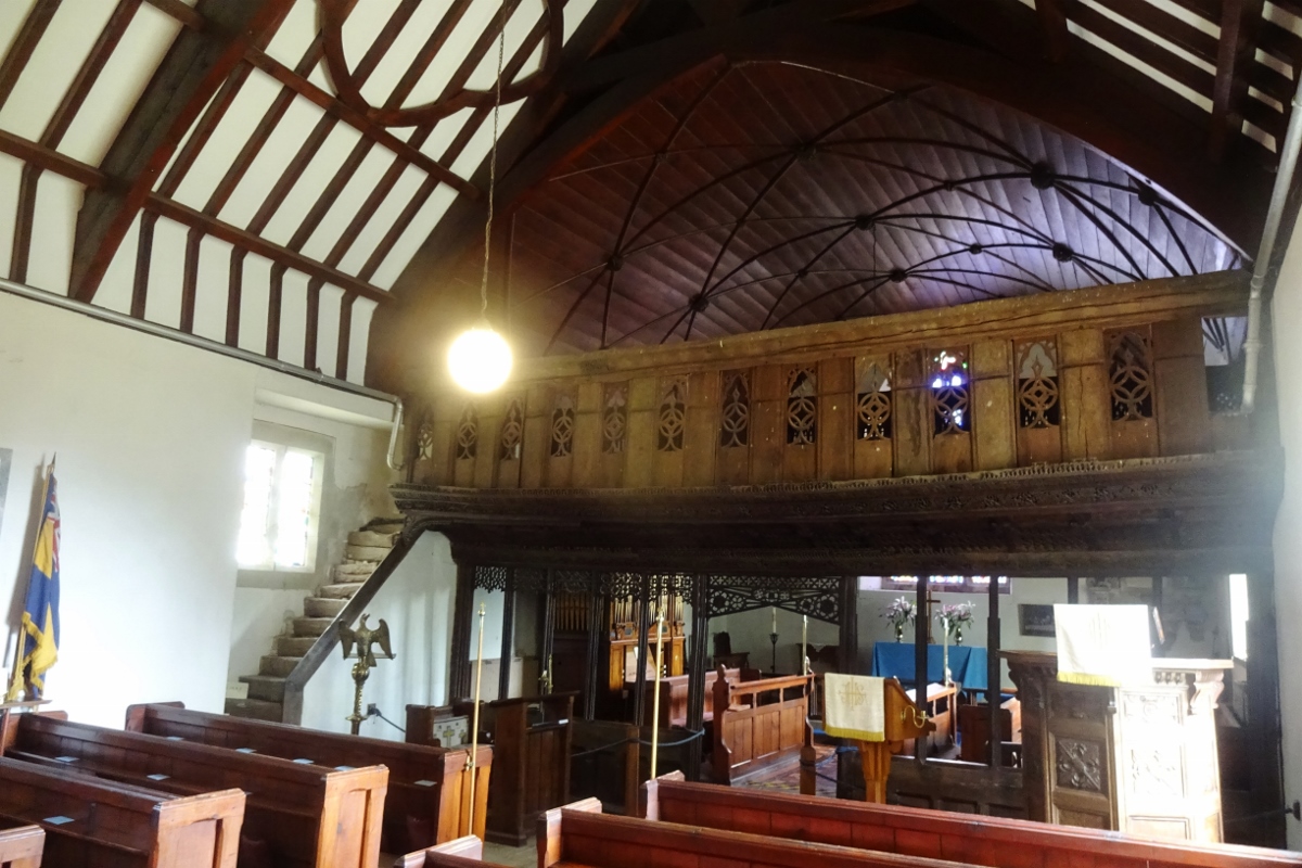

There church was very nice; the promised medieval rood screen was indeed present if not wildly exciting, there was some medieval stained glass that had been put back together in an interesting mixture of a “put whatever wherever” and a “reconstruct what was there” approach, and it was in general a very pleasant little space.
From there I plodded back to Caersws, picking up my bag again on the way, and had a half-hour drink, toilet and water-bottle-filling stop in the Buck Hotel before I got on my intended bus towards Shrewsbury at 1605. I had a really nice few hours in Caersws!

2 thoughts on “215: Caersws & Llanwnnog”