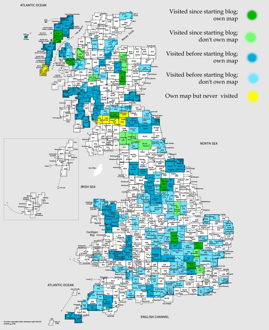
OS Explorer map 343, Motherwell & Coatbridge Whitburn & Carluke – I own this map, but had not visited it before starting this blog. Visited for this post 5th January 2018.
My previous post had my carful of people on the way up to Glasgow to meet everyone else for the ASNC Trip to Argyll; we had stayed the night in a hostel in Cumbria and, after a stop to look at the Bewcastle Cross, were soon to reach Glasgow. However, before we could do that, we needed to make a shopping stop, so that we could buy ourselves some lunch, and so that Millicent could get himself a replacement raincoat, as he’d accidentally left his in my room while we were repacking his bags.
The chosen place, found with a little help from mobile phones, was a Sainsbury’s in the town of Hamilton. (The Many-Named found this particularly entertaining, due to the shared name with the musical.) It was in a large retail park, meaning there were also clothes shops aplenty for those in need of that.

We stopped, lunch was bought, as was coffee by some, and a raincoat by one, the toilets were used, and before long we were back in the car, for the final twenty minutes of our drive to Glasgow, about which see my next post! Apologies for this one being fairly short and boring.
Vaguely related thoughts

Now, although I’ve never been to this map area before, I did already own the map; it was until now displayed in yellow on the maps-of-maps showing which maps I’ve visited, the ones that feature at the end of each post. (Yellow indicates a map that I own but have never been to.) Eagle-eyed readers will note that central Scotland features rather a band of yellow maps, six of them until now, now five. The reason for this is the Holy Island Trek, as we called it, the walking trip I did with Millicent, Vesper, Queenie and Erithacus in summer 2016, and which has featured rather a lot in the Previous Visits sections of this blog, such as here and here.
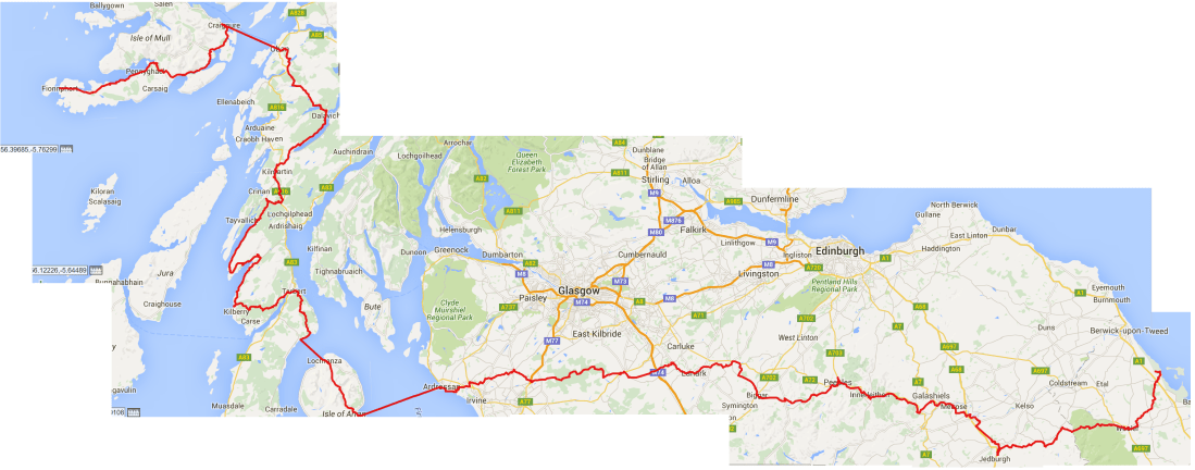
We orginally planned to walk all the way from Lindisfarne to Iona that summer, which I think would have taken about five weeks with a suitable number of rest days, as we weren’t experienced at walking for such a long stretch. For this purpose I’d planned three possible routes, which you can see in the map below. (I made extensive use of my subscription to OS Maps online, which really is the most wonderful service – £25 a year for unlimited access to Ordnance Survey’s mapping of the whole country!). We decided to reject the North and South options in favour of Mid, although North was the most direct, because Mid let us go through Argyll, where there was a lot of ASNaC-related stuff to see, and through Arran, where Queenie rather wanted to go due to ancestral links. Therefore, I bought the OS Explorer maps covering the whole of the Mid route.

However, by the time the walk came to be, we’d realised we actually only had three and a bit weeks when all of us would be free. For this reason we decided to cut out approximately the middle third of the walk, from Galashiels or Peebles to Ardrossan (the place from which the ferries go to Arran). Thus, those maps in the middle, including this one, were never used.
In the end, due to occurrences expected and unexpected, two of our number had to go home early, and the remaining three of us ended up, rather than taking public transport to skip across and then walking the rest from end to end, instead going back to get our car, and doing the rest of the trip driving between campsites and doing day walks. In the end we walked about 180 miles, about half of what the total distance would have been from Lindisfarne to Iona, but especially in the middle, it wasn’t anything like a connected line, what with circular walks and there-and-back walks, some even going backwards! The middle section of the route turned much more into a “visit interesting places and do some walking” trip than a long walk. We did walk a connected route at either end though – using lots of buses to get to and from our starting and ending points, or back to where we’d left the car – from Lindisfarne to Melrose along St Cuthbert’s Way, and along Mull to Iona. The two maps below show both the initially intended route, and our actual GPS tracks. (The maps were created using GPS Visualizer.)

[1] This is a screenshot from the Ordnance Survey’s website; on the page for each of their maps they have a zoomable map showing you exactly the area that each map covers. I have been making great use of that feature when determining which maps I’ve visited for this blog, of course! (See for example the page for this map.)
[2] The Rules also say that shop stops don’t count for a map, but only if they are on a route I would already be driving along or something like that. Since we had to go significantly off the motorway for this stop, it counts.

3 thoughts on “343: Hamilton”