OS Explorer map 193, Luton & Stevenage: Hitchin & Ampthill – I do not own this map, but had visited before starting this blog. Visited again for this post 10th February 2024.
Google Maps location links: Luton Airport, Dunstable Tesco, Five Knolls, Totternhoe, Wing, Chalgrave, Bedford
Regular readers may be familiar with my group of friends made up of me, Vesper, Erithacus and Millicent, with whom I’ve been on plenty of trips that’ve been described on here. Until last summer, Vesper, Erithacus and I lived together in Cambridge, so Cambridge was a logical place for the four of us to meet up pretty regularly; but now that Vesper and I have moved to Moreton-in-Marsh, there needs to be a fair bit more travelling for us to all meet up: the two of us are in Moreton, Erithacus in Cambridge, and Millicent in Oxford.

When planning our next meetup, we decided this time to try meeting somewhere between Oxford and Cambridge so it wasn’t a very long trip for any of us. We could’ve met in London, but were more interested in a day doing some classic us-style countryside exploring, i.e. visiting some random ruins, churches or similar. Millicent’s partner Betonica would also be joining us, and indeed we ended up naming the group chat where we planned the trip “Let’s not go to London”, and I named the document where I proposed some sites we could visit “2024-02 Not-London trip”. So that’s what this trip was!
The day started for me as I got an early train from Moreton in to Oxford, to then collect a hire car for the day from the branch of Europcar near the station. At the same time as I was collecting, there was a Chinese family having some trouble collecting their hire car. They’d clearly accidentally booked an electric car, and it was taking rather a while to get this across to them, and for them to discuss what to do with the staff member, since they had rather basic English skills – or at least, the parents did, and the much more fluent university-age daughter was rather uninterested in helping – and the staff member clearly didn’t have the skill of communicating to people with low language level. : no slowing down, no speaking clearly in simple words etc. It was a little frustrating watching the conversation: I know I could have got the relevant things through to them much more quickly, just by slowing down, speaking more clearly in simple words, using the words they clearly knew rather than those they clearly didn’t – e.g. it seemed like they were familiar with “gas” instead of “petrol”, but the shop assistant persisted with “petrol”. But I didn’t feel like I could butt in: if I could speak Chinese or something, I’d feel like I had an objectively good reason, but as is I didn’t really feel justified: it’d feel like a slight on the staff member’s ability. Alas. Still, I think they got there eventually. [1]
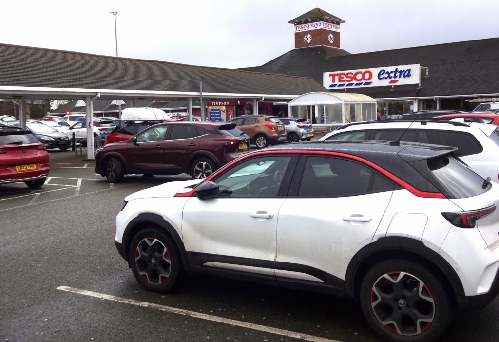
After collecting the hire car, I then collected Millicent, Betonica and Vesper at the nearby Waitrose – Vesper having come down on a later train than me, and we set off on our hour-or-so drive, having a good catch-up as we went, over to Bedfordshire. Entering this map area, we made our first stop at the distinctly unexciting destination of Luton Airport, because this had turned out to be the most convenient point to collect Erithacus: there’s a direct bus from Cambridge to Luton Airport, so she’d just caught that. Collecting her, we then headed off westwards, making a brief toilet and snack-buying stop at Dunstable’s giant branch of Tesco, before parking up for our first proper site of the day: the Five Knolls barrows.
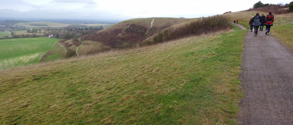
I had not at all realised that his area is hilly: Dunstable and Luton are at the northeastern end of the Chiltern Hills, which I hadn’t realised reach quite this far. The Five Knolls, a group of prehistoric burial mounds, sit at one end of Dunstable Downs, a National-Trust-owned, dramatic-looking section of the Chiltern escarpment; and one could see up to the hills from the Tesco car park. I just think of Luton and Bedfordshire as flat southeastern England, but clearly not!
Making good use of Millicent’s National Trust membership to get our parking for free, we had a nice twenty-minute walk along the ridge to the Knolls themselves, with great views out to our left, across the flat countryside below. The Knolls are at the north end of the Downs, and are just about in this map area, but where we were parked, around three-quarters of a mile further south, is actually just about in map 181 or 182. I decided to only count it for this map, 193 though.
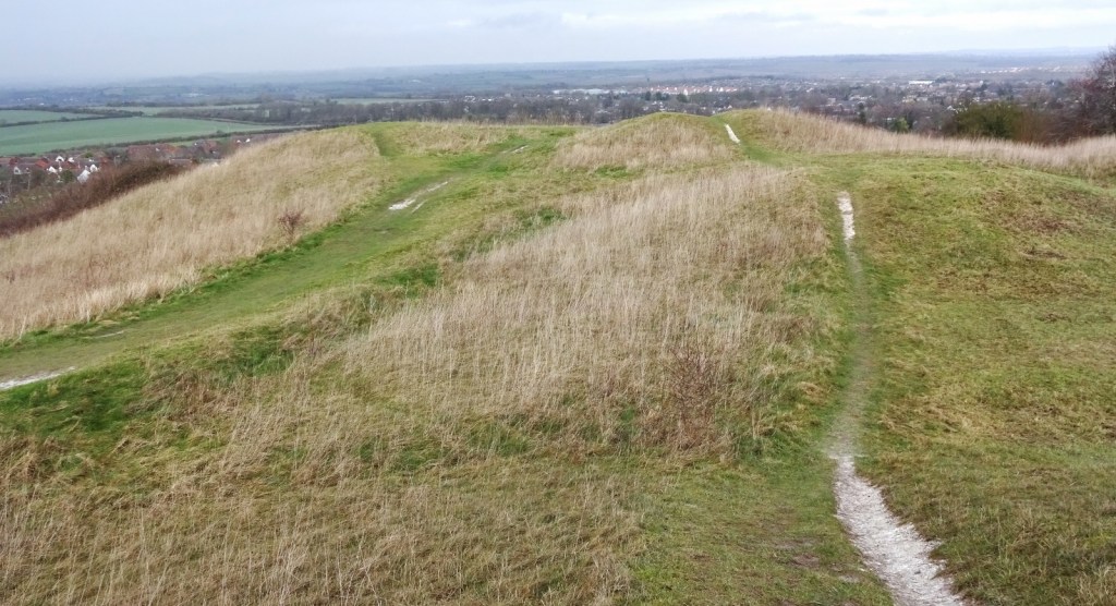
The Knolls themselves were interesting. As well as being prehistoric probably-burial sites as usual, a helpful if rather grisly sign – especially when it comes to the illustrations – told us that archaeologists also found hundreds of skeletons from 6th/7th-century mass burials, some of whom had clearly been kept captive; plausibly related to conflict between Britons and invading/settling Saxons. Betonica is always keen to come to mounds and tumuli, they being an academic interest of hers, so I’m glad we got her to some new ones!
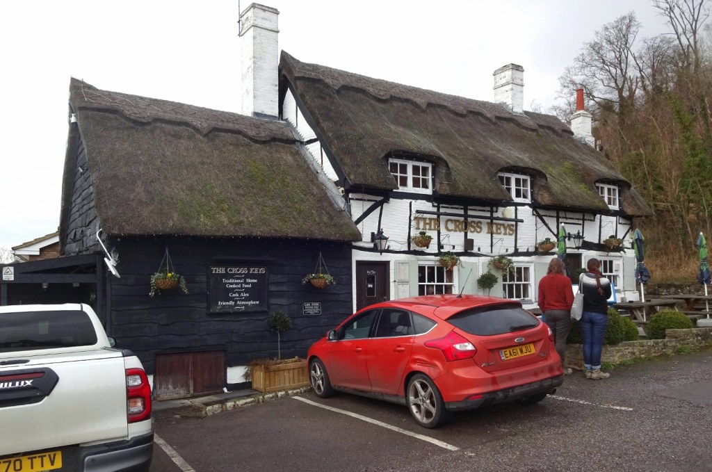
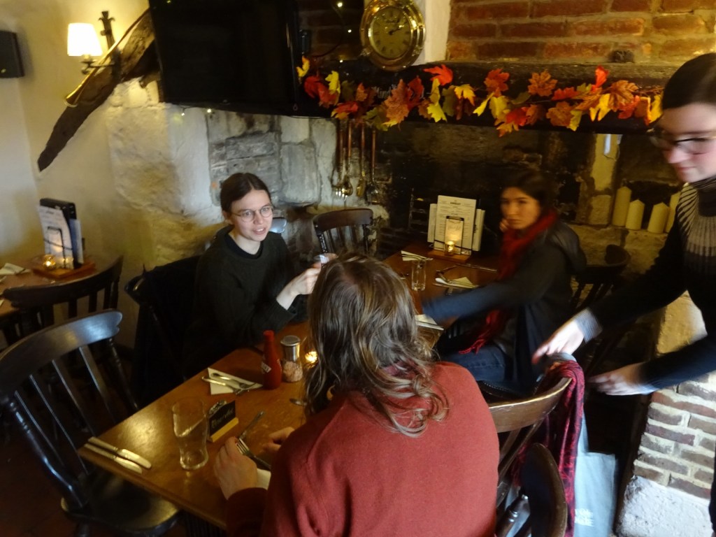
We walked back via a different route, along the bottom of the ridge, then got in the car and drove to our next stop, the village of Totternhoe – which is out of this map area, in map 192 which I’ve posted about before. In Totternhoe, we stopped for lunch in the very pretty Cross Keys pub – just a perfect little thatched building. I went to link its website here, and discovered that it really doesn’t do the place justice, not really having any proper photos on it; but it seems that the pub is at least notable enough that it has its own Wikipedia page, if rather a stubby one. We got a very fun table, which was partly inside the giant medieval fireplace.
From there, we headed further westwards to the village of Wing, still in map 192, to visit its church, All Saints, Wing.
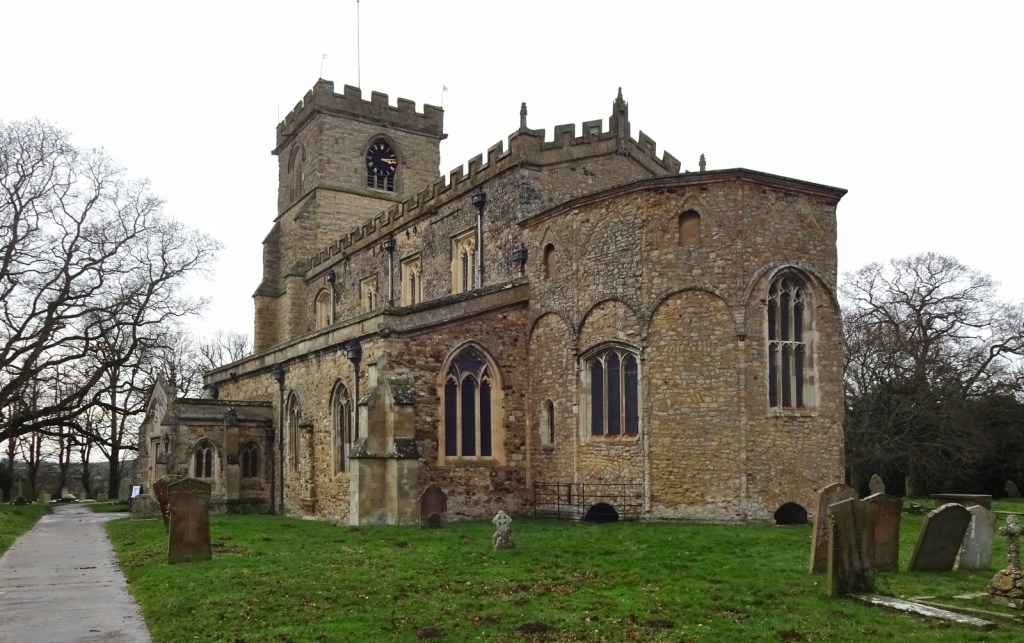
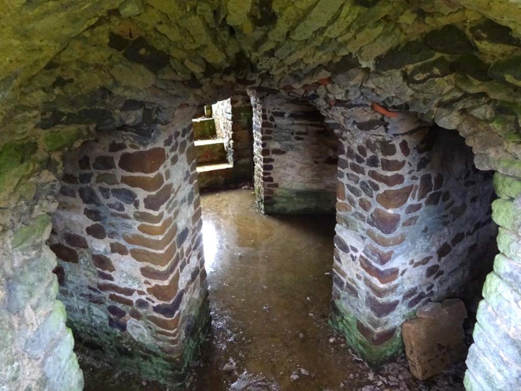
It’s a very cool church: I’m always keen to see anything early medieval, including Anglo-Saxon churches in England, but these are very much not all created equal – in the planning document for the trip, I’d noted of Lavendon, another church we could visit, “Anglo-Saxon, but looks fairly average”, while Wing earned the high praise of “Anglo-Saxon chruch, looks good”. A substantial amount of the surviving stonework is Anglo-Saxon, including several distinctive small arched windows (most blocked up but still visible). But what’s particularly fun about Wing (I thought) is its surviving Saxon crypt, which is open to the air via a set of little arches, kind of an undercroft to the rounded chancel bit – both of which are 8th/9th-century, which is nice and early for a Saxon church.
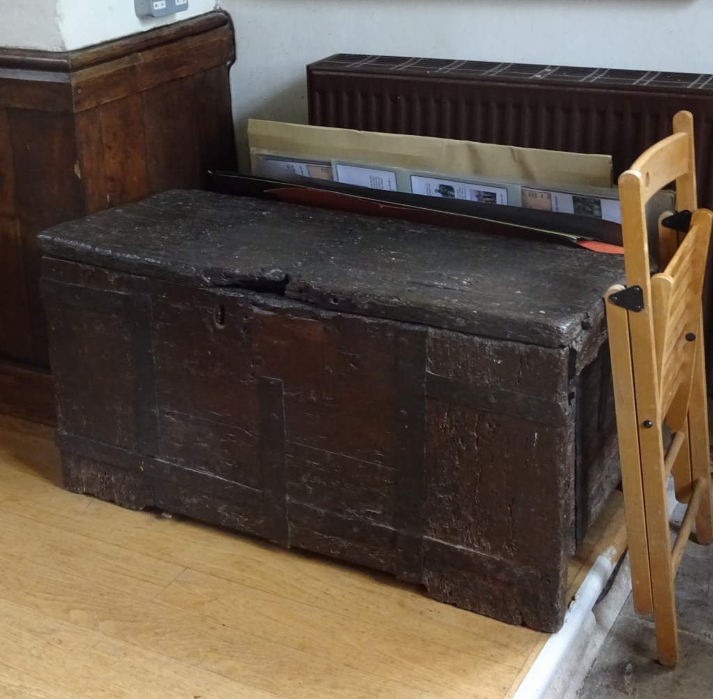
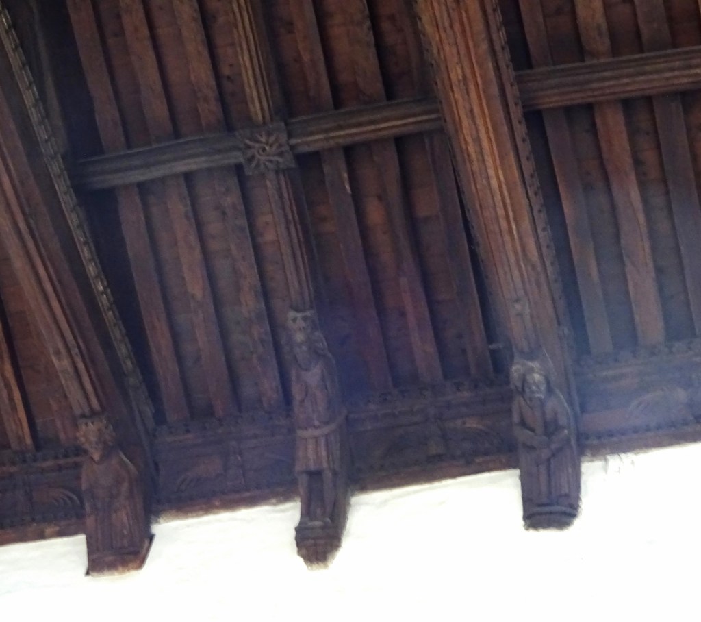
Plenty more of interest awaited inside, with some nice carved woodwork on the ceiling, floor-brasses and a cool, solid looking old wooden chest – I do love the really chunky ancient furniture that you find hanging around in churches.
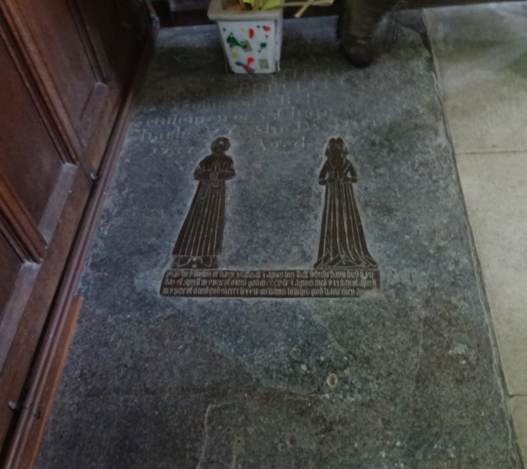
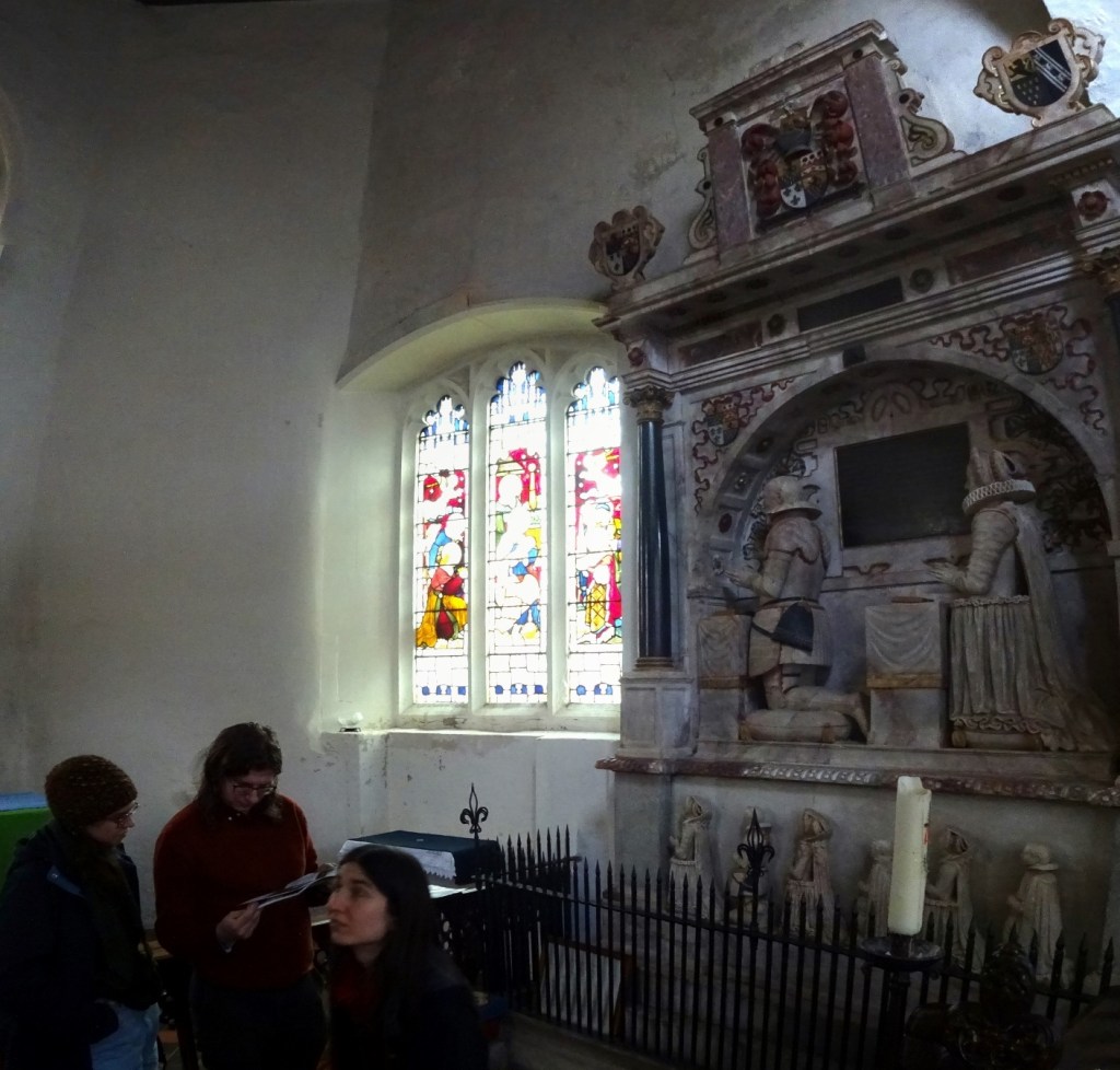
There was also a biggish neoclassical memorial inside, which is not all that unusual on its own, but Millicent pointed out it was really very early to be having neoclassical things, with a 16th-century date, and the people having distinctive Tudor ruffs on.
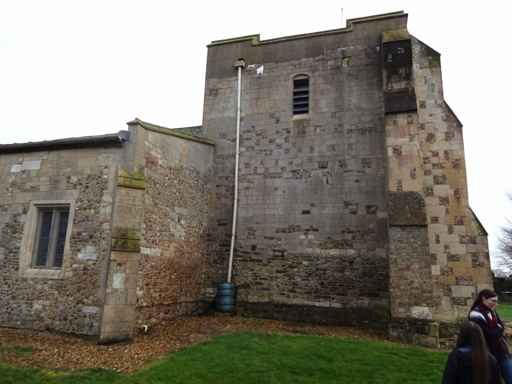
After Wing, we headed back over into this map area for our final planned site of the day – not only another church, but another All Saints’, namely All Saints’ Chalgrave. Chalgrave had some very extensive-looking medieval wall-paintings, always a favourite with this group.
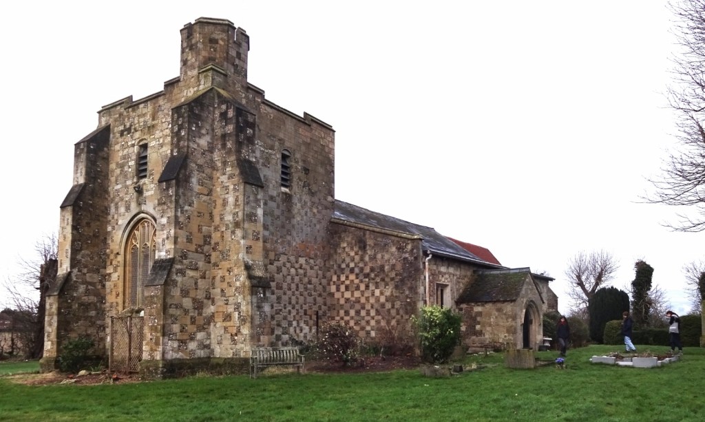
Unfortunately the church was locked, and peering through the windows showed it was full of internal scaffolding, so we didn’t get to see the wall paintings. Instead, we satisfied ourselves with looking at its very, uh, distinctive exterior, with an odd checkerboard pattern, a wide and stubby square tower which Millicent discovered was due to it being only partially reconstructed after falling into the church in a storm in 1888. The partial reconstruction happened in 1931, and they left a bit of an odd surprise for anyone walking around the back of the church, where the tower seems to have been completed with grey concrete blocks at the top.
Finally, from Chalgrave, we headed northwards out of this map area to Bedford, where we sat in a Costa coffee shop for a while before Erithacus hopped on a bus back to Cambridge. I drove the rest of us back to Oxford, returned the hire car, and Vesper and I returned to Moreton on the train. A grand day out!
Previous visits
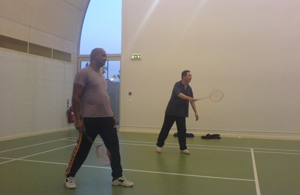
I’ve been to this map area many times before, especially in my childhood, since my dad used to have a set of friends who lived in Luton, and whom he’d play badminton with weekly. I occasionally was taken there with him to visit those friends and their families.
I don’t have many pictures or specific memories of that, but here are a couple of photos, namely (a) of Father Dearest playing badminton, I assume on an occasion when he took me with him for some reason. And (b) of him with my cousin Rice Pile looking rather pleased at at bottle of something that I think he’d just won in a charity raffle. Based on the title of the folder it’s in, it seems like this was at a party in early 2005, I assume which we were invited to by one of those Luton friends, aiming to raise funds for the 2004 Boxing Day tsunami in southeast Asia – which my father was nearly caught by, having left an affected area just the day before.

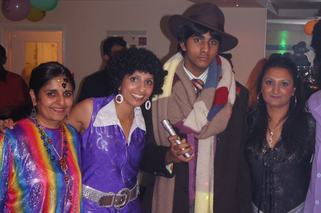
I’ve leave you with a couple more photos, from the 60th birthday party of one of my dad’s Luton friends, which had a 1970s theme, and to which I went dressed as the Fourth Doctor!


[1] I was actually also switched over to an electric car: they offered it to me at somewhat higher price, but which’d be more or less on a par with the petrol car I’d booked since I wouldn’t need to buy any fuel; and they assured me the range was plenty for my planned day’s driving and I could return it discharged.
