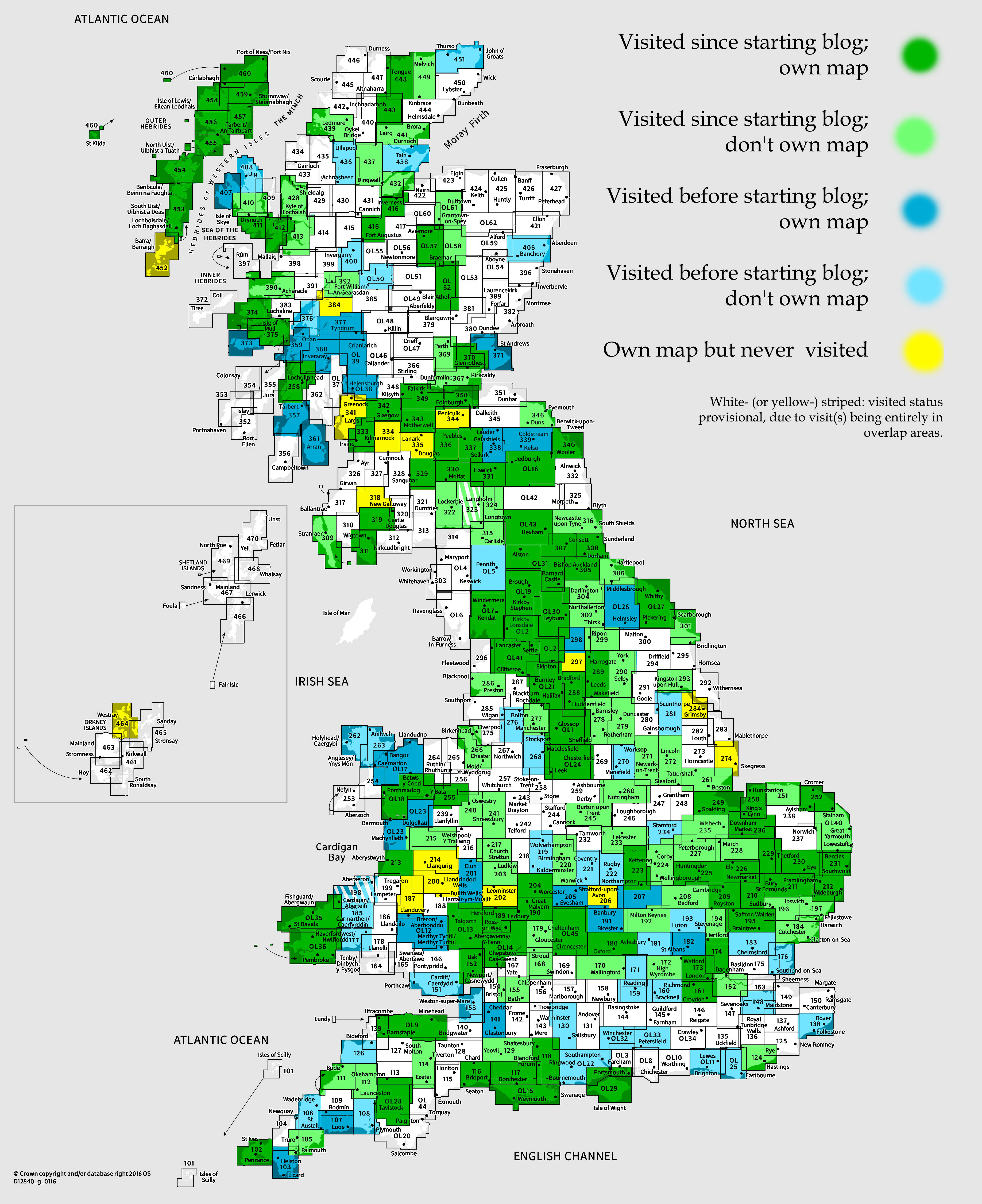
OS Explorer map 261, Boston: Tattershall, Billinghay & Heckington – I do not own this map, and had not visited it before starting this blog. Visited for this post 15th April 2023.
Google Maps location links: Fosdyke, Wyberton, Boston
In my previous post, I told you of the walk I did over three days in April 2023, starting in King’s Lynn in Norfolk, and walking through to Boston in Lincolnshire, along the south-western coast of the Wash. Almost all of the walk was in map #249, but Boston itself is in #261, so I walked into this map area just an hour or so before the end of my walk, on the final day, Saturday 16th April. I had, though, actually come to the map area on Friday evening: Wyberton, where I stayed that night in a Travelodge, is in this map area, but I described it in the previous post for continuity. I’ll therefore start here with me arriving into Boston on Saturday morning!

I crossed into this map area, with around 2.5 miles to go of my walk, at around 9am – the very early arrival for a place some 6 miles into my day’s walk being due to the fact that I’d started extremely early that day, having to catch the single 5:20am bus that could get me from my accommodation to my starting point at Fosdyke Bridge (see previous post for details).
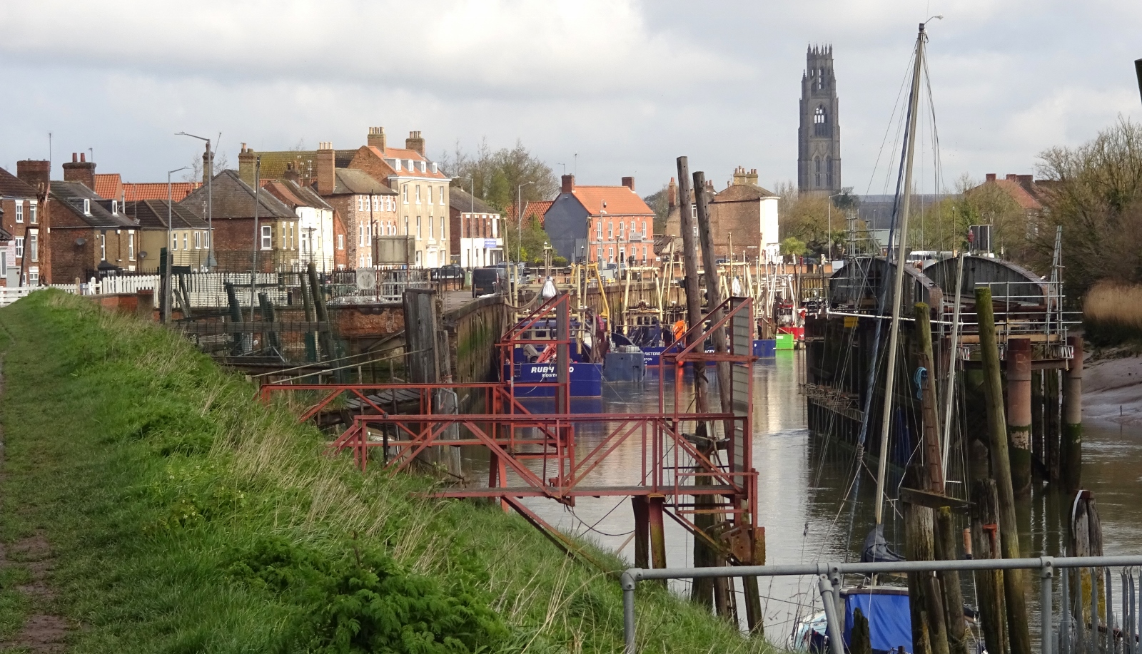
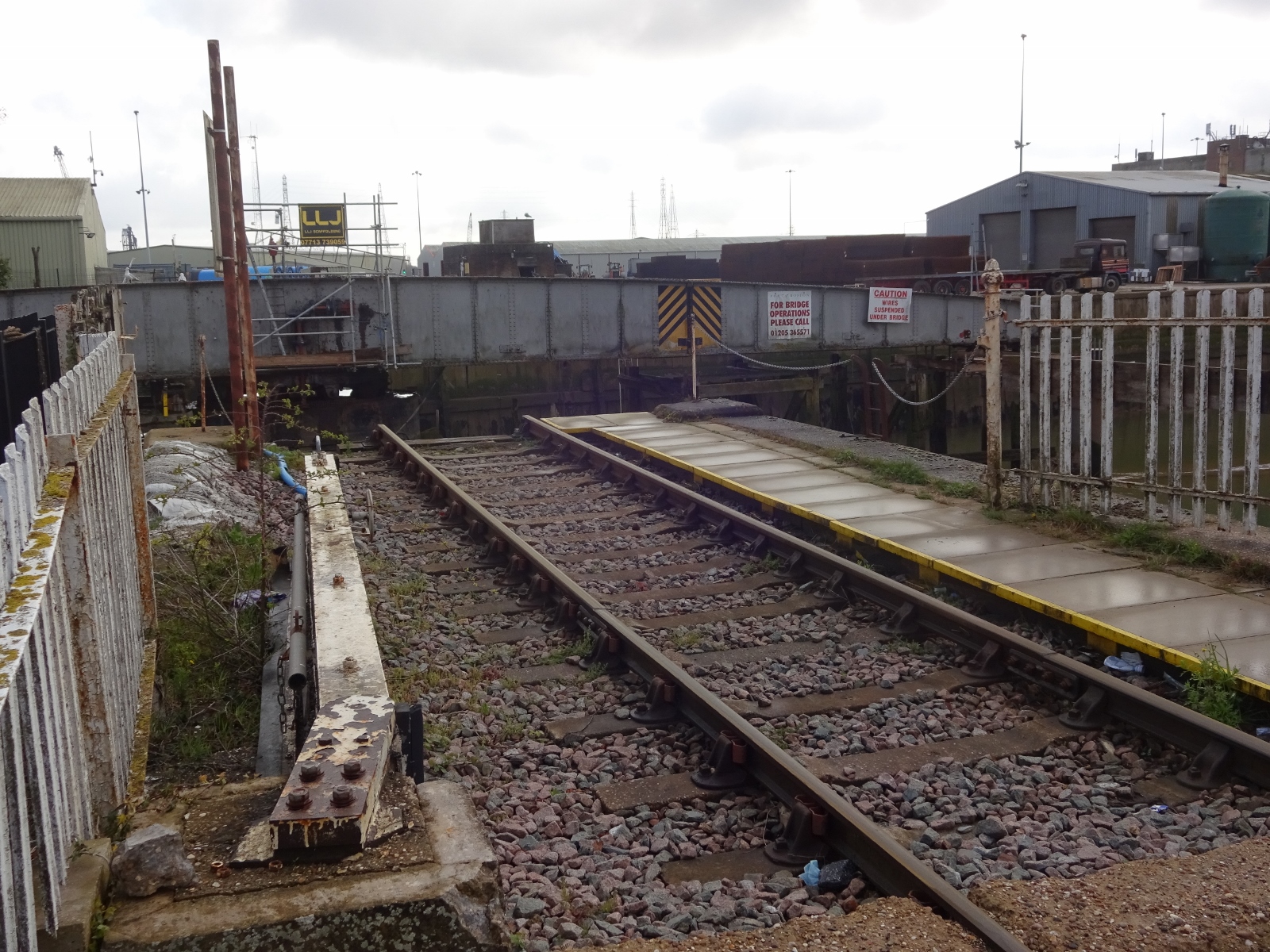
The final couple of miles of fields and suburbs weren’t much to write home about, but entering Boston proper there were some sights to see. I was walking into town along the river, and passed a rail swing bridge used by freight trains entering the port, which was very cool, and further into town there were some cool old wharf buildings along the river banks.

For the whole of the day’s walk, and much of the previous one, I’d been able to see the Boston Stump, that is, the giant tower of Boston’s parish church, St Botolph’s. Entering Boston, the true scale of it gradually became apparent – it’s over 80 metres high, on a scale much more typical of cathedral towers, and is dramatically higher than anything else around; I doubt many of the surrounding buildings top 20 metres.
I soon got to the town centre, and my three days’ walk was over! After I filled in a couple of gaps in the next month or two, this meant I’ve now walked all the way from London to Boston, which is very nice to have completed.

For the end of the walk, my transport plan was that my parents would soon be arriving in Boston to collect me and take me back to their house, where there was a family gathering that afternoon. I thought I’d leave any exploring for after they joined me, and so settled into a nearby Caffè Nero to await their arrival, using the time to write up some notes for this blog!
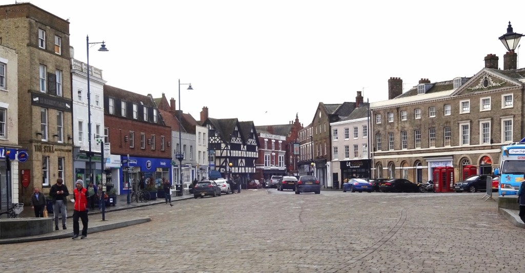
Boston is not known as a happy town; having high deprivation and crime rates, poor health statistics, and poor integration between locals and its large European immigrant population. However, I found the town centre pretty nice, and well worth a couple-of-hours visit including going up the church tower, as I did once my parents arrived. We first had a wander around the market that was on – I’m always a fan of market squares, and Boston’s huge central one was very nice, I thought. It was a nice non-posh market, which I always appreciate.


After that, we went into the church, which was very lively, having a café and a shop, and with preparations going on for hosting some kind of fashion show later in the day. There was also music playing; not ecclesiastical music, but more like they just had Radio 2 on the speakers or something, which was novel! While the body of the church looks tiny compared to the tower, it’s still huge for a parish church – in fact, it’s apparently the biggest parish church in England.
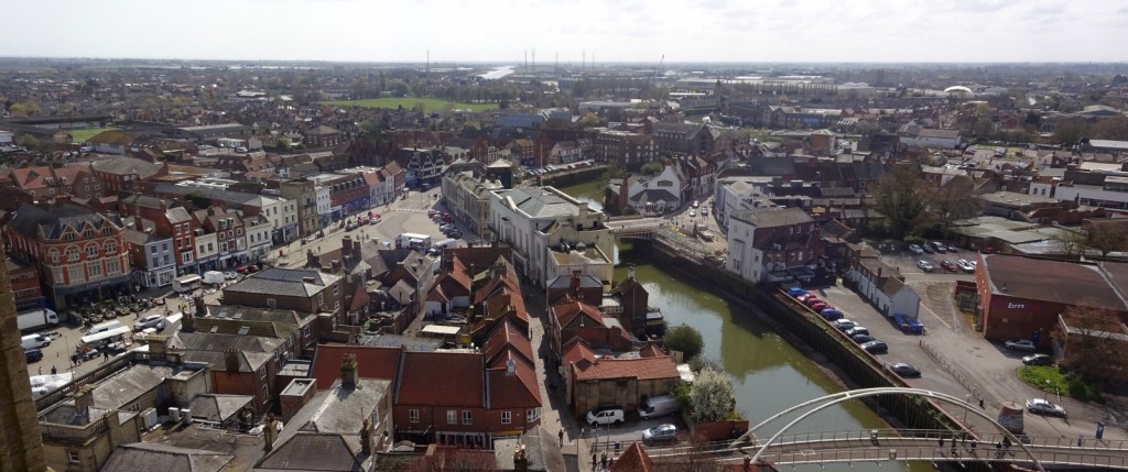
Going up the tower was, as expected, rather a long time, but the view from the top was great. It was a greyish day, but still, visibility was pretty good; we could see for miles across the flat Lincolnshire countryside in one direction, and back to the Wash and my past few days’ walking route in the other. Apparently on an even clearer day it’s possible to see Lincoln Cathedral some 30 miles away!

And that’s it! After a short explore and some tea in a nearby café, I got in my parents’ car and we drove off, just making a lunch stop in a pub near Spalding before heading to my parents’ Northamptonshire home. A satisfying trip!