OS Explorer map 255, Llangollen & Berwyn: Ceiriog Valley – I own this map, and had visited it before starting this blog. Visited for this post 12th November 2022.`
Google Maps location links: Oswestry, Llangynog, Pistyll Rhaeadr, Llangollen
In August this year, for Father Dearest’s 65th birthday, he had a big family gathering where 18 or so of us went to stay in a big house in Norfolk for a weekend. At this occasion, my cousins Chilli Sauce and Rice Pile cornered me with a proposal: I should take them on a walk sometime! After some thinking in the following weeks, I suggested a walk up on the Berwyn range, it being an upland area I haven’t visited before, likely to be quiet, and within a reasonable travelling distance of their Northamptonshire homes.
So, a few months later, off we went: Rice Pile booked us some accommodation near Oswestry (in map area #240), and he and Chilli Sauce drove over there on a Friday evening after work, collecting me at a train station on the way. We had a very late dinner assembled from a nearby Morrisons and KFC, before heading to bed, having a beans on toast breakfast, and leaving fairly early to drive to vthe start point of our walk: a lay-by in the hamlet of Pencraig, a little north of Llangynog.
I’d planned a circular route of about 12 miles, which would take us first along the valley Cwm Rhiwerth, before ascending to the peak Moel Sych from the west. We’d then come down to the waterfall Pistyll Rhaeadr, then head back up over the hil Y Clogydd to our parking spot.


The walk had a gentle start, with the first couple of miles taking us through more-or-less flat farmland along the floor of Cwm Rhiwerth, a pretty, deep-sided valley. Our path later started ascending fairly steeply up towards the pass at the head of the valley, and the views at this point were great: though it was cloudy over us, the sun was poking through the clouds further back along our path, lighting everything up very photogenically.

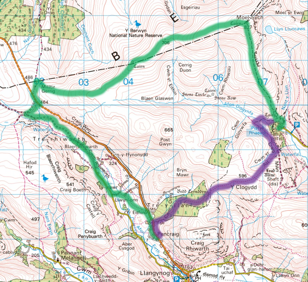
Exiting Cwm Rhiwerth, we crossed the road to start our ascent up onto the Berwyn range proper, encountering a very nice information board informing us that the Berwyn National Nature Reserve is Wales’s largest heather moorland. I wasn’t quite sure what kind of path I’d find to take us up to the summit of Moel Sych: the path we followed isn’t marked on the Landranger map above at all, and on the Explorer is shown as an orange-dashed permissive right-of-way, but with the underlying dotted black line indicating a physical path disappearing about two miles in.
In the end, the path was pretty great – the first couple of miles have clearly had a lot of attention paid to them recently, with wooden boardwalks in good condition, covering what I assume were the boggiest areas. Huge, empty expanses of heather moorland like this are maybe my favourite kind of scenery, and really enjoyed it.
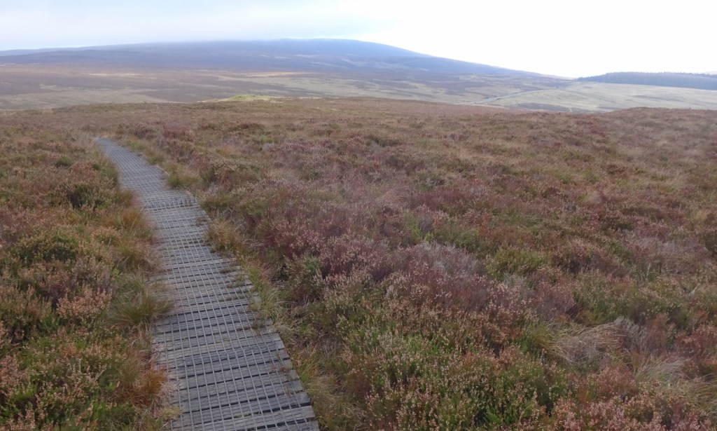
Until this point, the weather had been pretty good – the sun kept missing us somehow, though we could see it in other parts of the valley, but it was dry, still and clear. Unfortunately though, the higher slopes of Moel Sych were in dense low cloud, and as we climbed into them the wind really picked up as visibility dropped dramatically, and the helpful boardwalks gave way to a more standard path, with plenty of boggy sections that had to be picked around or squelched through – much as you’d expect for moorland in November of course, but still, less nice than what had preceded it. I’d also made a bit of an error in communication when planning the trip: I’d mentioned proper walking boots being important, expecting some bogginess, but hadn’t clarified I specifically meant ankle-high boots. The cousins were both in walking shoes that they’d used on long hikes but in summery weather, and quite quickly got soaked socks once things got boggy. Oops!
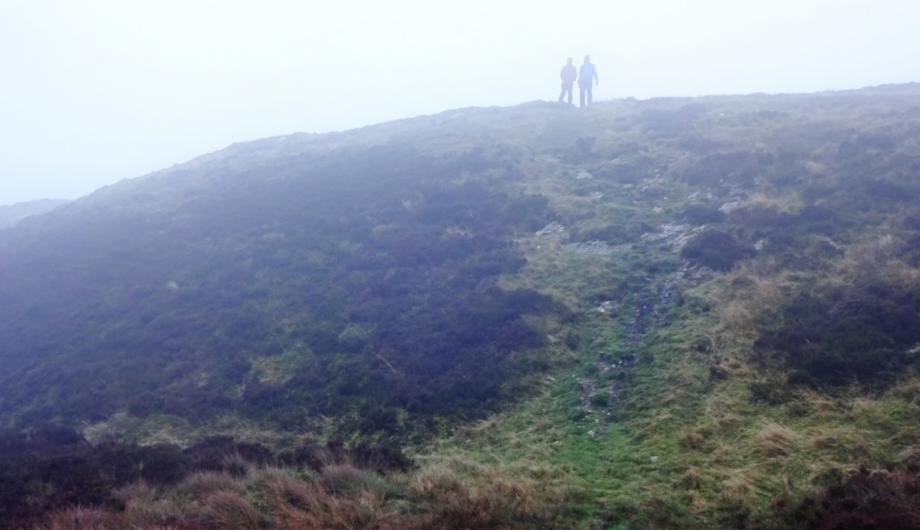
We reached the summit of Moel Sych in pretty good time, unfortunately still unable to see the views, which I understand are rather spectacular in clear weather. Given the windy conditions, we hung around for only a short while, before beginning the third side of our roughly square-shaped path, descending towards the waterfall Pistyll Rhaeadr. Rice Pile’s knee had started giving him trouble towards the end of the ascent, so we took things slowly, taking plenty of breaks, but fortunately the descent was more sheltered, and after half an hour or so we got out of the clouds. On this leg, we also started encountering other walkers for the first time – we’d been entirely alone so far.

Near the bottom of our descent, we sat down to eat our packed sandwiches and admire the view into the valley, and had a chat about what to do next. I’d planned for us to walk around another three miles, including some more climbing to go over the hill Y Clogydd to get back to Pencraig, possibly popping down to the base of the waterfall first. However, Rice Pile’s knee was still giving him pain, so we decided this would be a bad idea: I booked a taxi to meet us at the base of the waterfall, the taxi driver’s availability giving us a leisurely hour and a half to slowly make our way down.
We reached Pistyll Rhaeadrslowly but surely, and it was a great reward for our effort! It’s just a good, high, impressive waterfall, probably the best I’ve seen in the UK. I think High Force in the North Pennines, which I saw at the start of the year, may have more water flowing through it, but Pistyll Rhaeadr is much higher, and the two separate main cascades with the little rock archway in the middle just make it more spectacular.

After looking at the waterfall for a few minutes, we headed towards the little car park, and were happy to find there was a café we could sit in for the forty minutes until our taxi would collect us. We settled down with some tea, soon met our taxi driver, and were driven back around to Pencraig while the driver told us about the gradual disappearance of all the small local taxi companies in the area – he’d had to drive over from Oswestry, which he said would never have happened a few years ago, when there were two companies in Llanrhaedr-ym-Mochnant.
It was a good walk, even if the ending didn’t quite go to plan – I really liked this area, which is much quieter than Snowdonia, but still very rugged, and I do love a good heathery moor!
Previous visits
I’ve been to this map area once before, briefly stopping in Llangollen for a meal break on the drive back home from a trip to Snowdonia. However, I have a slight problem here: I can’t remember which trip this was! I distinctly remember stopping in Llangollen, and eating a slightly disappointing pizza. But I can’t remember whether it was lunch or dinner, nor when it was or who I was with.
I think it’s most likely it was my summer 2013 camping trip to Wales with No Longer Hairy, Little S and Big Coat, which has featured on this blog before. Who knows, though! Oh well.

