OS Explorer map 316, Newcastle upon Tyne: Gateshead, South Shields, Prudhoe, Ponteland, Cramlington & Whitley Bay – I do not own this map, but had visited it before starting this blog. Visited again for this post 24th September 2023.
I visited this map area as part of my All Line Rover trip in September 2022, travelling around Britain by train, for which I did day-by-day blog posts already, and am now going through doing my regular posts about the new map areas I visited. The main content below will therefore be just a lightly edited version of relevant parts from my post about Day 8 of the trip – for a more connected narrative I recommend taking a look there instead. The Previous Visits section will be new though!
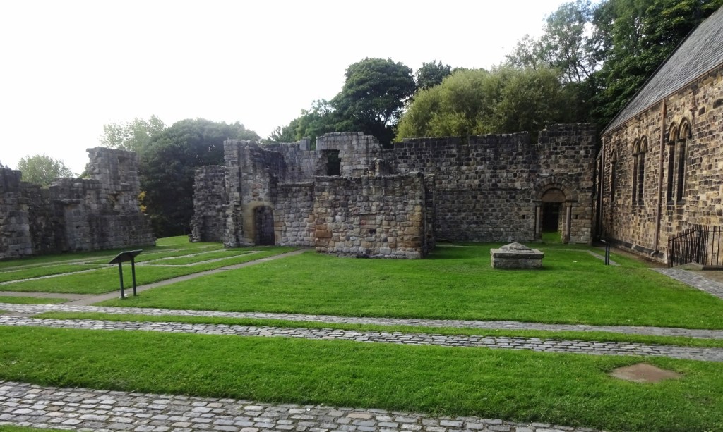
I entered this map area from the south on a Tyne and Wear metro train from St Peters, a station in the suburbs of Sunderland near the church of the same name, the old monastery church of one of the ancient double monastery of Monkwearmouth-Jarrow, well known to students of Anglo-Saxon history as I was a few years ago! Before heading into Newcastle proper, I wanted to make a stop off at Jarrow, the other half of the monastery, though I’d been before (see below).
Jarrow, a sizeable town and part of the larger Tyneside conurbation, has a metro station, so normally getting there from Sunderland would just be a simple matter of changing at Pelaw to the Yellow Line. Unfortunately, the Yellow Line from Pelaw to South Shields was closed for upgrade work that day, so instead I got off at Heworth, and took a #27 bus to Jarrow, which conveniently stops right outside the monastery church!


Jarrow is great! Though unfortunately I somehow didn’t manage to get any particularly good photos either this time or last. The chancel (east end) is original 7th-century Anglo-Saxon and pretty much intact, which is amazing; one can stand in there and be in the space the Bede stood in. In the wall of the tower is an original, legible dedication stone, which is very cool. Outside the church, there are later monastery ruins, with lots of helpful interpretation boards and so on.
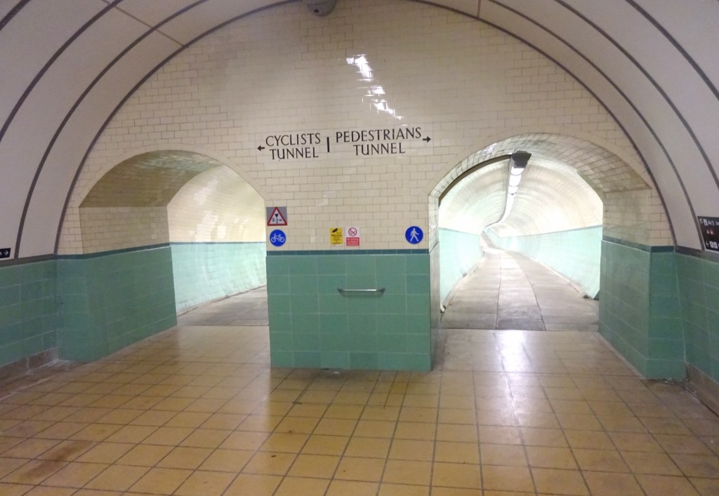
As well as visiting Jarrow monatery again, before heading into central Newcastle there were a couple of odd ocrners of Tyneside’s transport network that I’d been interested in exploring when planning this day. As well as the metro and the buses, Tyne and Wear’s transport authority Nexus runs the passenger-only Shields Ferry between (as you might guess) North and South Shields, and maintains the very cool Tyne cyclist and pedestrian tunnels between Jarrow and Howdon. If the metro had been fully operational, I might’ve walked through the tunnel to Howdon, then metro’d to North Shields, got the ferry, and metro’d to central Newcastle from there. However, with the South Shields metro not operating, this would’ve taken a lot longer on replacement bus services, and the day was getting on, so I decided I’d just do the tunnel, leaving the ferry for another time.

I now had a day ticket for buses and the metro in the area (the third ticket that could’ve been covered by just the one Network One ticket!), and since there was a bus passing, I got on one for the short hop down to the tunnel portal, though it’s only a 15-minute walk. This was a small error – I missed the stop and ended up back at the closed Jarrow metro station, with just as long a walk just from a different direction! Oh well.
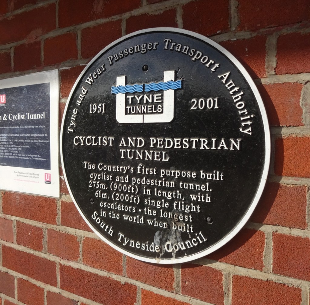


The tunnel was very cool. It felt a little like stepping into the past – as well as the pastel tiles and old painted signs, it still has wooden escalators. I know these were common in the past, but I’d never seen one of before!

After crossing under the river, I made the short walk to Howdon metro station, to get a train into central Newcastle. At Howdon, there’s a level crossing in the middle of the station, which is a little incongruous for a place calling itself a metro station – the Tyne and Wear Metro is a little misnamed, not really being a metro in the sense of the London Underground and so on. As well as level crossings, a lot of the track is shared with other passenger and freight trains. Not putting it down though; it’s a great system and I love it – I expect Bristol, Southampton or Leeds would love to have the like, and it and will be even better once it gets very nice-looking new trains in late 2023.

I got off the metro at the end of the line, St James station, where I spent the next forty-five minutes on a wander around central Newcastle. I’d never been to Newcastle before, and didn’t have the time to do it justice, but I really liked what I saw, and would definitely like to come back.
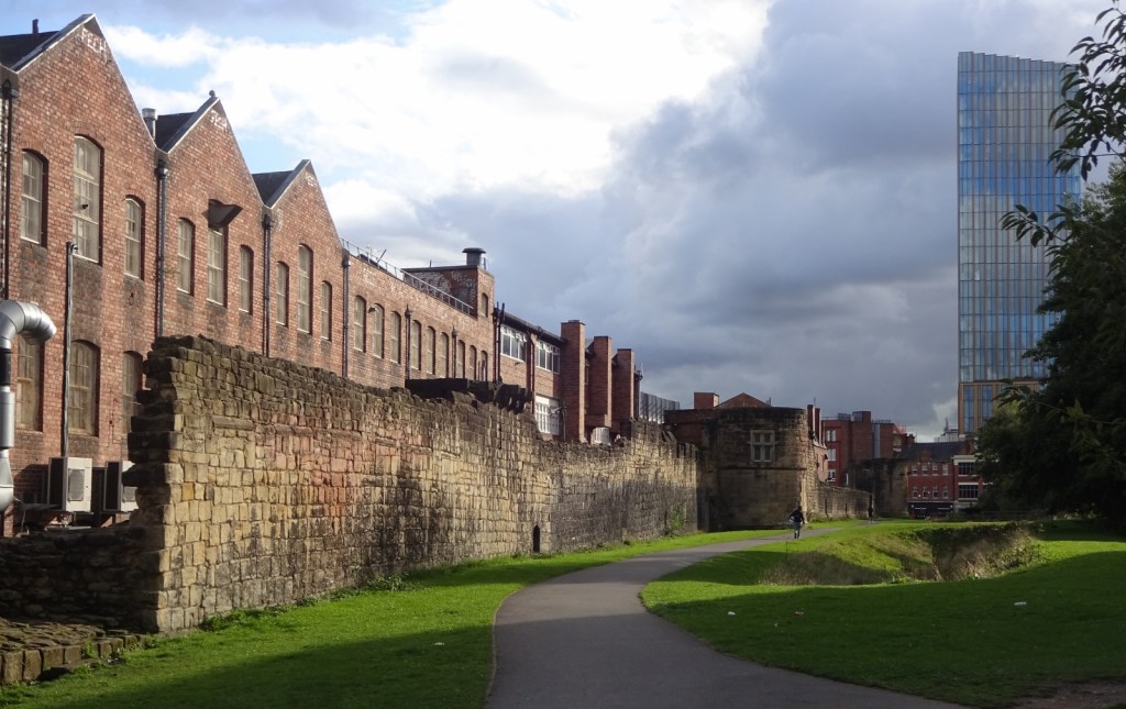
I started off by seeing some of the old city wall, before heading over to Blackfriars, a medieval Dominican friary.
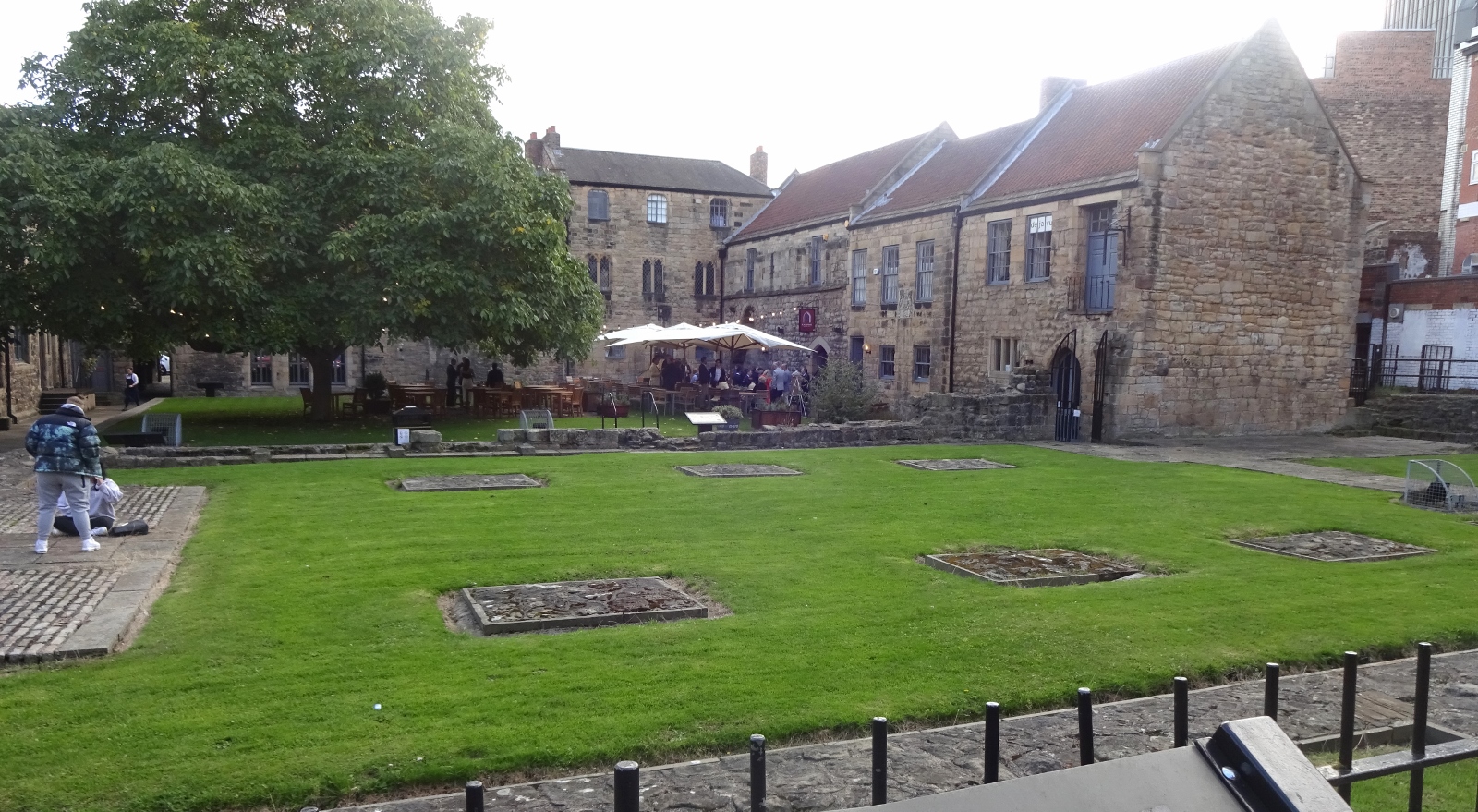
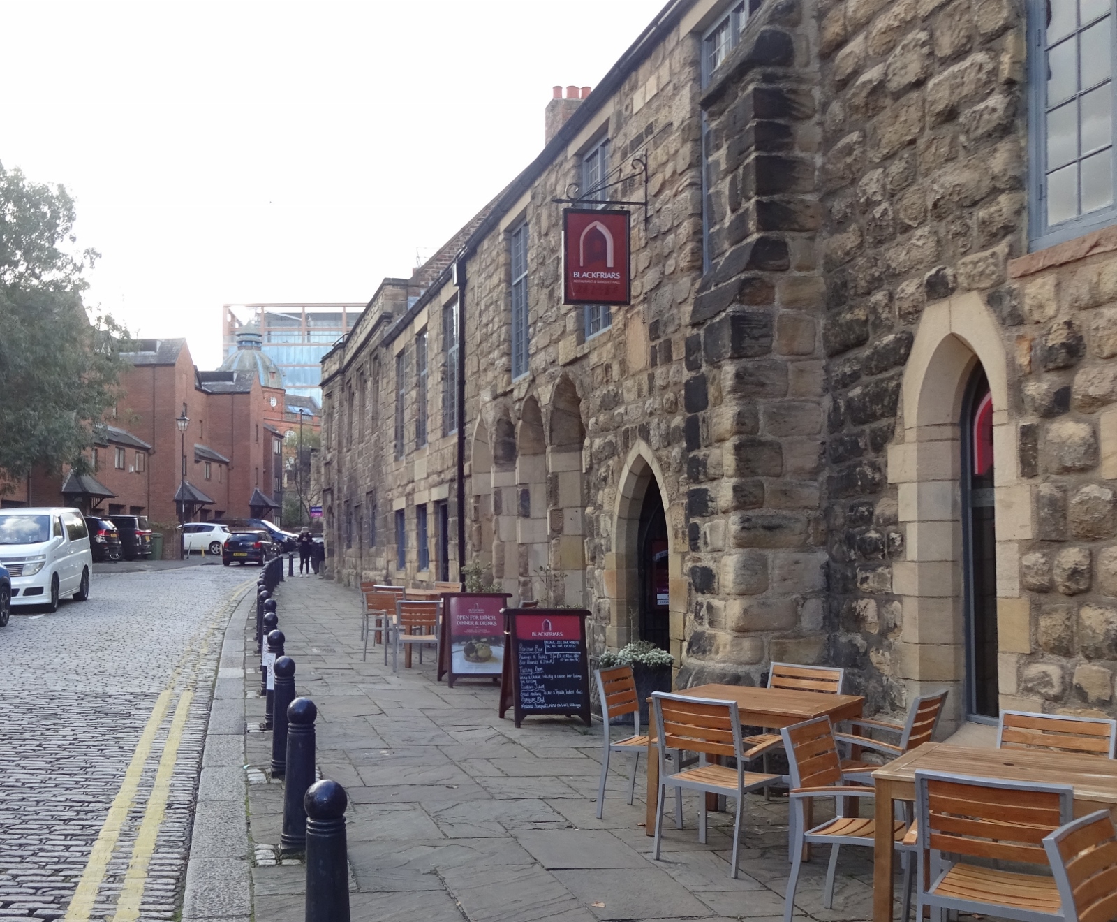
After its dissolution, Blackfriars was used as trade guild building headquarters, and now contains craft workshops, and exhibition, and the very cool Blackfriars Restaurant, which I’d love to come back and eat in one day – while I haven’t evaluated its claim to be the “oldest dining room in the UK”, it does seat guests in the medieval dining hall, which is appealing!
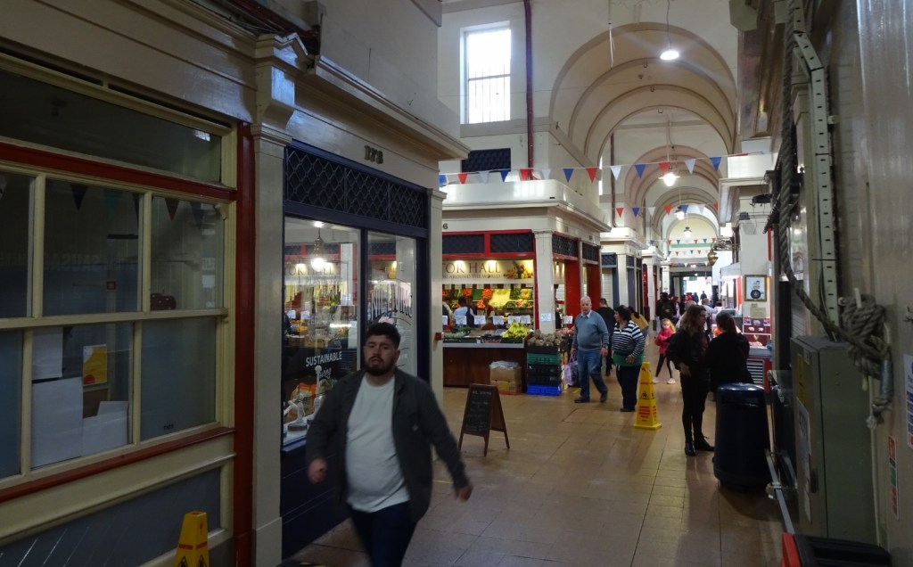
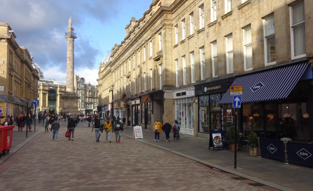
I then just walked through the city for a while; saw the Grainger Market, a big covered market.

And before heading into the station for my train, I had time to take a quick look at the amusingly- but logically-named Newcastle Castle. In a similar vein, the signs pointing to this area refer to it as “Old Newcastle”!


The castle site has been partly built over, with a railway viaduct running through the middle of it, which makes it a bit of an odd experience to explore. Since I wanted to get on, I only looked at it from the outside rather than paying to go in and see the surviving castle keep, but I’d like to do that sometime!

I was also interested by the High Level Bridge, a two-level bridge with a rail deck on top and a pedestrian and car deck below which, as the name suggests, crosses high over the River Tyne, giving an impressive view down to the lower bridges below!
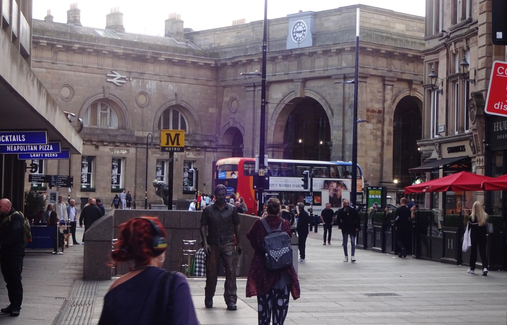

From the station, I got a train in the Carlisle direction, to get off in the village of Haltwhistle, where I’d be staying the next two nights!
Previous visits
I’d somehow never visited Newcastle proper before the above trip, but I had been to this map area, visiting Jarrow as mentioned above. Specifically, this was on 2017’s instance of the annual trip organised by the ASNaC Society – the student society associated with the university department I was a student at at the time – which this year had us staying in Durham and visiting various sites in the North East, and which has featured on this blog several times before.
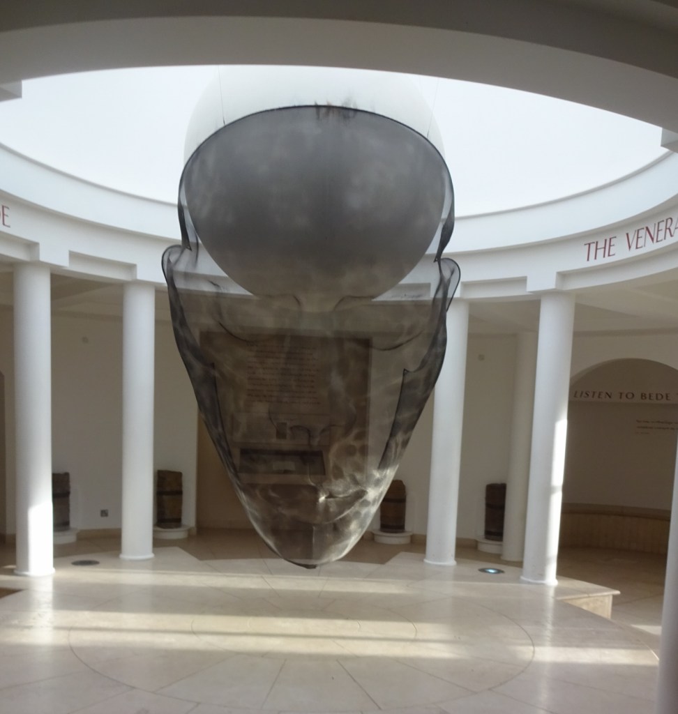
We had a look around Jarrow church, and In this map area, we both visited Jarrow, and also the next-door Jarrow Hall museum/reconstructed village. Until recently, it had been known as Bede’s World and we’d heard great things about it. However, it had recently shut down, closed for renovations, and was now re-opening as Jarrow Hall: we’d arrived in its very early days it seemed, as it was very empty and I believe the outdoor reconstructed village wasn’t accessible. However, we did enjoy the very scary giant Bede head…
